Just like in the West, the history of how lands changed hands has contributed to today’s public access challenges
In the media and in popular imagination, public lands are most closely associated with Western snowcapped peaks managed by the U.S. Forest Service and National Park Service or vast expanses of sagebrush prairie managed by the Bureau of Land Management.
But places like the Superior National Forest in Minnesota offer as much of a chance to immerse oneself in adventure as any of the public lands in the West. And for Midwestern hunters and anglers, there are millions of acres of state, county, and locally managed lands that provide critical access close to home.
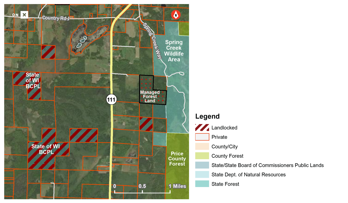
There are also as many as 300,000 acres of public lands in Minnesota and Wisconsin that are completely surrounded by private land, according to our latest report in partnership with onX. These lands represent lost hunting and fishing opportunities and a national challenge that is unfortunately becoming all too familiar—they’re your public lands, but you can’t get to them without asking someone’s permission.
So how did these public lands become landlocked?
As with other states in the West and Midwest, upon statehood the land base in Minnesota and Wisconsin was organized into six-by-six-mile squares known as townships according to the Public Land Survey System. Each township was further divided into 36 individual one-mile-square (640-acre) sections.
Both states received land grants from the federal government, originally comprised of two sections within each township, which were to be used to support public schools. Following statehood, several subsequent conveyances of federal land were provided to Minnesota and Wisconsin to serve various purposes, such as to support additional state institutions, create state parks and forests, expand agriculture, and retire marginal or unproductive farmland during the Great Depression. Meanwhile, millions of acres reverted back to counties and the states due in part to tax forfeiture.
Later, the Department of Natural Resources in each state began actively purchasing lands to meet management needs, generate revenue, protect critical fish and wildlife habitats, and provide access for sportsmen and women.
There were also vast federal public lands set aside in the Northwoods in the early 20th century, including the Chippewa and Superior National Forests in Minnesota and the Chequamegon-Nicolet National Forest in Wisconsin.
The result today is some of the most diverse public land holdings found anywhere in the nation and, unfortunately, a remnant patchwork of landlocked public lands.
Click here to read about three programs that offer solutions to the landlocked problem in the Midwest.
VISIT UNLOCKINGPUBLICLANDS.ORG
Top photo by Joe D via flickr.


Why is there 55,000 acres of so called
“Public land” in wisconsin and I being a tax payer can’t access any of it being landlocked? And do the perimeter private land owners get to hunt it use it.. access it and don’t have to pay taxes on any of it?… Please respond in layman. Thanks concerned citizen