Landmark new legislation in Congress promises to bring public land access into the 21st century
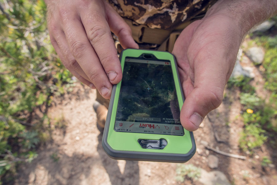
Digital mapping and GPS technologies have revolutionized the ways in which sportsmen and women navigate public lands. By pinpointing a user’s real-time location on the landscape, handheld GPS units and smartphone applications allow hunters and anglers to know exactly where they stand relative to property boundaries and other key landmarks.
Unfortunately, when it comes to public lands, incomplete and inconsistent mapping data prevents hunters and anglers as well as land management agencies—including the Forest Service, Bureau of Land Management, National Park Service, and Army Corps of Engineers—from utilizing the full benefit of these technologies.
But a bipartisan bill recently introduced into both chambers of Congress promises to bring our public land mapping records into the 21st century. Here’s how the Modernizing Access to our Public Land (MAPLand) Act would do that.

Restoring lost recreation opportunities
Most recreational opportunities on public lands are identified in agency management plans and appear on agency-produced paper maps that show, for instance, roads and trails open to different types of motorized and non-motorized vehicles. Sometimes alongside a national forest road you’ll see a sign marking a zone where hunting or recreation shooting is, such as near a campground or forest service ranger station. Other times you’ll pull up to a mountain lake parking lot and a sign is posted that specifies horsepower restrictions for boats.
While some of this information might, in certain places, be available in a GPS-compatible format, in most places it is not. As a result, it is difficult for the general public to find specific information about available recreation opportunities on their public lands without spending considerable time exploring public lands to ground-truth areas or poring over volumes of agency documents. Sometimes, a person might avoid hunting in an area altogether simply because they can’t tell by looking at a sign where the shooting boundary starts and ends. Many members of the public might also avoid driving on an open road because the existing sign long ago went missing and they don’t want to inadvertently break the rules.
A lack of modern information about recreational access opportunities on public lands is resulting in lost days afield, and in the 21st century, sportsmen and women should be able to reference their handheld GPS or other mapping units so that they can instantly know the rules for recreation and where the boundaries of restricted areas are located within a matter of feet. Such measures would not only help busy Americans discover new recreation opportunities and give them confidence to enjoy the outdoors, but it would also reduce conflicts and the likelihood that outdoor enthusiasts will break the rules.
This need for better information is what the MAPLand Act is designed to address by providing funding and guidance to our land management agencies to digitize mapping information about outdoor recreation. This includes, among other things, seasonal allowances and restrictions for vehicle use on public roads and trails; boundaries of areas where hunting or recreational shooting is regulated or closed; and portions of rivers and lakes on federal land that are closed to entry, closed to watercraft, or have horsepower limitations for watercraft.

Shining a Light on Access Opportunities and Challenges
Millions of acres of federal public lands across the country have restricted access, particularly in areas with mixed public and private landownership. In the West alone, more than 9.52 million acres of federal public lands have no permanent legal means of access and permission to access to public lands across private property can be difficult to obtain.
In many places where public land trail and road access exists across private land, it was established by a legal agreement known as an easement, in which an agency such as the BLM or Forest Service formally acquired the permanent right for the public to travel a designated route (such as a road or trail) across private land.
Many of the agencies’ records of access easements across private lands are still held on paper files at local offices and cannot be easily accessed or reviewed. The Forest Service alone has an estimated 37,000 recorded easements, but only 5,000 have been digitized and uploaded into an electronic database.
Currently, the federal land management agencies lack the resources and capacity to digitize and standardize these records. Because of this, it is difficult for hunters and anglers to understand the full extent of access opportunities. And when they are not used, public rights-of-way can be forgotten by the public and the agency alike.
MAPLand would require our public land agencies to digitize records of easements or rights-of-way across private lands, making it possible for the public to understand where public access has been formally secured in legal records. Doing so would both help expand public access opportunities and reduce conflict with landowners, because everyone would have factual information about access allowances and restrictions.
In addition, by giving land managers a comprehensive picture of all available access points, they can fulfill their mission to identify public lands with limited or nonexistent public access, and take proactive steps in cooperation with private landowners to open those lands to the public. Conservation groups and land trusts that have been working on access issues will be able to use this data to identify priority areas and work more efficiently to expanding opportunities on our public lands.
Take Action
Elected officials need to know how much MAPLand would mean to hunters and anglers. Write your lawmakers today and ask them to support public land access!
Top photo: Rick Hutton


The forest service is now cutting access to public land to people like me and others with disabilities here in Arizona. Roads that have been open for generations are now only accessible to people who can walk ride a bike or horse. Trying to call and get answers and never hear back. I was given a name and number form their Facebook page and he never responded. Why is this happening.
Excellent article. I appreciate the Take Action tab.
Since hearing about my state of Idaho’s Rep. Fulcher’s involvement in the bill to digitize and make available all the road access information my brain has been stewing on it. I smell a rat. I can’t imagine him doing something to help the public get better access. So what is he really up to?
What he no doubt really wants is for there to be no public access anywhere, and to make all lands and roads private property. But right now that is too big of a reach. So all I can come up with is that he figures his road bill is a first step. At this point he will concede some roads and some public access, but only those roads for which there is bombproof legal public deed or right of way on paper. But everything else will be declared private. Thus any roads that have been public by common use for generations will be declared private, and public access taken taken will be away.
Now to make it a conspiracy theory I also wonder if ALEC (American Legislative Exchange Council) is somehow involved in this. It seems like something the Wilks brothers would be happy to fund through them in some sort of dark money operation. Perhaps we will see a bunch of such bills introduced in local and state governments. Then we’ll know. So while this Bill seems like a good idea, I think public lands users should be wary.
Could the Federal Agencies outsource to onXmaps to help them complete much of this work?
It would seem that they have taken ahold of this challenge across the country and turned it into a successful business model.
In Montana if you use available property boundary maps and “corner jump” from one piece of public land to another, you’re breaking the law and can be fined for trespassing.
The bill has passed and become law.