To restore a stream on the Arkansas Delta, conservationists faced down dead-zone-creating nutrient runoff, pernicious beaver activity, erosion, and many other challenges—here’s how wetland easements played a role in their success
Arkansas’ famed Delta region has historically been home to the largest continuous system of wetlands in North America and now serves as critical seasonal habitat within the Mississippi Flyway. Hunters kill more mallards in Arkansas than in any other state, and only Louisiana has a greater overall annual waterfowl harvest. What’s more, the Delta’s lowland rivers and lakes draw anglers in pursuit of bass, crappie, and catfish.
Hunting and fishing are woven into the fabric of life in this region, and money generated by sportsmen and women is crucial to the well-being of wildlife populations throughout the state. But the Delta also has a long agricultural history that has resulted in the serious degradation of some of its best habitat, requiring the committed work of conservationists to restore its waterways and wetlands, thus preserving the wealth of hunting and fishing opportunities found in the region.
Last year saw the completion of a five-year effort to support the area’s biodiversity, improve wildlife habitat, enhance water quality, and encourage the restoration of native vegetation by way of the Dark Corner Stream Restoration Project. Its success and many resulting benefits are thanks to the collaborative work of The Nature Conservancy, the Arkansas Natural Heritage Commission, and the Natural Resource Conservation Services, with technical assistance from Cache River National Wildlife Refuge and Natural State Streams.
Now, this project could offer a model for similarly degraded waterways and wetlands throughout the region and across the country.
The Degradation of the Delta
Otherwise known as the Mississippi Alluvial Plain, one of Arkansas’ six eco-regions, the Delta is defined and shaped by the flow of its rivers: the Mississippi, Arkansas, White, Cache, and St. Francis. The deep layers of soil, gravel, and clay deposited by these waterways make it one of the most productive regions in the world for large-scale agriculture.
As a result, the land has been largely cleared of native vegetation and drained for cultivation, leading to the widespread loss and degradation of wildlife habitat, while agricultural runoff contains fertilizers, sediment, herbicides, pesticides, and livestock waste. Water testing has typically revealed high concentrations of total suspended and dissolved solids, phosphorus, nitrogen, sulfates, biological oxygen demand, chlorophyll a, and fecal coliform.
Furthermore, the drainage canals and ditches widely used in the region separate rivers and their adjoining habitats from the rest of the natural hydrologic system and accelerate the transport of excess nutrients and sedimentation downstream. The effects of this pollution reach down to the Gulf of Mexico, seasonally creating a low-oxygen “dead zone” that renders thousands of square miles uninhabitable by most marine life. On a more local scale, the entrenched, heavily channelized nature of Delta streams results in turbid water conditions unsuitable for wildlife or human use.
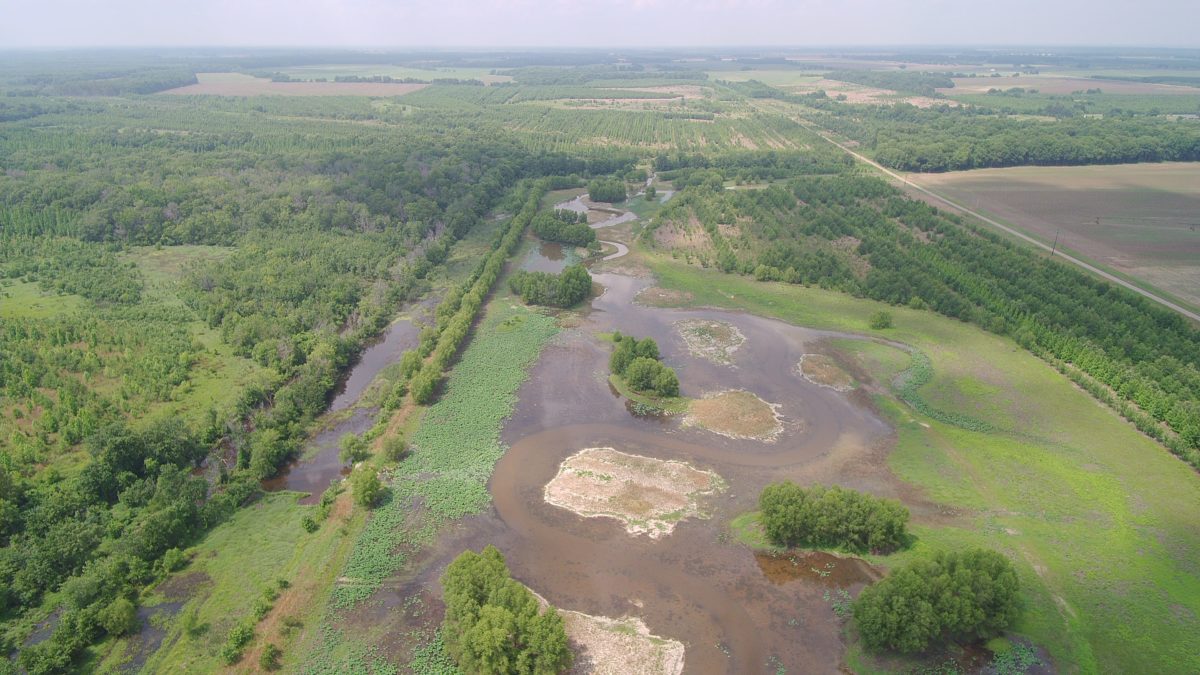
Among the many waterways historically affected by these changes was Dark Corner Creek, a small feeder stream in the Bayou DeView watershed, which, in turn, is a major tributary of the Delta’s Cache River. Historically, the stream drained an area of approximately 7,000 acres, but extensive channelization through ditches created for agricultural use in the 1940s reduced the drainage area to 3,384 acres. Much of the Dark Corner watershed lies on Benson Creek Natural Area, part of a system of 73 such public lands across the state—many of which are open to hunting and fishing—managed by the Arkansas Natural Heritage Commission.
Planning the Project, Getting to Work
In 2012, The Nature Conservancy identified the Benson Creek Natural Area as an ideal candidate for restoration according to a process that utilizes a number of scientific lenses to replicate as closely as possible the natural flow regime of the original watershed.
Because the property is subject to a perpetual Wetland Reserve Easement, the Natural Resources Conservation Service provided funding using a program dubbed “no easement left behind.” First implemented in the mid-1990s, these wetland easements provide economic benefits to landowners in perpetuity, with the cost covered by NRCS.
Currently the Arkansas Delta contains more than 250,000 acres of these wetland reserve easements with 4,000 to 6,000 additional acres enrolled each year. Other states also reap the benefits of this program, providing contiguous habitat totaling more than 700,000 acres across Arkansas, Mississippi, and Louisiana. In years past, these hydric soil landscapes of the Mississippi Alluvial Valley provided fair production for the local farmers, but recent changes in the frequency of spring flooding have made them very difficult to farm. This program allows landowners to choose an alternate use for their properties and even future income through leasing and guided duck hunts.
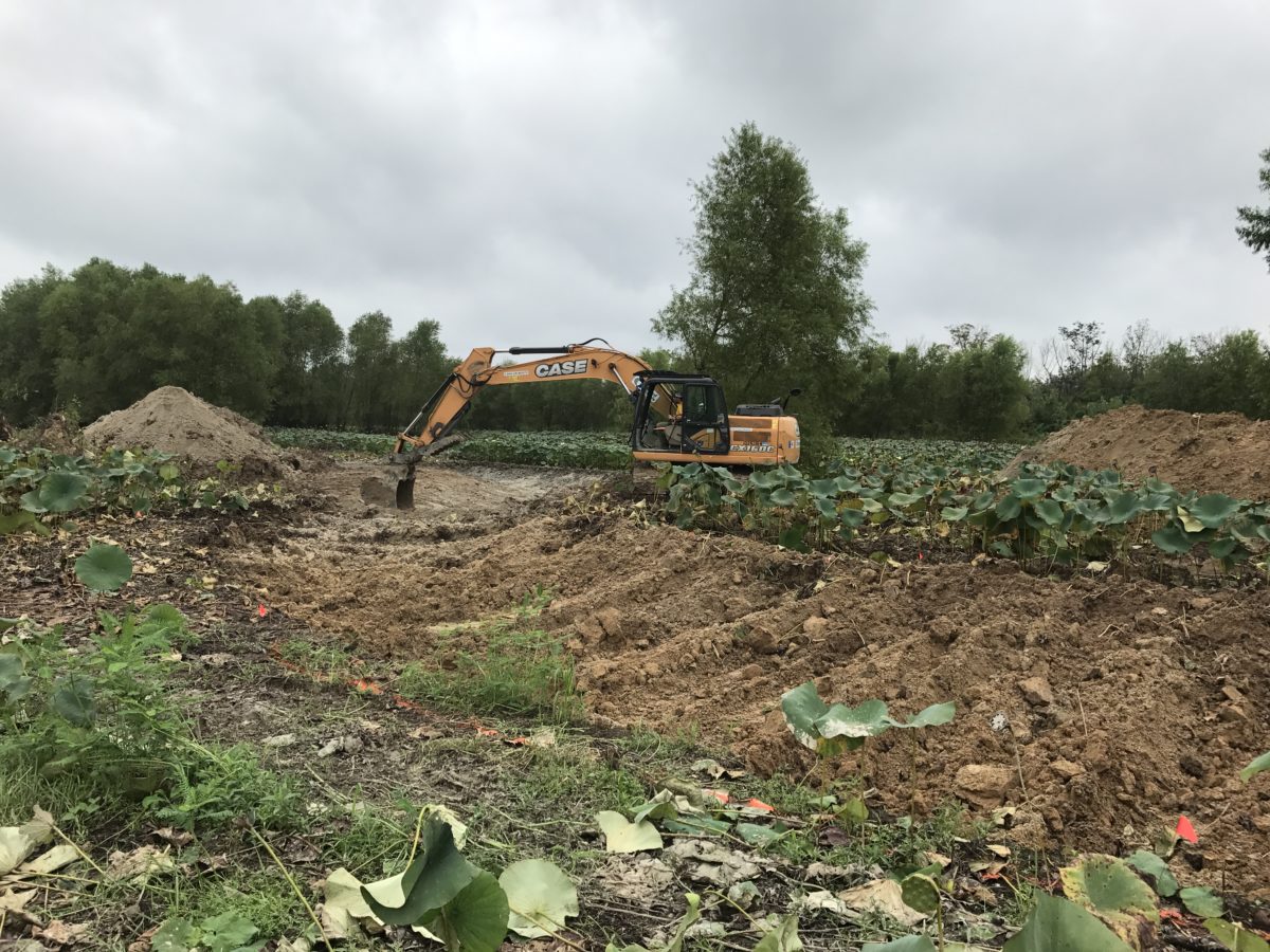
With funding in place, TNC secured the services of a private specialized contractor, Natural State Streams, whose team specializes in all aspects of stream restoration including erosion control, stream bank stabilization, and native riparian planting and establishment. Personnel from the nearby Cache River National Wildlife Refuge provided technical assistance, additional funding, and equipment.
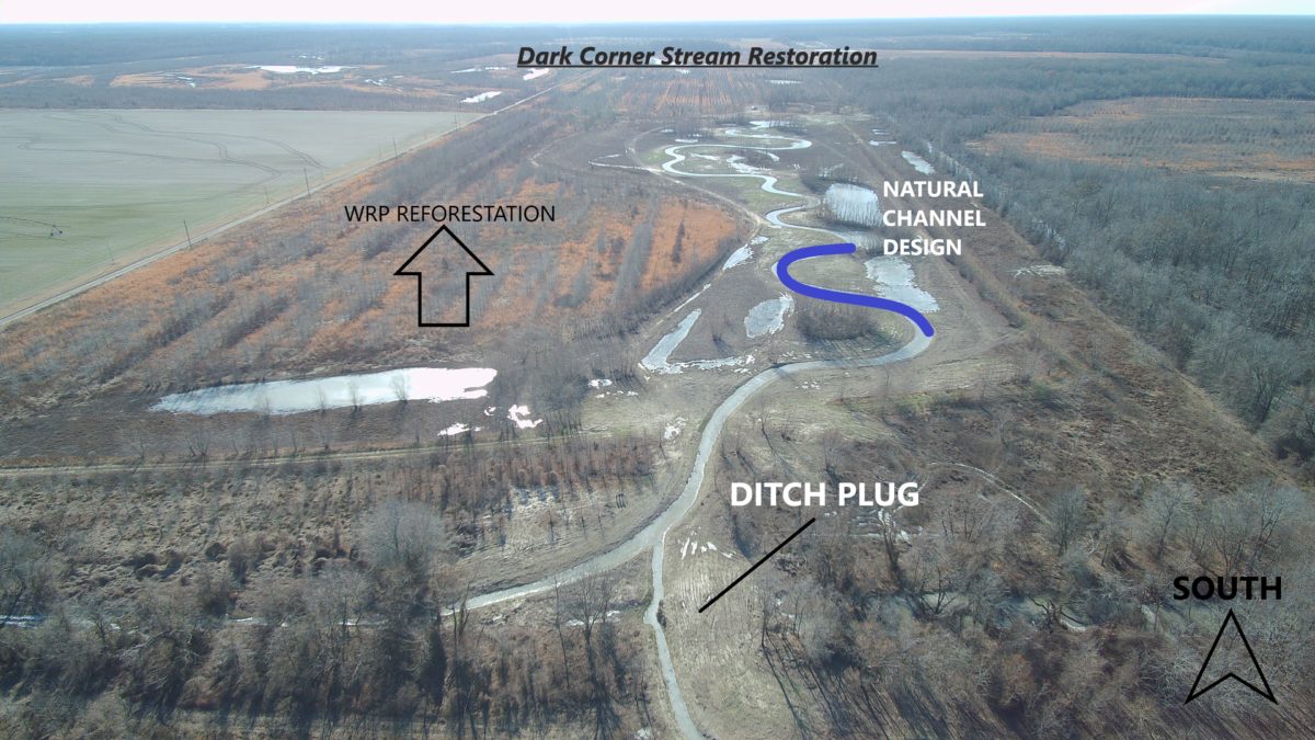
Using a stream in western Tennessee with similar soils and habitats to use as a reference, the team determined the appropriate width, depth, and sinuosity (or degree of meander) that would allow the stream to function as it did prior to alteration, and they drew up plans for a new channel according to these findings.
The construction phase of the project brought many challenges. Due to heavy spring rains and a network of downstream beaver dams, the wetland proved difficult to drain for long enough to allow the work to get underway. As quickly as levees could be breached, beavers would rebuild the dams, necessitating their vigilant monitoring and removal throughout the process.
Before water could be diverted into the newly constructed stream, precautions against erosion were needed. Jute matting, a biodegradable material made of woven vegetable fibers, installed in the channel and along its banks offered temporary protection until newly grown vegetation, including live stakes of black willow planted during the project, could anchor the soil. Cutting these stakes from on-site trees ensured better rates of survival. Finally, the removal of a culvert immediately downstream allowed as much unrestricted flow through the system as possible.
A Model Success
Since the project’s completion in October of last year, water-quality samples collected twice a month have evidenced its effect on the ecosystem. The data already indicates a reduction in turbidity as the natural hydrology of the restored system filters nutrients and traps particulate matter, and further decreases are projected as vegetation in the floodplain takes hold. There has also been some reduction in nitrogen at the site, although it may take years for it to decline to historic levels.
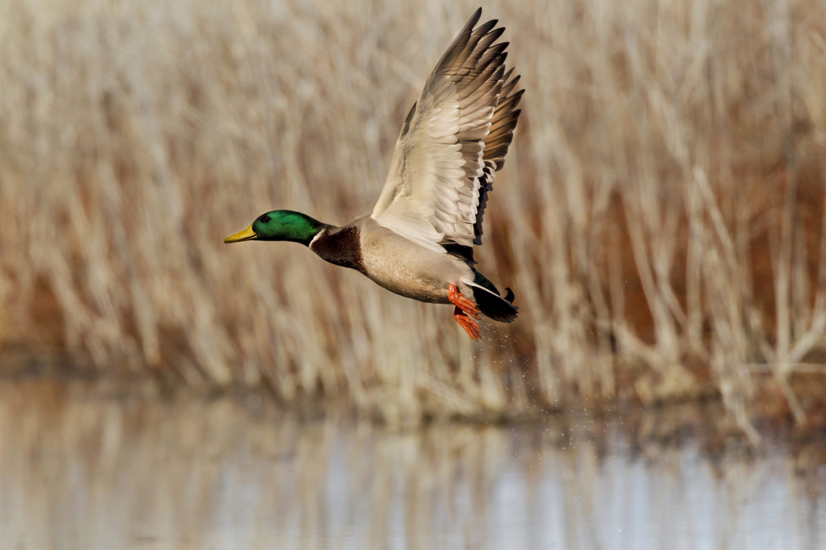
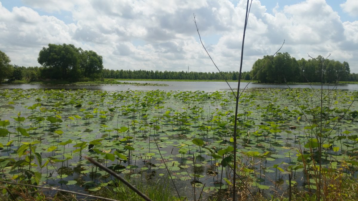
A variety of aquatic species now utilize the newly constructed stream habitat. ANHC staff have documented fish species including largemouth bass, bluegill, spotted gar, and banded pygmy sunfish, as well as a variety of invertebrates and amphibians. Grasses, sedges, and broadleaf plants are flourishing at the site and will ultimately provide much-needed food for wintering waterfowl. Prior to construction of the new stream channel, the site consisted largely of a monoculture of American lotus, which has little nutritive value for waterfowl.
While restoration of a small creek in eastern Arkansas may seem like a small piece of a very large and complex puzzle with far-reaching consequences, it clearly epitomizes the conservation adage “think globally, act locally.” It is the hope of all the contributing partners that the Dark Corner Stream Restoration Project can serve as an example for future efforts throughout the region to tackle some of our most serious challenges when it comes to wildlife, habitat, and waterways.
Top photo courtesy: Mike Wintroath/Arkansas Game and Fish Commission

