A unique private-land conservation project is restoring fish and wildlife habitat and opening hunting and fishing access—follow along on a four-day backpack adventure into these storied landscapes and isolated public lands beyond
“The whole face of the country was covered with herds of buffalo, elk and antelopes; deer are also abundant . . . the buffalo, elk and antelope are so gentle that we pass near them while feeding without appearing to excite or alarm them, and when we attract their attention they frequently approach us more nearly to discover what we are . . . in these delightful tracts of country.” — Meriwether Lewis, 1804
With images of prairies teeming with wildlife dancing around my cranium, I turned to gaze out of the airplane’s window. Stretched out below as far as I could see was an endless array of irrigated crop circles, crowded together in that extra efficient way that makes America the most productive agricultural power in the world.
The benefits of a strong agricultural sector are obvious, but as our footprint on the landscape grows and grows, and land ownership trends are shifting, where do wildlife and hunters fit in? Agriculture producers and other private landowners are, in fact, an essential part of the collaborative work of conservation, particularly since fish and wildlife do not recognize property boundaries or jurisdictions drawn on a map. And some landowners do more for hunters than improve habitat, though gaining access to private land may look different than in years past, when a knock on the front door and a handshake was the norm.
In Montana, a constellation of successful access programming, private landowner support, and a unique conservation project has given hunters, anglers, and other outdoor enthusiasts some extraordinary opportunities to enjoy the very same landscapes that westward explorers like Lewis and Clark experienced.

Into the Vastness
The purpose of my trip was to travel far off the beaten path across some of these lands and see firsthand a private-land conservation project called the American Prairie Reserve.
One of the best things about the APR is that it’s opening gates to both people and animals. Wildlife corridors are being extended and expanded. People are invited to visit and enjoy it through hiking, hunting, fishing, camping, birding, biking and more. Even better, many of the properties acquired by the APR provide new or improved access to tracts of public lands previously cut off by fences and no trespassing signs.
This is because many APR properties are enrolled in Montana Fish, Wildlife & Parks’ Block Management system, a cooperative, voluntary program that helps private landowners offer free hunting access on their land, which is sometimes adjacent to isolated public lands.
That said, it certainly takes time and commitment to get here. We arrived at last, having overnighted in Billings and driven for several hours to the edge of the American Prairie Reserve’s 14,000-acre Blue Ridge property south of Malta, Montana. Our plan was to identify an end-of-the-road jumping-off point for a four-night backpacking trip to explore this new property and the adjacent public lands, which includes portions of the Burnt Lodge Wilderness Study Area and the Charles M. Russell National Wildlife Refuge.
The Blue Ridge is the most recent addition to the APR, resembling in some ways a puzzle piece of essential habitat plugged into the expansive surrounding ecosystem, which stretches some 160 miles on either side of the Missouri River from roughly the Fort Peck dam in the east to Coal Banks Landing in the west. This region is comprised of vast tracts of public lands, including the Upper Missouri River Breaks National Monument. While not all of it is easily accessible, the vast majority of both the public lands and the APR additions are open to a wide range of recreational pursuits, including hunting and fishing.
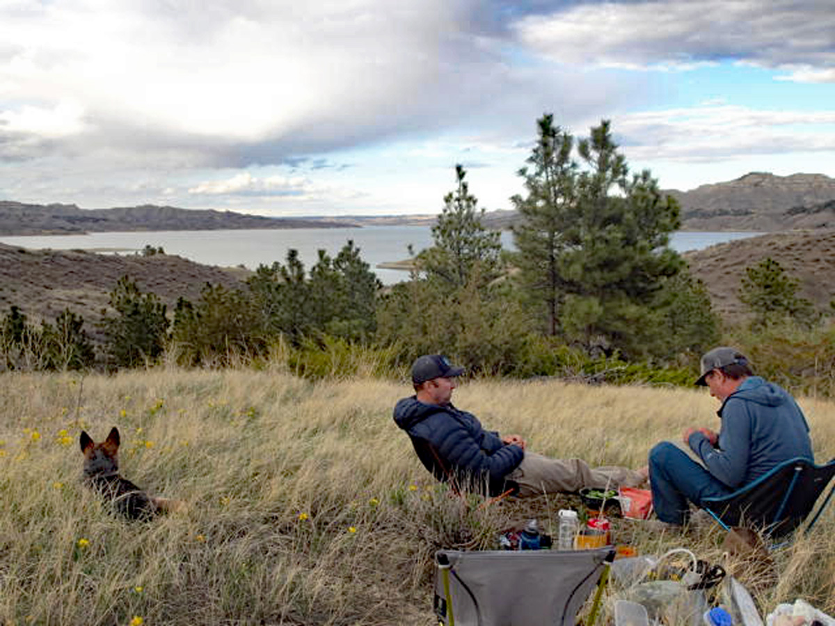
Joining me were two adventurous friends: Luther Propst and Randy Luskey, both wilderness aficionados with extensive outdoor resumes. Luther brought along his dog, Sofie, a rescue Blue Heeler who turned out to be the perfect trail companion.
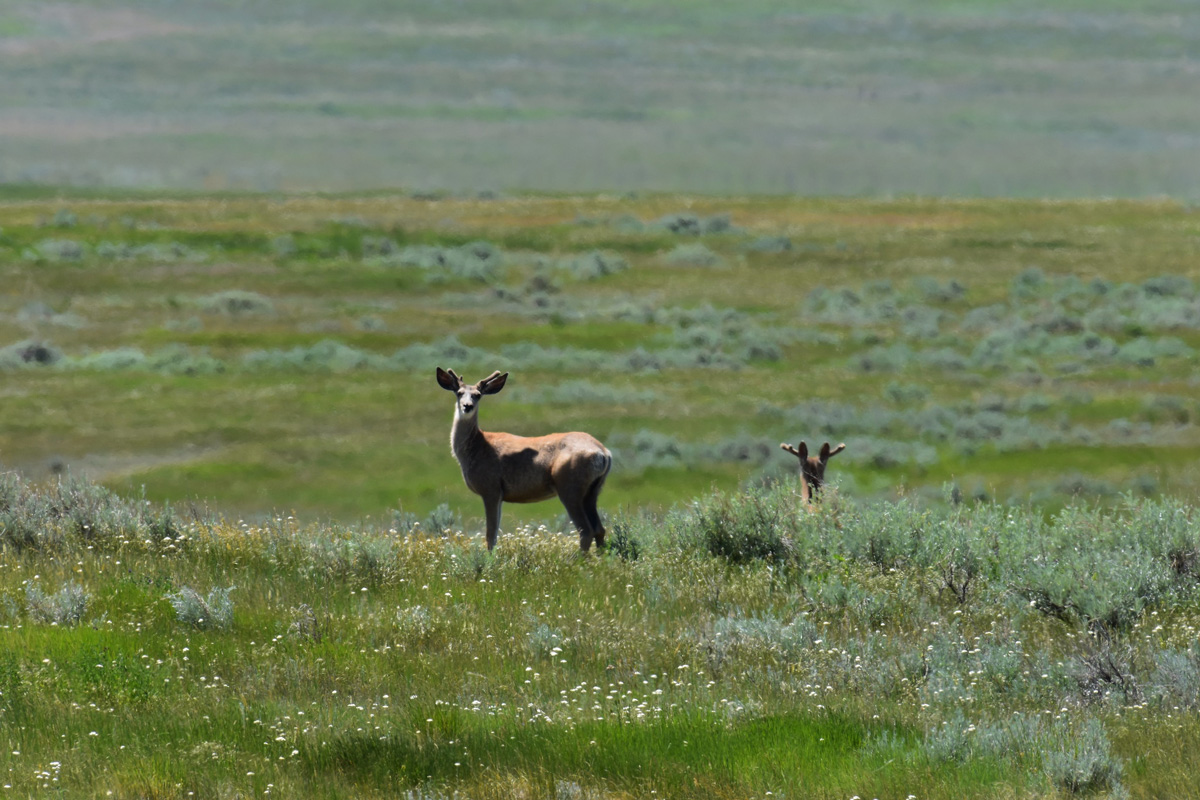
We were attracted to the Blue Ridge because of its remoteness and its function as a wildlife corridor and home to a resident elk herd, bighorn sheep, mule deer, pronghorns, prairie dogs, and other interesting flora and fauna. But our departure point required navigating a matrix of unpaved back roads that are not always well-marked.
In this wide-open country, the farms and ranches are widely spaced, and we passed only a handful of vehicles after leaving the blacktop, seeing more bison and antelope than people. In fact, besides our party, the APR staff knew of only one other group that had ventured into the Blue Ridge over the past two years.
Ultimately, a combination of maps, Randy’s acumen with the GPS, and deductive reasoning got us to our destination with only a few wrong turns. At last, we pulled off the dirt road at a fenceline and parked on a rise circled by a grove of pine trees, anxious to shoulder our packs and head out. A coyote picked its way across the landscape only 100 yards ahead of us.
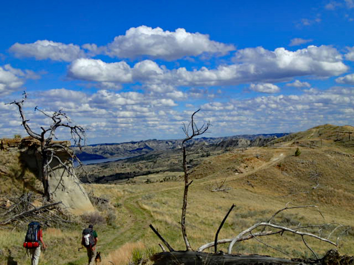
Across the rolling prairie we could see the Missouri River to the south and east. In both directions were broad ravines—“coulees” in the local vernacular—cutting down to the river every half mile or so. We picked an interesting-looking one to the southeast and began our descent, easing ourselves into a world of fresh air, welcomed by the scents of pine and sage blended with scattered wildflowers. There was beautiful bird song everywhere.

Following Game
Initially, it was easy walking through scattered cedars and juniper, and we kicked up mule deer in ones and twos. Soon, however, deep cuts and smaller side ravines hidden by slight folds of terrain and screens of trees blocked our path. What had looked like a nice level track across the bench was, in fact, bisected by narrow, steep-sided, and deep gouges running at right angles to the main coulee. The long prairie grasses hid the terrain’s edges from view until we were almost on top of them, facing a classic dilemma in wilderness navigation: Either we could take things head-on by scrambling down one side and up the other, head uphill and hope the terrain leveled out, or seek level passage closer to the valley bottom.
After some experimentation, we did some combo of trekking along the high ground and wending along the bottoms. Still, the challenge made things fun and interesting. We charted solo routes, claiming small, unspoken victories over each other when our path proved the most efficient.
Well-used game trails both illustrated the health of the local big game herds and also demarcated the most efficient routes across the landscape. While the trails tended to disperse and fade out on more level ground, the resident wildlife seemed to agree on the best ways to traverse the most challenging sections of the terrain, and we followed their lead.
We regularly came across the bones of elk and deer, oddly without the teeth marks of predators, and even more oddly without the gnawing toothmarks of porcupines. Elk and deer scat was abundant, and we speculated that an unidentified pile was a sign of the bighorn sheep we were told spend time here.
Randy, a serious mountaineer, tended to range a bit ahead and christened it “mud-a-neering” as we scrambled up and down the tight spots, kicking footholds in the soft soil typical of the badlands and the breaks. This stuff becomes paradoxically slippery and sticky when wet—the famous gumbo. Luckily, the skies were blue and the rain was a few days away.
A few hours in, we stopped for lunch next to a grove of small junipers. Relaxing in the shade, we noticed that we’d rarely heard or seen any jet planes overhead, adding to the sense of untouched grandeur and isolation that the Lewis and Clark expedition must have encountered when they passed through this area.
Looking at the terrain ahead, we decided to navigate along the valley bottom, which worked out well until it didn’t. We headed for some higher ground, each of us charting our own course and calling out to our comrades to guide us away from the bad terrain and to the good. What appeared to be a straight, relatively flat section of ground turned out to be just that, only cleaved by several deep and steep ravines which were not fun to clamber over. We kicked up more mule deer and then a small group of large, healthy-looking elk with beautiful dark, red-brown coats.

Might As Well Be 1805
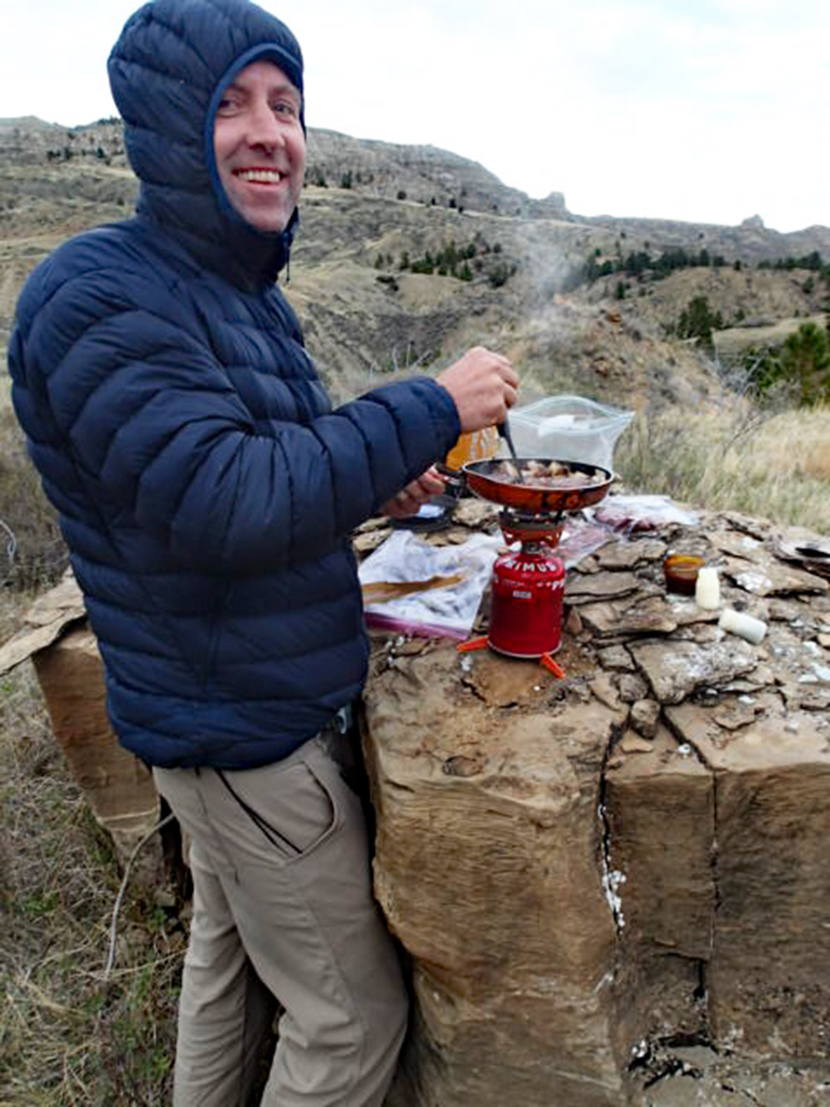
As the afternoon faded, we spotted a spacious level area with a scattering of trees and a nice view of the distant Missouri river. Even better, it had a flat, waist-high boulder that made an ideal kitchen table and bar.
I waited as Randy and Luther threw down their packs and put up their tents. I’ve adventured with these guys before, and one is a world-class snorer. I knew I needed to be at least 50 yards away and upwind. On the plus side, the cacophony kept away curious predators.
The next day, we headed out on a loop hike down to the Missouri River to explore along the shores, water up, and circle back up to the other side of our coulee. I knew from reading the Lewis and Clark accounts of their passage through this immediate area that they passed by here in May of 1805. I’m no longer astounded by the sheer volume of wildlife they encountered.
Deer and elk scat was everywhere. Other than a single spent shotgun shell and a well-weathered .30-30 casing, we saw no other signs of humans until we approached the river. There, dozens of geese and ducks took to the sky, making as much noise as possible. Several hundred yards out on the water we spotted three fishing boats working the bays and inlets.
With honking waterfowl swirling overhead, we finally reached the top of the narrow, barren ridge to an expansive, 360-degree view. The perfect lunch stop quickly lost its appeal as the wind kicked up and the skies started to spit cold rain while lightning flashed to the west.
Later on, our path hooked south and west, paralleling the shoreline before heading up one of the adjacent coulees. Navigating up a steep ridge line, we entered a patch of ponderosas that offered three level spots for our three tents, with a nearby clearing that boasted a fantastic view of the Missouri and wild country in every direction.
Even after the sun went down and the world went dark, we couldn’t see a single artificial light on the horizon.

End of the Trail
After hot coffee and a robust breakfast the next morning, we packed up to head up valley and top out. This valley was a little rougher than the one we took coming in, complicated by the fact that we were moving and looking uphill, always a suboptimal perspective for reading the terrain. Randy took the lead and Luther and I trailed behind him.
As we approached the head of the drainage, we hit a pronounced game trail, which led us steeply uphill and then across a bare rock face for about 200 feet. The trail was about 10 inches wide with the rock face to our left and a sheer drop to our right. It was exhilarating to cross. A bit further on, the terrain opened up and we finally hit the rolling prairie where we’d started four days earlier. The several miles back to our starting point went by quickly.
Back at the truck, Luther pulled a cooler from the back. Tucked inside were three cold beers, which we raised in a toast to future adventures in the vastness of the APR and public lands beyond.


Hello,
I’ve donated to the American Prairie Reserve as the thought of bringing back remnant Bison to the plains enthralls me. I’d pleased to here sportsmen are invited to the lands to hunt and fish. I enjoyed your article and was wanting for me about the lands surrounding this unique area.
This APR coalition is a great thing and definitely needs to be expanded, not only in the American West but in many other parts of this country. Beyond that the country could well use more likeminded people , similar to Patrick Collins to venture into these places and show them to us, encouraging us to see and respectfully use them.
A splendid article and gorgeous pictures. This is my first introduction to the American Prairie Reserve and I am so pleased to know such a program exists and is opening up vast acres of wilderness land for challenging expeditions. If I’m ever fortunate enough to go I’ll remember to follow the well used game trails, be ready to go up and down many times to make small progress, soak in the spectacular beauty every moment and be sure I go with experienced hikers like Randy, Luther and Patrick! A thoroughly engaging and informative article! Thanks, Wendy Benchley
Great to read a first-hand account of the wilderness being protected in the APR! With so little left, every acre is precious. Thanks!
What an adventure! Collins’ very interesting, off-the-beaten-path account of his and his friends’ trek in the APR offers a beautifully descriptive glimpse into what it must’ve been like for Lewis and Clark when they first set eyes on –and traveled through– this territory 200+ years ago. APR’s efforts to maintain these lands as pristine as possible and restore wildlife while offering access to the public to enjoy is a commendable goal which it appears to be achieving. Collins’ article will definitely excite many who want to join in the APR’s goals!
The best adventure story I’ve read in a long time! We need to see a lot more stories by this Collins guy.
This is a well written article that gives one a good idea of what one will be encountering when hiking through this area. It piqued my interest in an area I was not aware of and will be seeking it out next time I travel through Montana. It also highlights how different entities can and should be working together to preserve what is left of America’s prairies and other areas to not only preserve them, but to have them accessible for multiple use interests. I am looking forward to my first visit to this area and I will be donating to both the TRCP and the APR.
Awesome wilderness chronicle, Guest Blogger Patrick Collins. It makes me want to give generously to support the APR, then shut my laptop immediately and head west. How does this area compare to other parts of the APR you’ve visited? Where are you heading next?
Juan – thank you. It is a great project, isn’t it? I’ve also wandered around in the PN unit on the far western end of the APR, which provided some really spectacular views of the river and the landscape – the eye could wander over miles of the Breaks. At one point we dropped our packs to soak in the vista in silence for close to an hour, the only sign of human impact a single canoe far below, heading down the Missouri. Up next? I’d like to check out some corner of the APR where one might stumble across some of the bison that are being reintroduced.
Well written, fascinating story! Looking forward to reading about Collins’ next trip!
Thank you for this personal account of a backpacking trip that only the intrepid among us would pursue! I loved the details about wildlife, and it makes me want to know more about the provisions required for such a trip. Thank you for including photos to give a glimpse into camp life – how civilized that you trekked with chairs!
I like how the article highlights the need for the public and private sector to work together to achieve the scale of the projects described here. Sometimes people think protection means exclusion – your article shows how we can include the needs and desires of people to interact with and enjoy nature with vital efforts to steward the balance of the natural world. Thank you for sharing this story!
Loved reading about this adventure. It took me to APR, making me feel that I was exploring the spectacular landscape alongside with you. We dream of visiting someday and clearly PTG has to be the guide. Maybe not for four days but two? Did you make this trip in late June or earlier in the spring or fall? TRCP, you should make Collins a regular contributor. He has a great conversational style that is also eloquent and evocative. Thank you for sharing!
Terrific blog on what sounds like a great trip! Reading this makes me want to visit the American Prairie Reserve, and reminds me of the importance of supplementing public lands with conservation efforts aimed at private landowners. We need more initiatives like this to care for an increasingly fragmented landscape across the country. It’s nice to be reminded that there are still wild places where few people venture, available to the more adventurous explorer. Thanks, Patrick Collins; we’ll look for more of your writing in the future!
Great blog of an incredible trip! I love the collaborative approach that makes the APR possible and hope it can be applied to other important open spaces. We protect the things we love, and now more people will get to fall in love with this special place. Collins’ writing made me feel like I was a part of the trip and now I’d love to try it in person! Looking forward to Collins’ next article as I build my list of future hikes.