fbpx

December 6, 2023

What is the MAPWaters Act?

Here’s what you need to know about the bill that will help you navigate your hunting and fishing waters with confidence

While hunters and anglers are known to enjoy their traditions, 21st century technologies have been widely integrated when it comes to clothing, optics, and ballistics.

Yet there is no technology more revolutionary to the modern hunter and angler than GPS and digital mapping. These tools—often housed in smartphone applications such as onX—have transformed the way hunters and anglers navigate their public lands and waters, but there are still growing pains with this technology as federal documents containing valuable access and regulation information must be made more readily available to the public, specifically in the digital space.

The Next Step in Modern Access

The MAPWaters (Modernizing Access to our Public Waters) Act builds on the momentum of the successful MAPLand (Modernizing Access to our Public Land) Act, which was signed into law in 2022.

Just as the MAPLand Act requires our public land agencies to digitize records of easements or rights-of-way across private lands, making it possible for the public to understand where public access has been formally secured in legal records, the MAPWaters Act will direct federal agencies to digitize water and fishing access and recreational use information on federal waterways and make those resources readily available to the public. 

This one-two legislative punch will expand public access opportunities and reduce conflict between landowners, managing agencies, and recreationists as everyone will have easy access to the facts about rules and regulations.

The federal waterways specified within MAPWaters include any portion of a body of water managed, or partially managed, by the Bureau of Reclamation, the National Park Service, the Bureau of Land Management, the United States Fish and Wildlife Service, and the Forest Service.

This newly digitized public information would include:

  • Status information on which waterways are open or closed to entry or watercraft, including watercraft inspection or decontamination requirements.
  • The areas of waterways with restrictions on motorized propulsion, horsepower, or gasoline fuel.
  • Types of watercraft that are restricted on each area of a waterway, including the permissibility of canoes, rafts, motorboats, airboats, snowmobiles on frozen bodies of water, etc.
  • The location and boundaries of fishing restrictions on recreational and commercial fishing, including full or partial closures, no-take zones, and fishing restrictions within or surrounding marine protected areas.
  • Fishing restrictions concerning equipment or bait, such as restrictions on the use of barbed hooks or live bait and catch and release requirements.

Locations of boat ramps, portages, wake-zones, as well as depth charts and the operating hours of federally managed buildings and services near these waters would also be made available.

Why We Need MAPWaters

Much of this information can be found in agency documents but is difficult for the public to discover and access. For example, in the Code of Federal Regulations, the U.S. Fish and Wildlife Service includes 42 pages worth of National Wildlife Refuge recreation rules, many of which are tied to waterway navigation and fishing.

The environmental and budgetary factors influencing the management of the thousands of miles and acres of federal waters often make it difficult to construct and maintain physical markers and signs to inform water recreationists of regulations and restrictions. Even where signs have been posted, they are often torn down or physically located at a body of water—which requires driving to the lake or river to read them and discover the rules.  

People are busy, and a lack of easily accessible information about recreational access on public water results in days lost enjoying the outdoors. If the danger of breaking fishing regulations because of a lack of available information keeps anglers from fishing certain waters, the American public is being deprived of valuable opportunities to enjoy the outdoors. With the incredible advances in 21st century mapping technology, hunters and anglers should have the ability to reference their handheld GPS or digital mapping apps to instantly know the rules for recreation and where the boundaries of restricted areas are located.

The MAPWaters Act is designed to address these gaps in information by providing funding and guidance to our water management agencies to digitize mapping information about outdoor recreation so you can fish, boat, float, and relax on your public waters safely and legally with confidence.

It should be noted that the MAPWaters Act would not require the digitization or mapping of state or Tribal rules about navigation or fishing. Further, the legislation would not change the definition of navigable waters, affect the jurisdiction or authority of states or federal agencies to regulate navigable waters, or modify the authority or jurisdiction of federal or state agencies to manage fisheries.    

Learn more about the status of the MAPWaters Act here, and learn more about TRCP’s work to enhance public hunting and fishing access here.

One Response to “What is the MAPWaters Act?”

  1. David Cencula

    Just as the MAPLand Act requires our public land agencies to digitize records of easements or rights-of-way across private lands, making it possible for the public to understand where public access has been formally secured in legal records, the MAPWaters Act will direct federal agencies to digitize water and fishing access and recreational use information on federal waterways and make those resources readily available to the public.

Do you have any thoughts on this post?

XHTML: You can use these tags: <a href="" title=""> <abbr title=""> <acronym title=""> <b> <blockquote cite=""> <cite> <code> <del datetime=""> <em> <i> <q cite=""> <s> <strike> <strong>

Comments must be under 1000 characters.

November 16, 2023

Why Hunters and Anglers Are Stepping Up for Alaska’s Brooks Range

What’s at stake and how you can urge the Bureau of Land Management to prevent the risky Ambler Road project

The Brooks Range of Alaska is the pinnacle of wild country. This largely unbroken chain of mountains buckle into foothills thick with willow and blueberry, as cold creeks fill wetlands and large rivers braid their way through the valleys.

Here, massive sheefish — otherwise known as “the tarpon of the north” — inhale streamers and jerk baits. Tundra swans glide over oxbows, 50-plus-inch Yukon moose wade in the marshes, Dall sheep survey from the shale slopes, and the largest caribou herd in Alaska migrates over the vast landscape to spend their winters in the south.

This is a dream destination for many hunters and anglers. Alaskans and visitors from across the globe revere this wild country for the world-class hunting and fishing it provides, as well as the adventure it promises. But a risky project could permanently alter the bucket-list experiences you can currently enjoy in the Brooks Range. Here are the details and how you can get involved.

Where Risks Outweigh Potential Rewards

In 2020, the U.S. Department of the Interior granted federal permits for a road to connect the Dalton Highway in north-central Alaska to four undeveloped mineral deposits. The proposed Ambler Industrial Road, a 211-mile corridor, would scrape itself across the southern foothills of the Brooks Range to bring foreign-owned mining companies within reach of what could become at least four open pit mines. The economic feasibility of these mineral deposits is still in question.

Due to the vast number of streams, rivers, and wetlands along the proposed corridor, the massive undertaking would require breaking up free-flowing waters with nearly 3,000 culverts and 29 bridges. Industrial vehicles would make an estimated 168 trips per day along the private corridor, diminishing the wilderness character of the area and the quality of hunting and fishing opportunities.

While our nation needs minerals to support our economy and way of life, the risks to habitat, clean water, and this wild landscape far outweigh any potential rewards from the Ambler Road project.

This is why the TRCP has partnered with Hunters and Anglers for the Brooks Range, a coalition of hunters, anglers, conservation organizations, hunt-fish businesses, and Alaskan guides, outfitters, and transporters to make sure our unique voice is heard on this issue. Time and time again throughout the conservation history of this country, the hunt-fish community has proven that we are stronger when we work together.

Now we undertake the challenge to conserve the most wild and remote hunting and fishing grounds in North America.

What You Can Do

The TRCP and Hunters and Anglers for the Brooks Range are urging the Bureau of Land Management to maintain the unique values of this iconic landscape by denying the right-of-way for the proposed Ambler Road. You can lend your support by taking action during a public comment period that ends on December 22, 2023.

Learn more about the hunting and fishing opportunities in the Brooks Range, get the facts on the proposed Ambler Road, and take action on the Hunters and Anglers for the Brooks Range webpage.

What is the Voluntary Public Access and Habitat Incentive Program?

If you’ve used a state walk-in access program to hunt or fish on private land, you’ve experienced what the Voluntary Public Access program can do. But what is VPA-HIP and how does it benefit hunters and anglers?

We know it can be challenging to break through the acronyms to understand why the reauthorization and improvement of Farm Bill conservation programs is a top priority.

In this short video, we demystify a crucial Farm Bill conservation program, the Voluntary Public Access and Habitat Incentive Program (VPA-HIP) and shed light on its benefits to hunters and anglers.

Championed by the Theodore Roosevelt Conservation Partnership’s founder, Jim Range, VPA-HIP is the only federal tool aimed at increasing hunting and fishing access on private lands, yet it is probably the least well-known of Farm Bill conservation programs. Watch the short video below to learn more about VPA-HIP and how this crucial program benefits hunters and anglers.

The next few months will be critical for the Farm Bill and the conservation programs we cherish as hunters and anglers. In the face of gridlock, conservation is, and should be, a shared priority regardless of party affiliation or ideology. Click here to learn what’s next for the Farm Bill.

November 15, 2023

Proposed State Land Auction Threatens Habitat & Hunting Opportunities Near Grand Teton National Park   

TRCP asks for a better solution to raise money for public education while conserving big game habitat

Nestled between Grand Teton National Park and the Bridger Teton National Forest lies a single section of state-owned land. Besides the incredible views and proximity to the National Park, the “Kelly Parcel” is a gateway to the scenic Gros Ventre River drainage and along the path migrating elk take to the National Elk Refuge. A mix of aspens, conifers, and sage intertwine with native grasses, providing habitat for numerous native species of wildlife.  

However, the future of this land is at risk. To meet its fiduciary duty to generate revenue for education, the Wyoming Office of State Lands and Investments has proposed to dispose of the Kelly Parcel via public auction, which could lead to development and permanent loss of invaluable habitat if it ends up in the wrong hands. 

The OSLI exists to manage state-owned land for the primary purpose of generating funds for the Wyoming public school system. To do so, state land is leased for uses like grazing, mineral extraction, or recreation.  Leases on the Kelly Parcel currently exist, but due to its appraised value at $62 million, disposing of the land would increase annual profits for the state through interest dividends.  

According to the Wyoming Game and Fish Department, the Kelly Parcel is valuable habitat for 87 “Species of Great Conservation Need” including moose, bald eagles, and bighorn sheep. In addition, it is a key piece in multiple species’ migration corridors including elk, deer, and the world-famous “Path of the Pronghorn.” During spring and fall migrations, more than 1,000 elk pass through the parcel at one time. 

The Kelly Parcel also provides valuable hunting opportunities for elk and bison, along with river access to the Gros Ventre River. This piece likely offers the most recreational opportunity out of all state land parcels in Teton County. Keeping this parcel accessible to the public and conserved for its irreplaceable habitat values should be at the forefront of anybody’s mind who enjoys wildlife, recreation, and the outdoors in Teton County. 

We understand the critical importance of raising funds for public education via state lands and believe the state can meet its fiduciary duty while also conserving the Kelly Parcel. The privatization and development of the parcel would benefit a few with extraordinary wealth at the detriment to Wyomingites who come to the area to visit, hunt, view wildlife, and experience this iconic landscape. Instead, we ask the Office of State Lands and Investments to work with a diverse coalition of Wyoming citizens to find a solution that benefits our school children while ensuring they have a future to experience the wildlife who depend on this parcel.

If you care about open spaces, wildlife, and the future of the Kelly Parcel, please consider attending one of three public hearings listed below, or submit written comments using our easy tool here. 

Thursday, November 16, 5:30pm

Thyra Thomson State Office Building

Round House Room

444 W. Collins Drive

Casper, WY 82601

Tuesday, November 21, 5:00pm

Laramie County Library, Cottonwood Room

1st floor

2200 Pioneer Avenue

Cheyenne, WY 82001

Tuesday, November 28, 5:30pm

Wyoming Game and Fish Department Cody Field Office

Cody Field Office Public Meeting Room

2 Tilden Trail

Cody, WY 82414

Photo credit: Josh Metten

November 8, 2023

Ryan Nitz: The ‘Barefoot Bandit’ of the Everglades

In part one of a two-part blog, the charter captain and swamp stalker talks bowhunting close calls and using his social platform to push Everglades conservation


If you’re Ryan Nitz, South Florida hunting is all about risk taking. Along with a little sacrifice, and even more suffering.

After bushwhacking through the subtropical forest, the Florida native once swiped a massive, fuzzy, orange-striped puss caterpillar from the back of his neck. Almost immediately his vision blurred and profuse drool dripped from his slack mouth as he stumbled back to his truck. That injury was just to his neck. His feet take bigger risks.

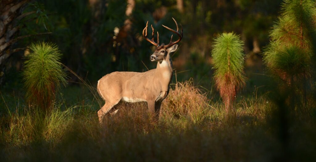
That’s because Nitz often opts to hunt barefoot. Not in the cool, open woodlands or grassy meadows of middle America, but in the snake and spider-filled swamps of the Everglades. While wading northern Everglades haunts in search of goonie bucks, his feet find a lot more.

“I’ve literally stepped on a water moccasin,” Nitz says.

He trod on the squirming snake while walk-and-stalk hunting for deer, jumping away before it could strike because by sheer luck he’d stepped on the serpent’s neck. He’s also stumbled into an alligator while heading out of a cypress dome in fading twilight. He was marching toward his swamp buggy pickup spot, bow in hand, not paying attention as he tried to get a cell phone signal. He ran smack into a massive gator, luckily facing away from him.

“When I hit the tail of him, he did a one-eighty and snapped his jaws,” he says. “I’ll never forget the sound it made, like a 12-gauge shotgun going off. I could actually feel the percussion.”

While he says those reptile encounters were scary, they don’t compare to his worst barefoot experience: stepping on a scorpion. “The only way to describe it is if you stepped on a knife. I couldn’t put shoes on for like nine days.”

Risks Are Worth the Rewards

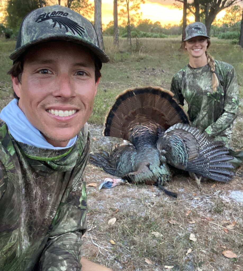
Why does Nitz, nicknamed by peers the “Barefoot Bandit,” risk exposing his feet for hunting? Because where he lives, the best place to find 10-point whitetail bucks is in inundated cypress swamps, where wearing boots means overheating, having soggy socks inside sunken boots, and making lots of noise. He also barefoot hunts, for deer as well as hogs and turkeys, for better maneuverability and stealth. He acknowledges the risk. But he’s onto something. Because this story is not just about his feet, but also his feats.

Feats garnered due to his early sporting success – and not just personally bagging the biggest South Florida bucks. Feats like the rush of getting to guide out-of-state hunters into pristine Florida uplands to call in Osceola turkeys. Or like changing his career from pest control specialist to one of the more highly sought after (and youngest) snook fishing guides in South Florida. And like being able to lend his experience to offer fishing and hunting trips that leave positive lifelong memories with those who hire him.

“I really like showing people what I’ve learned over the last 20 years,” he says. “And my clients are sometimes almost in tears because they had such a memorable day in the field with a family member or friend.”

Social Media Sensation

Nitz has spent his entire 32 years in coastal southeast Florida, in and near the northern reaches of the Everglades ecosystem. From turkey hunts in north Florida to whitetails in the Glades, he’s had hunting success throughout the state. But it was snook fishing in his backyard that really launched his business, Ryan Nitz Charters.

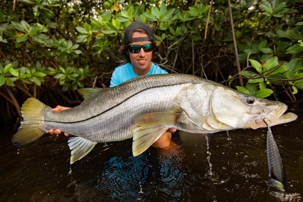
Nitz became an expert snook fisherman near his Jupiter home after spending every afternoon in high school wading along mangroves and under bridges in what he calls “the snook capital of North America.” Until seven years ago, it was only for fun. Back when he was working in pest control to earn a living. But as a wildlife photographer, he started taking pictures and filming experiences using the GoPro on his head. His girlfriend at the time insisted he set up social media accounts and post his unique photos from the field, which he’d resisted because he thought people often use these platforms for all the wrong reasons. But he gave in and started posting the snook shots online.

His Instagram following blew up.

Television shows began to find him through his social media accounts, as did a sudden rush of people willing to be clients. He suddenly realized he could make a living out of doing what he loved. So he went and earned his captain’s license, bought a better boat, and stopped doing pest control. The rest is history.

“Now I’ve made myself known for the biggest snook you can catch.”

Over time Nitz’s Instagram account has literally become his business. It also lets him showcase the deer and gobblers he still stalks for fun, and which ultimately led to him guiding hunters into some to the best Osceola turkey habitat in the state.

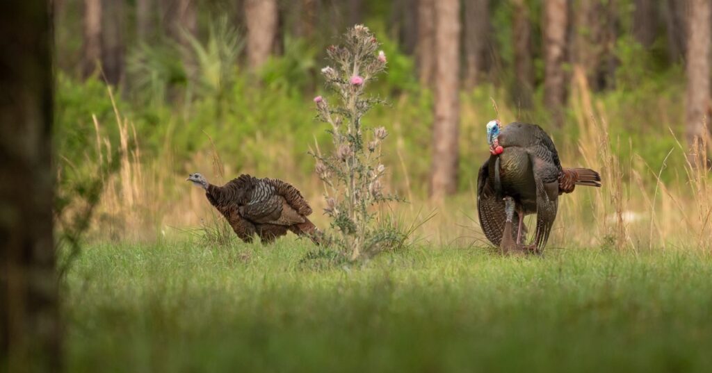
He says that much of the land he leases for 20 to 30 turkey hunting clients each year is in the eastern part of the Everglades, in the “most pristine Florida woods you can find.” But recently he’s been running into more and more problems with development. One 300-acre property he leases for hunting, along with the property to the north, will soon be developed.

“There goes another piece of the woods we’ll never get back,” he laments. “And all that new infrastructure will block the flow of water from the Kissimmee [River] to Biscayne Bay.”

A Mouthpiece for Conservation

Like the sacrifices he makes for a successful hunt, Nitz has come to recognize that if we care about the natural world and conservation, we all have to be willing to give something up. Like turning down clients who want to fish an area that’s been hit too hard one season, regardless of regulations, or offering time or effort to support restoration efforts. He also wants to use the platform he’s created for conservation.

“Because I have that voice and following, I want to use it while I’m still young.”

Click here to support critical Everglades restoration projects

Nitz readily admits that the South Florida areas he’s put in the spotlight have gotten more pressure due to his own social media popularity, but he intends to use this to his advantage now. With 50,000 followers, that means a lot of potential hunters and anglers to hopefully follow his lead on caring about conservation.

“Because I have that voice and following, I want to use it while I’m still young,” he says.

Nitz says the allure of Florida has always been the beautiful beaches, the inshore waterways, the vast swamps teeming with wildlife, and the resulting fishing and hunting. Without these, and the fish and wildlife they support, all Florida would have left are theme parks and new condos. He sees rampant development and the politics that enable it as the biggest problem Florida’s terrestrial ecosystems face, due to the flood of people moving to the state and too many decision-makers focused more on money than conservation.

“I wish somebody would have wild Florida at heart,” he says of the powers that be. “Right now is the time to act to have any chance of saving the state. And the Everglades are the heartbeat of Florida, so you have to start there. Once they’re gone, it’s all gone.”

Solutions Lie in Teamwork, Targeted Funding

Nitz believes one of the main pathways to conservation is getting organizations and individual hunters and anglers rowing in the same direction.

“It’s a great thing to have organizations like TRCP, because there’s strength in numbers,” he says, referring to the nonprofit’s large following in the sporting community and its connections to partner groups. Like TRCP’s involvement with the Everglades Coalition, a group of almost 60 conservation and environmental organizations dedicated to restoration of the Greater Everglades Ecosystem. The coalition’s efforts to restore North America’s largest wetland largely revolve around getting the sporting and conservation communities to notice, and to care.

“That’s really our only chance,” Nitz says. “Get enough people involved and pissed off enough about it that they’ll do something.”

###

Read part 2 of our blog on Ryan Nitz, which focuses on his fishing charter business and risks to giant snook.

Click here to support Everglades conservation efforts by insisting that lawmakers continue to provide funding for critical infrastructure work.

Want to Hunt or Fish with Nitz?
He still does everything through his Instagram account, including respond to inquiries. If you don’t use social media, just type ‘Ryan Nitz’ into Google to find him and request to book a charter. He’ll get back to you between barefoot backwater hunts and midnight snook runs. 

Photo credits: All images except of water moccasin courtesy of Ryan Nitz

HOW YOU CAN HELP

CHEERS TO CONSERVATION

Theodore Roosevelt’s experiences hunting and fishing certainly fueled his passion for conservation, but it seems that a passion for coffee may have powered his mornings. In fact, Roosevelt’s son once said that his father’s coffee cup was “more in the nature of a bathtub.” TRCP has partnered with Afuera Coffee Co. to bring together his two loves: a strong morning brew and a dedication to conservation. With your purchase, you’ll not only enjoy waking up to the rich aroma of this bolder roast—you’ll be supporting the important work of preserving hunting and fishing opportunities for all.

Learn More
Subscribe

You have Successfully Subscribed!

You have Successfully Subscribed!

You have Successfully Subscribed!

You have Successfully Subscribed!

You have Successfully Subscribed!