Web Viewer for Montana and the Dakotas Spotlights Access Easements for Outdoor Recreation
In the world of policy, it can at times be difficult to show how a single piece of legislation could improve the lives of hunters and anglers. But thanks to a new digital resource from the Bureau of Land Management, we can come pretty close to showing the public what a game-changing access bill (MAPLand Act) can do.
The BLM recently released a web-viewer that incorporates a new GIS layer identifying public access routes to BLM lands in Montana, North Dakota, and South Dakota. And this web-based tool not only presents hunters and other outdoor recreationists with a valuable resource for planning their next public land outing, it offers a glimpse of what would be available with the passage of the MAPLand Act. This bipartisan legislation is a top TRCP priority that could make a positive impact when it comes to identifying access opportunities on public land across the country.
Hard Copy Hassles
On an antelope hunt several years ago, I stopped by the local BLM field office to ask about the legality of driving on certain unimproved roads in an area where I was hoping to spend the weekend. As is the case throughout much of the West, there were large parcels of BLM-managed public lands interspersed with privately owned lands, and a tangled network of dirt two-track roads connecting them all. Without any signage on the ground, I couldn’t tell which roads were open to public access where they crossed private lands, and which roads could only be used with the permission of the private landowner.
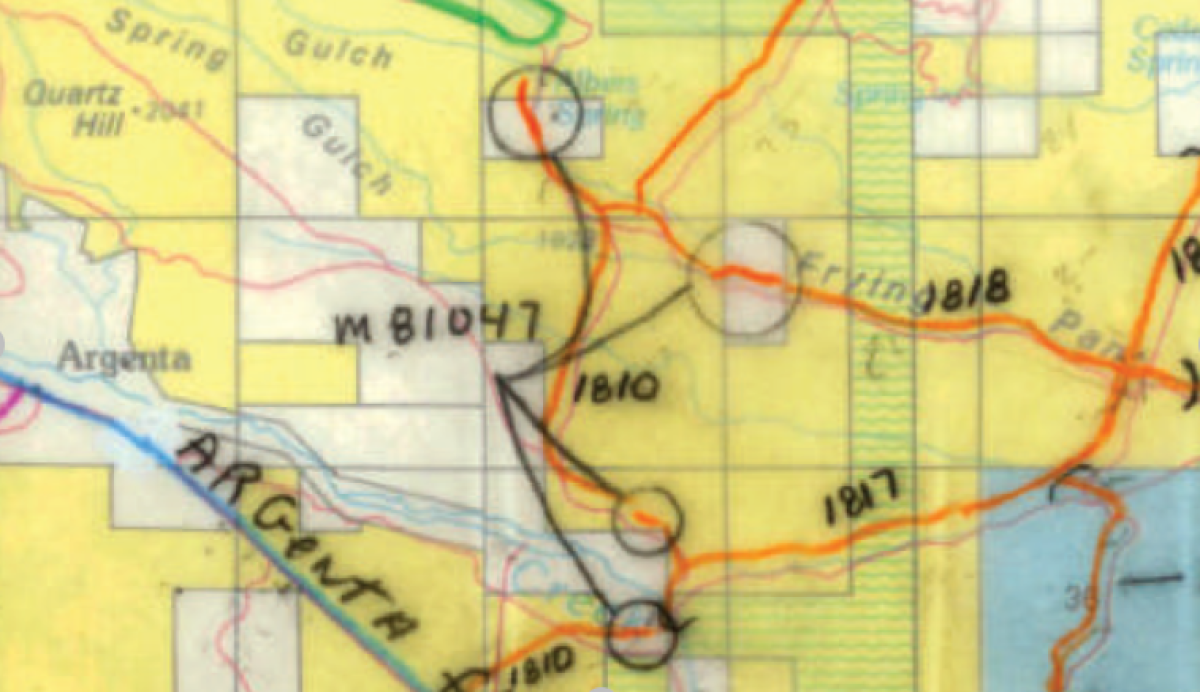
What happened next was surprising: to provide me with this information, the agency staffer had to manually find paper maps, scan them, and email me the files, which I could then reference on my phone’s PDF viewer. The legal documents that establish the public’s right to use a road—easements—were stored on PAPER records, and so the only way I could see which roads I could use was by looking at a paper map that had been annotated with colored pens and pencils! Different colors, it was explained, indicated the particular agency in charge of the road. Where there was a circle around a piece of road spanning private land, an accompanying note specified the particular document that had secured legal access. Getting any additional information about a specific easement would’ve required a review of the hard-copy files stored in the field office’s records.
For the past few years, I’ve kept that email with the scanned maps as a reference whenever I head down to that part of Montana, which has plenty of unimproved, unsigned roads that appear as lines on the map, but don’t clearly indicate one way or another whether they can be used by hunters to cross private property.
A Better Way
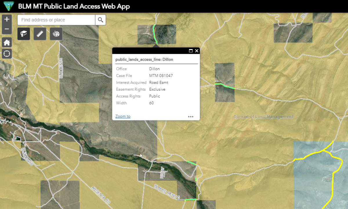
Next time, however, I won’t need to visit the local BLM office or ask so much of busy agency personnel. With the BLM’s new Public Land Access Web App, I can simply zoom in on the part of the state I’m interested in, and the routes offering public access across private land via easements are highlighted in yellow. When a user clicks on a highlighted segment, a pop-up offers additional details about the access agreement, including the relevant case file, the type of interest acquired by the BLM, and what type of access rights exist. That road segment, and any other segments to which the open easement info apply, changes to a bright green color.
The GIS layer underlying the web app was completed in October of last year. According to the BLM, it required a tremendous volume of research on the part of the agency’s realty specialists. Staff digitized 378 easement deeds and patent reservations from casefiles and records from the General Land Office, a now defunct federal agency that was something of a predecessor to the BLM. Many of these easements date back decades, and over time they collectively established public access to more than 2.8 million acres of public lands. Now in a digital format, these records can be used more easily by the public as well as the agency itself, particularly in management and acquisition decisions that would impact access. This layer was something of a pilot project for the BLM, which, like other public land agencies, has been working to modernize its access records with limited resources dedicated to this priority. The agency is now working to expand the Web App and access layer to include additional Western states.
The Future of Access
Here’s where the MAPLand Act comes in. The Modernizing Access to Our Public Lands Act, S. 904, would provide agencies like the BLM, Forest Service, and National Parks Service with the direction and funding to establish and make publicly available the type of detailed, digital access records like those now available through the BLM Montana/Dakotas Public Land Access Web App. Not only would this include easements, which in most places are only held on paper files, but all sorts of other map-based recreational information. Such records would include information about legal easements and rights-of-way that provide public land access across private land; seasonal or vehicle-type restrictions on public roads and trails; boundaries of areas where any special rules or prohibitions apply to activities like target shooting or hunting; and areas of public waters that are closed to watercraft or subject to horsepower restrictions.
Most importantly, in a digitized format this information would be available to the public in an easy-to-find and easy-to-use interface. Whether in the field on your smartphone or planning your next public land adventure from home, a click of the mouse or a tap of your finger could bring up exactly what you need to know in order to stay legal and safe on your hunting or fishing trip. In addition to helping you take full advantage of existing opportunities, the agencies themselves would benefit from these resources by more effectively managing their holdings, reducing user conflict, identifying public lands with limited or nonexistent access, and taking proactive steps to expand recreational opportunities.
The reintroduction of the MAPLand Act in the Senate last week should be welcome news for sportsmen and sportswomen. A modern mapping system to serve the growing numbers of outdoor recreators is a long-overdue, common-sense investment. It is critical that lawmakers hear your voice on this issue.
TAKE ACTION NOW



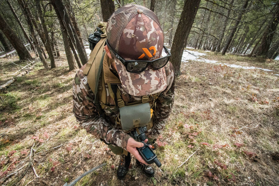




I really found this blog post to be very informative. If there ever was such an app made I would 100% download it. However, there are already similar apps that provide the same, or a similar service such as onX, but the downside is I pay a yearly subscription for this. I think if there was a free version then it would help a lot of people out who want to explore public lands, but don’t necessarily want to pay a yearly subscription to do so. Thanks for your time!