Three fishing buddies land fish after fish on a stretch of shoreline that is significant to Louisiana sportsmen and conservationists—it was rebuilt with fines from the 2010 Deepwater Horizon oil spill after years of incremental habitat loss
I have been spoiled by the fishing in Louisiana for more than 40 years. Many days, my wrists have ached and my fingers have been scarred from landing countless speckled trout and redfish. There are times when, no matter how many fish I’ve caught, I can’t stand to walk out of the surf or point the boat back to the marina, because I know the next cast will mean another thump or topwater explosion.
But there are great days on the water and near-perfect ones, when the wind gods are merciful, the tide is just right, the company and camaraderie is unmatched, and the fish strike ferociously at just about anything cast their way.
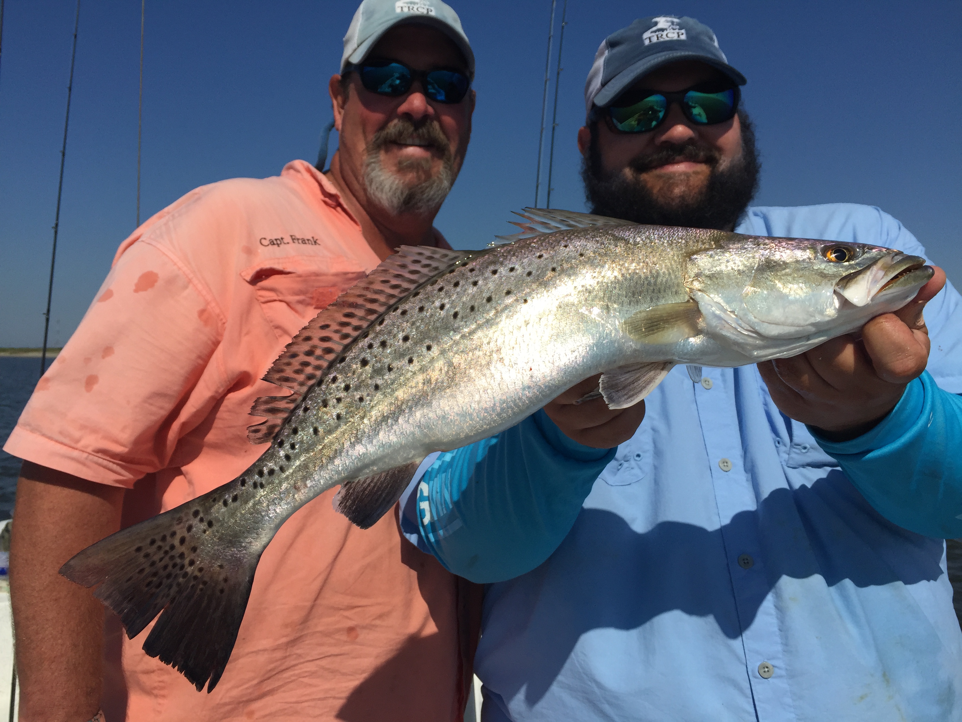
I recently had one of these days in a place with particular significance to conservationists who have been following the Gulf Coast’s recovery from one of the worst ecological disasters in American history.
The Disappearing Shoreline
Perfection greeted me and two of my best fishing buddies, outdoor writer Todd Masson and Grand-Isle-area fishing guide Capt. Frank Dreher, on an early May trip to the Fourchon Beach, one of Louisiana’s most popular and renowned spring and summer fishing destinations. Two- to four-pound trout demolished a litany of lures—from topwater plugs and soft plastics to jerkbaits and minnow and shrimp lures—all morning long.
The backdrop for all this incredible fishing action just happened to be the largest coastal restoration project and the largest single investment in the recovery of the Gulf Coast after the 2010 Deepwater Horizon oil spill, something that meant a lot to three lifelong Louisianans who have seen a lot of beaches, barrier islands, and marshes vanish over the last four decades.
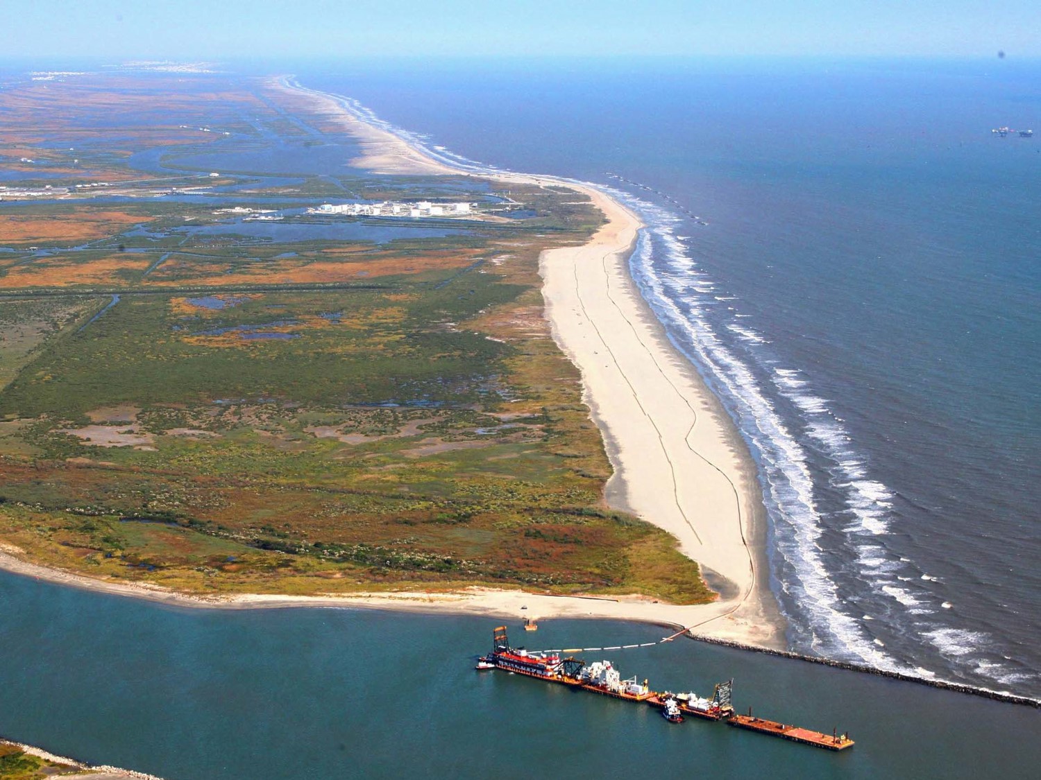
The Fourchon Beach is the westernmost section of a stretch of shoreline known as the Caminada Headland, which, including Elmer’s Island, stretches 14 miles between Caminada Pass and the mouth of Bayou Lafourche, once a main artery from the Mississippi River to the Gulf of Mexico about 1,000 years ago. The headland was formed by sediment deposits delivered via the Mississippi and replenished by water-borne river silt until the bayou was dammed at the river around 1900.
For the last century, hurricanes, strong winter storms, subsidence, and tidal currents have eaten away at the headland, causing the beach to retreat about 35 feet per year and threatening the more fragile marshes to its north—not to mention the energy infrastructure of Port Fourchon and camps and homes on Grand Isle, Louisiana’s only inhabited barrier island.
This land loss has also threatened the tremendous fishery along the beach, which is popular with boaters as well as wade fishermen. As most seasoned surf fishermen know, the best action of the morning is often right off the sand, giving waders an opportunity to target fish that boat-bound anglers can’t reach. I grew up fishing the Elmer’s beach with my dad, catching stringers of beautiful speckled trout and redfish and dozens of fat blue crabs in the summer.
From Off-Limits to Off the Hook
In 2010, oil from the Deepwater Horizon spill coated this beach. Many of the iconic pictures circulated in the media coverage of the spill, showing sheets of sticky, rust-colored tar mats and brown pelicans coated with oil, were taken at Elmer’s Island and the Fourchon Beach. In August of that year, not long after the Deepwater Horizon well was finally capped, I fished along Elmer’s by boat, catching trout and Spanish mackerel on topwater lures and gold spoons, just like I always have. Wading wasn’t allowed for more than two years after the spill.
Louisiana’s Coastal Protection and Restoration Authority were back with more heavy equipment and personnel in August 2013, this time to restore the beaches and dunes, rather than drag and sift them for oil. Using fines paid by the oil company and directed by the National Fish and Wildlife Foundation’s Gulf Environmental Benefit Fund, more than $200 million was invested to bring in sand from an ancient, sunken headland of the Mississippi River about 35 miles west of the Fourchon.
The entire beach was extended back into the Gulf by about 500 feet, fencing was installed to capture sand and rebuild the dunes, and sea oats were planted to hold the beach together. We at the Theodore Roosevelt Conservation Partnership joined a host of other conservation and sportsmen’s groups in championing the restoration effort because of the enormous benefit to wildlife and fish and boost to fishing access.
It is a quintessential example of the kind of project that deserves to move forward using oil spill penalties, especially considering that this funding has the potential to leave the Gulf of Mexico a better place than it was before that awful event.
So, it was a proud day to be able to cast just short of the sand on that newly restored beach and set the hook into fat, feisty speckled trout. We watched specks jump clear out of the water, while brown-and-white shrimp skipped across the surface and gulls and pelicans dove all around the boat—it’s a memory that will stay with me for a long time. And, thanks to a wise investment by the state of Louisiana with support from a broad coalition of sportsmen and environmental groups, memories will be made along that beach for decades to come.







How many of these seatrout do you intend to eat? Why don’t you participate in catch and release?
Deepwater Horizon restoration is perhaps the best conservation win this century? Way to geaux!
Why have they removed the only way to gain access to Fourchon beach and they no longer allow fishing, camping, recreation use or just to take beautiful pictures. I so miss Fourchon Beach. I started going there in 1969.