Using the industry-leading mapping software, TRCP and onX team up to make the case for a broader approach to public lands access acquisition
For Western hunters who depend on public lands, software from onX combined with a smartphone or a handheld GPS unit has changed the game. Showing a user’s real-time location in relation to tangled property boundaries, this technology allows sportsmen and women to hunt unmarked and isolated tracts of public land along rivers and roads without the risk of trespassing on private land.
Recognizing how transformative their mapping software has been, we’ve partnered with onX to illustrate a major challenge for public land hunters across the West, and how this technology might be used to change the game for public land policy as well. Here’s how.
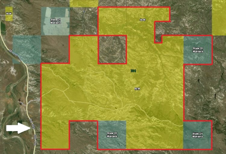
Still Locked Out of Our Public Lands
In many Western states, millions of acres of public lands remain “landlocked”—meaning they are rendered completely inaccessible by surrounding private lands. Historically, establishing legal access to these often small and remote parcels through easements, right-of-ways, or land acquisitions would not have been particularly useful, given the difficulties involved in identifying them and discerning their boundaries.
The modern GPS-equipped sportsman, however, can confidently make good use of small tracts of public land that might sit only a few hundred yards from a public road, if provided with a means of legal access across private tracts.
Officials in Washington, D.C., currently have at their disposal a powerful tool to do just that. Enacted in 1965, the Land and Water Conservation Fund is the primary source of federal revenue for acquiring new public lands and a critical program for expanding hunting and fishing access to Bureau of Land Management and U.S. Forest Service land and water resources. It is incredibly popular among hunters and anglers, and it enjoys bipartisan support on Capitol Hill.
While in the past, LWCF acquisition funds have generally been used to consolidate blocks of checker-boarded public lands, the Bureau of Land Management and U.S. Forest Service have utilized LWCF funds in recent years to work also toward establishing legal recreational access to currently landlocked parcels of public land. The current state of technology means that we now have more sophisticated means for doing so with tremendous opportunities for the average sportsman.
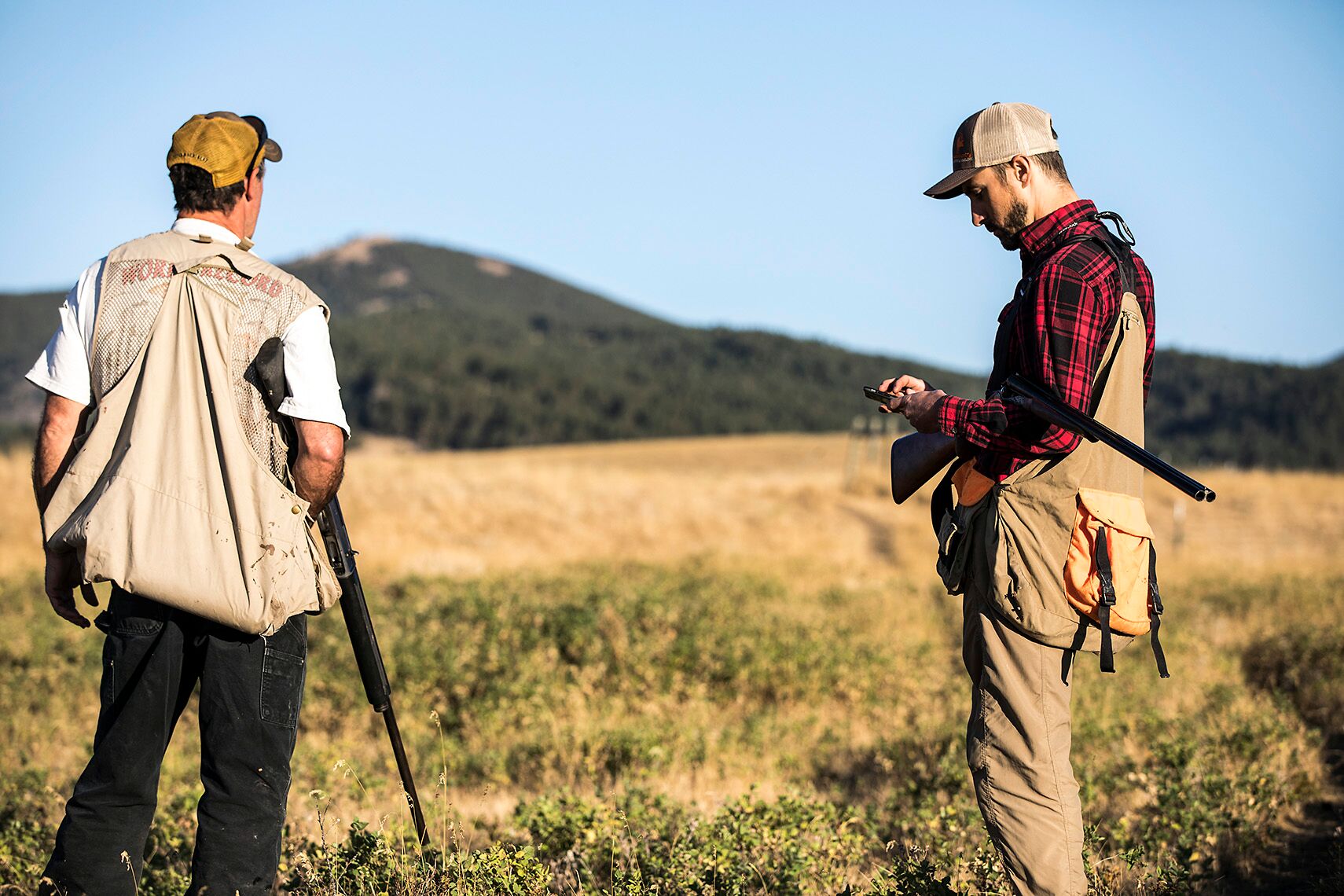
What’s more, the current administration has committed to improving sportsmen’s access. In September 2017, Interior Secretary Ryan Zinke directed the Bureau of Land Management, National Park Service, and the U.S. Fish and Wildlife Service to produce plans for expanding hunting and fishing opportunities on public lands. The agencies were also specifically charged with identifying lands where access is currently limited or impossible via public roads or trails.
This is great news for public land hunters and anglers. But DOI’s focus on access is at odds with the precarious position of the Land and Water Conservation Fund. Despite its many existing and potential benefits, the program will expire on September 30, unless reauthorized by Congress. We believe that the new opportunities to expand technologically assisted access to our public lands should inspire Congress and the administration to move LWCF reauthorization across the finish line as soon as possible.
Breaking Through
The TRCP and onX are convinced that securing public access to inaccessible public lands should be a priority among policymakers. That’s why we have partnered up to educate legislators and agency personnel on exactly how mobile technologies are changing the way people access our public lands.
As part of this effort, onX founder and CEO Eric Siegfried traveled to Washington, D.C., where he joined TRCP staff in meetings with officials at the Department of the Interior, Bureau of Land Management, and U.S. Fish and Wildlife Service, as well as staff at the White House Council on Environmental Quality and Office of Management and Budget.
Together, we impressed upon the agencies and decision makers how modern GPS technologies that enable the public to pinpoint the exact location of property boundaries have created new opportunities for both sportsmen as well as policymakers looking to expand public access. Using onX software to show how public land is locked up back home, we also explained the importance of LWCF to the ability of the federal government to continue opening inaccessible lands to the public.
We now require your help to convince the administration and your congressional delegation of the need to reauthorize LWCF as soon as possible. Without this critical program, most public land access and acquisition projects would not occur—and time is running out.





A lot of land in northeast Wyoming is landlocked and ranchers will not allow access or charge access fees too high to be reasonable. We should be allowed to hunt ALL public lands.
I totally agree. I think all public land should be assessable and a land owner should have to be made to provide an easement to the public land. In the State of Michigan it is illegal to keep someone land locked out of private or public land. Our current Administration and Congress should work together and open up these western lands for the public. Instead of being used a private land by the surrounding land owners
Thank you.
Love the app. Used it last year to stay on state land. We were 20 yards from private.
I use the OnX app ALL the time. The landownership feature is awesome.
Legalizing corner crossing, with some stipulations, would solve a lot of the problems and would cost little to nothing.
Lots of talk about the West. Have any east coasters used the software? We don’t have much of the landlock issue here in Virginia, but there are lots of small private chunks of land entangled into our public land.
Great idea, I pioneered GPS mapping in CA with a military surplus unit after Desert Storm. We donated to CDFG and they sent out an intern, who over a period of 2 yrs mapped all man-made developed water sources for wildlife. This information was gathered only for CDFG/BLM/USFS use, not available to the public. Used for maintenance purposes and to provide game warden’s unfamiliar with our ecosystems to be able to monitor for poaching, etc. The big problem today in the west besides, public access is POACHING, nite vision scopes and use of drones. Liberal judges not punishing commercial poachers. We are seeing a big decline in all huntable large and small game….Fishing with gill nets, just cleaning out whole sections of river ecosystems.
Great article! Public land that doesn’t allow for public access just doesn’t make any sense. Living in Washington and Oregon there are a number of instances this occurs.
It would be great to see easements and other agreements to help sportsman.
All public lands should be made accessible by reasonable means. Corner crossings should be legal in all states which would open up thousands of acres of public land. It is bad policy that corner crossings are illegal.
We used this technology for our public land/landowner permit hunt in Montana a few years ago. It was great at keeping us where be belonged.
Fantastic tool! I’m a falconer in the Deep South. Most of us hunt squirrels in timber. It’s been a nightmare navigating around other hunters especially when red-tail hawks are traditionally seen as vermin. Hopefully this may help those of us whose hunting partners are on the wing. Thanks for all you do!