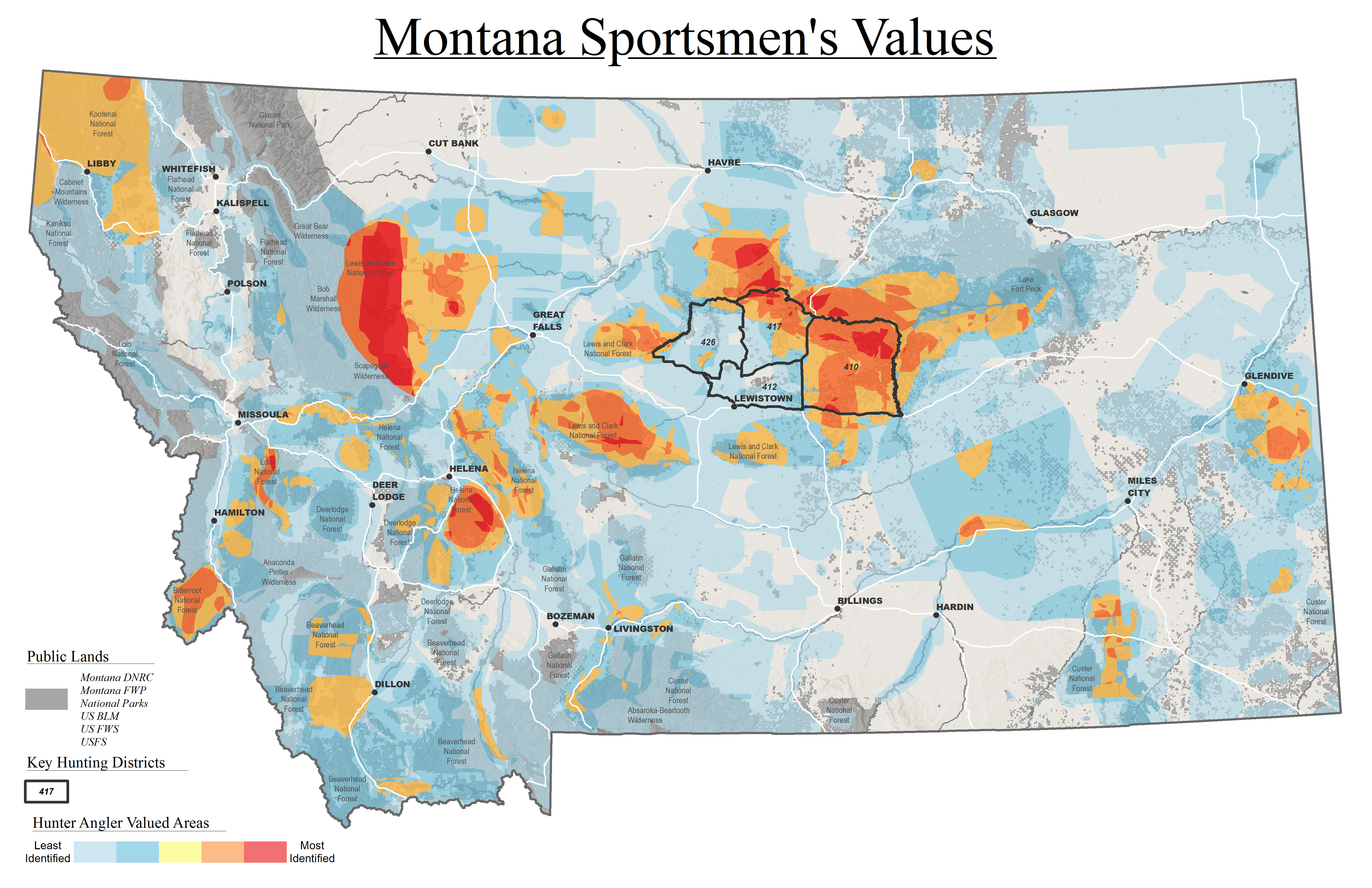
In January 2007, the TRCP worked with the Montana Department of Fish, Wildlife & Parks (FWP) and more than 40 sporting clubs in 30 communities throughout the state to gather information about Montana’s most important hunting and fishing areas. Montana FWP provided maps and GIS technical assistance along with full support of the project.
After the information-gathering phase of the Montana project was complete, the TRCP made presentations to illustrate to the local hunters and anglers who participated that their input contributed to a map of highly-valued hunting and fishing areas within the state, and to discuss uses for this valuable data in support of access and habitat conservation.

To date, the Montana sportsmen’s values map has been used to inform important land-use decisions, such as the acquisition of new public lands along a major tributary of the Smith River in Central Montana, and to promote responsible management of BLM public lands with high-quality elk and mule deer habitat, such as the area around the Missouri River Breaks.
Contact Information:
Scott Laird, Montana Field Representative
Missoula, Montana
406-926-3201
slaird@trcp.org


