fbpx

January 12, 2022

Here’s How Sitka Black-tailed Deer—and Hunters—Benefit from the Roadless Rule

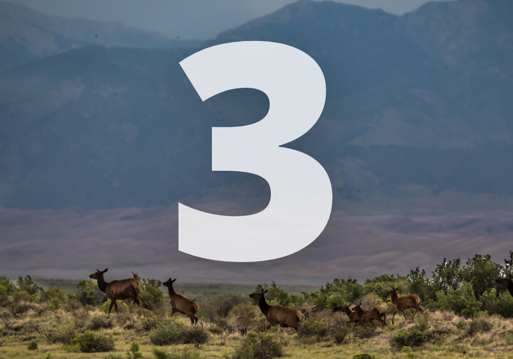
Reinstating these foundational safeguards to 9 million acres of undeveloped forests in Southeast Alaska supports critical winter range and deer hunting opportunities

This is the first piece of a two-part series on how to improve Sitka black-tailed deer habitat in Southeast Alaska. This blog focuses on the role that old-growth forests play in determining hunting opportunities for deer. A future discussion will address approaches for improving deer habitat in unmanaged stands of second-growth forests.

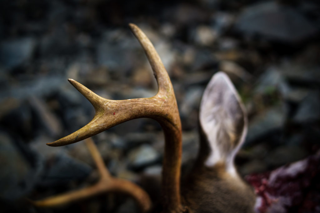
A small deer with a big role

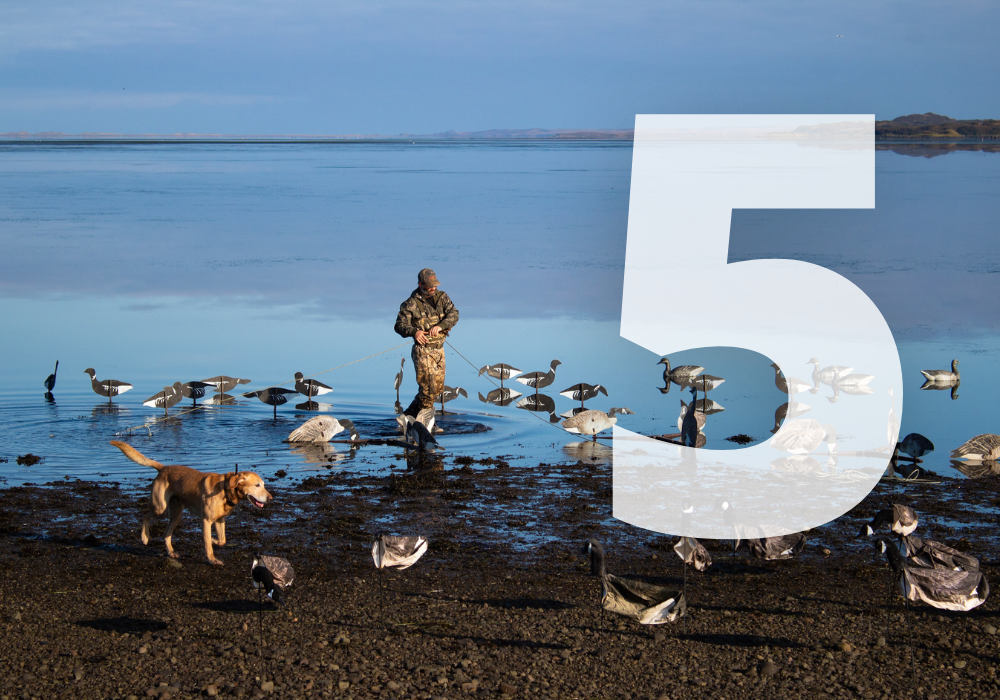
Despite their relatively small physical stature, Sitka black-tailed deer play a big role in the hunting traditions of Southeast Alaska, where they are the most pursued species of big game. These short and stocky ungulates, which are a subspecies of mule deer, serve as an important food source in a remote region where store-bought groceries—which are typically transported by plane or boat—are costly and limited. Many rural residents, both Alaska Natives and non-Native people, practice a subsistence lifestyle and rely on the rich, wild resources of the Tongass, such as deer, salmon, grouse, berries, mushrooms, and more.

Sitka black-tailed deer also provide one of Alaska’s best hunting opportunities for non-residents. During the 2021-2022 season, non-residents could harvest up to six deer on Admiralty Island with an over-the-counter tag. Many other big game species in Alaska require non-resident hunters to hire a guide and/or draw a coveted tag in a competitive lottery. Sitka black-tailed deer offer the most abundant opportunities for unguided hunters from the Lower 48.

Bethany Goodrich

The Tongass: a mosaic of deer habitat

Sitka black-tailed deer are native to the coastal rainforests of Southeast Alaska and northern British Columbia. Populations have also been introduced on many of the islands in Prince William Sound, near Yakutat, and on Kodiak and Afognak Islands. Much of the habitat that these animals rely on is located within the Tongass National Forest.

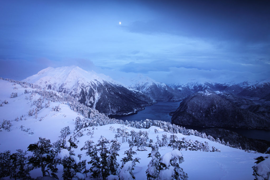
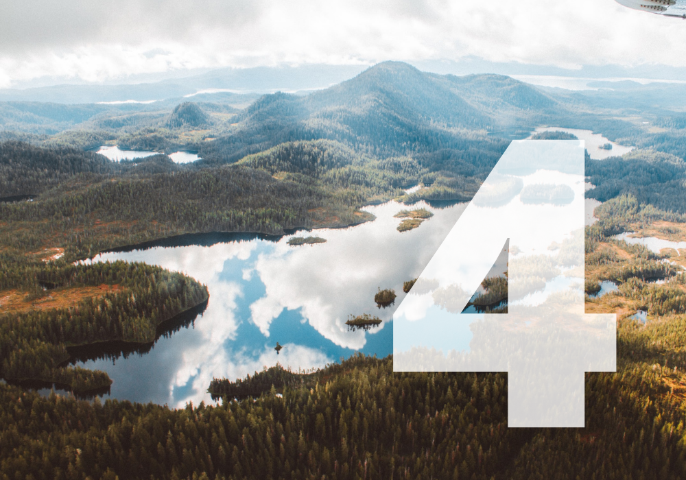
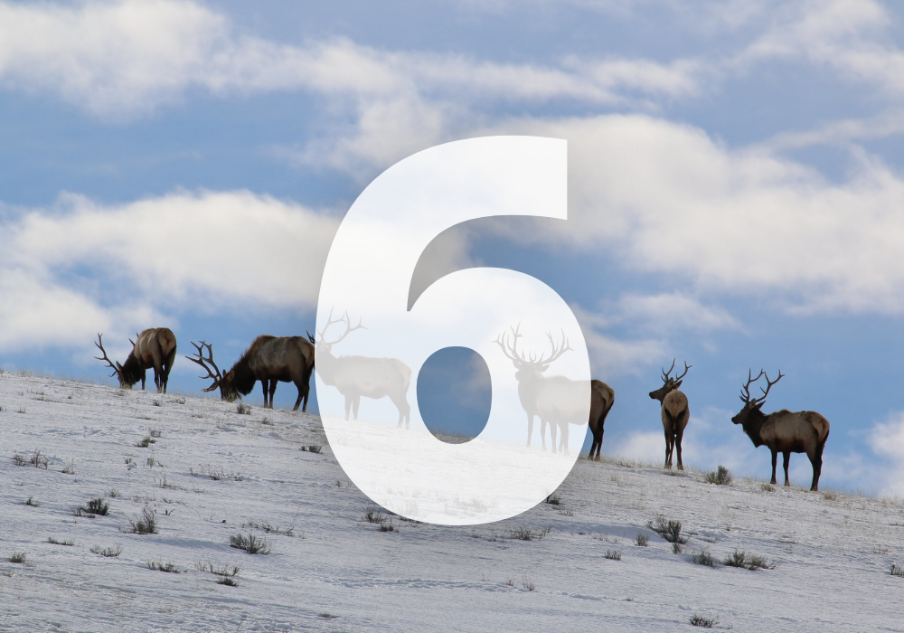
At 17 million acres, the Tongass is the United States’ largest national forest and the largest temperate rainforest in the world. Its remaining stands of old-growth timber—primarily large western hemlock and Sitka spruce trees that range from 200-700 years old—provide an ideal mosaic of habitat that is critical to the survival of deer, especially in heavy snow years. Severe winter weather is one of the biggest factors influencing the dramatic population swings affecting deer, according to the Alaska Department of Fish and Game (ADFG).

Bethany Goodrich

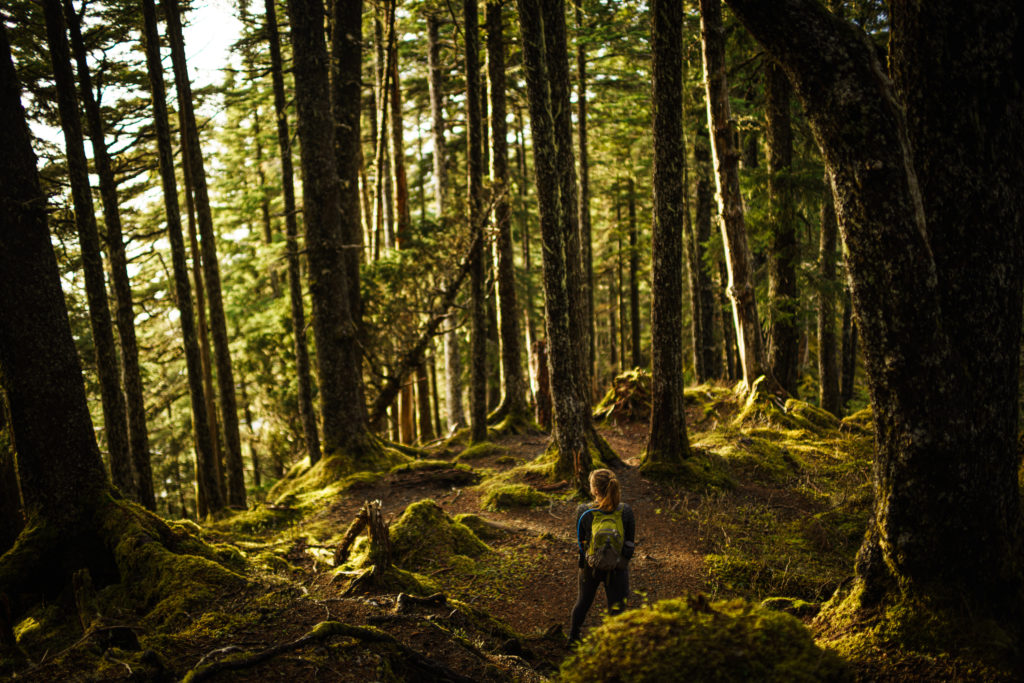
Mature forests make the best winter range

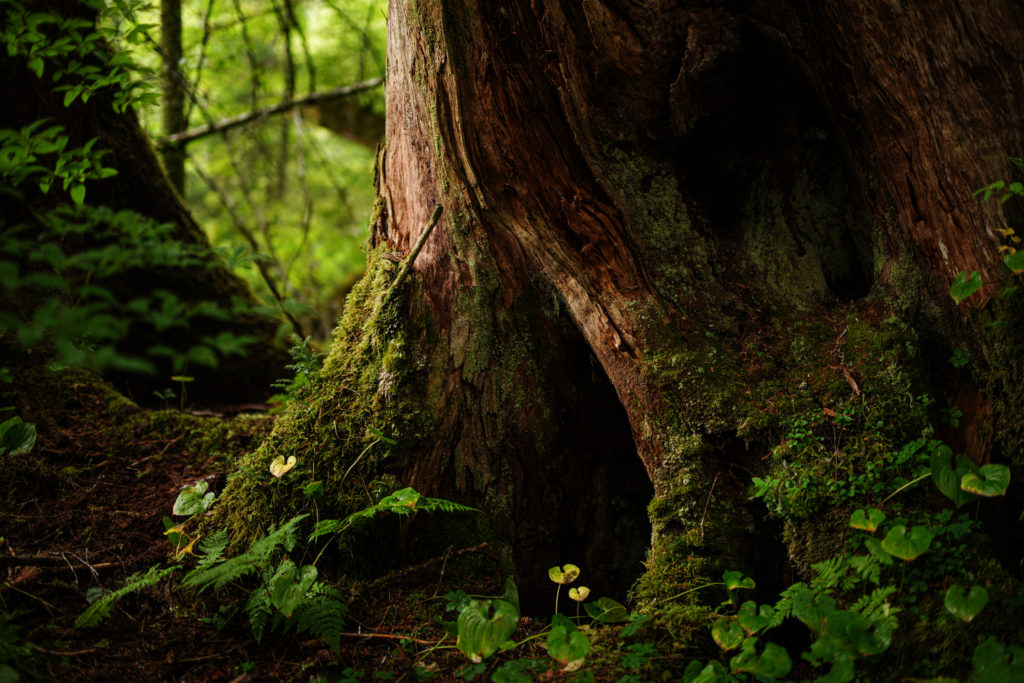
From a deer’s perspective, not all forests are created equal. Two general factors determine the suitability of winter range in forested areas: a productive understory that provides a variety of high-quality forage, and a canopy-like overstory that prevents those food sources from being buried by snowfall.

A blanket of snow not only reduces the quantity of forage accessible to deer, it also decreases its quantity. About four inches of snow is all it takes to bury nutrient-rich herb-layer forages and non-woody plants like bunchberry and trailing bramble. Although deer will eat deciduous shrubs and conifer forage when their preferred foods are covered by snow, these lower-quality foods cause deer to lose weight (Hanley et al. 1984).

At the same time, when snow depth reaches approximately 10 to 12 inches, deer sink in the snow beyond their front knee, which greatly increases the amount of energy required for deer to walk and run.

As snow depth builds, a deer’s diminished energy intake and heightened energy expenditure poses a significant threat to its survival. Population declines in Sitka black-tailed deer have typically been attributed to starvation during winters with deep and persistent snow.

Bethany Goodrich

A common misconception about clearcuts

While many hunters view clearings from logging as beneficial for deer habitat, the severe winters in Southeast Alaska create a different situation, where old-growth stands are most beneficial. It’s true that young, open stands provide forage during snow-free months. However, a lack of mature trees to intercept snow often makes these food sources unavailable during Alaska’s harsh winters. Deer also face higher predation risks in snowbound open areas.

As these clearings transition into even-age second-growth stands (>20-30 years), the available forage is reduced substantially as the closure of the forest canopy virtually eliminates the understory. These conditions persist for the remainder of the 90- to 125-year timber harvest rotation (Schoen and Kirchhoff, 1984). Data from fecal pellet studies confirms that Sitka black-tailed deer use quality old-growth habitat year-round more than recent clearcuts and unmanaged, closed-canopy young growth.

In discussing the threats facing Sitka black-tailed deer, ADFG cautions, “habitat capability and deer numbers are expected to decline in some areas as large tracts of previously logged areas reach the closed canopy stem exclusion stage and become extremely poor deer habitat. Population models predict declines in deer carrying capacity in the Ketchikan area of 50–60 percent by the end of the logging rotation in 2054.”

In the long run, a deer population that is forced to rely on unmanaged clearcuts will suffer.

Note: A future blog post will address strategies for managing young-growth forests to improve wildlife habitat.

Bethany Goodrich

Take action for Sitka black-tail habitat

The greater the expanse of mature forests, the greater the opportunity for wintering deer to obtain sufficient energy and maintain healthy populations. That’s why the TRCP supports reinstating the Roadless Rule in Alaska, which will restore safeguards to more than 9 million acres of undeveloped forests in the Tongass, including critical Sitka black-tail habitat. Join us in sharing your support for the Roadless Rule with the Forest Service.

Take Action

Photos courtesy of Bethany Goodrich.

5 Responses to “Here’s How Sitka Black-tailed Deer—and Hunters—Benefit from the Roadless Rule”

  1. Mark Consigny

    I don’t think the author even understands the content of this article. While it may be true that excessive snow depth in clearcuts is bad for deer, it’s also true, as stated in the article, that old-growth forest with a solid canopy is horrible deer habitat, as the lack of understory equates to a lack of forage. Creating roadless rules which make large tracts of forest closed to logging eventually leads to large tracts of poor habitat, unless the forest is naturally renewing due to fire or other natural occurrences.

  2. Tara Schultz

    Thanks for this question, Mark. Here’s a response from the TRCP’s Alaska field rep, Jen Leahy:
    (1/2) Thanks for taking time to read the post and offer feedback. You’re correct that closed forest canopies create low-quality deer habitat. In the Tongass, previously logged areas with even-aged trees—NOT undeveloped old-growth stands—will eventually result in closed canopies if not actively managed. In describing the threats to Sitka black-tailed deer, the Alaska Department of Fish and Game states (https://www.adfg.alaska.gov/index.cfm?adfg=deer.main), “habitat capability and deer numbers are expected to decline in some areas as large tracts of previously logged areas reach the closed canopy stem exclusion stage and become extremely poor deer habitat.”

  3. Tara Schultz

    (2/2) On the other hand, old-growth forests in the Tongass—where tree species typically include western hemlock, Sitka spruce, and sometimes red or yellow cedar—are characterized by trees of diverse size and age. In these unique stands, multiple canopy layers contain gaps that let in adequate sunlight, resulting in a productive understory.

    See p. 4 of this piece (https://ak.audubon.org/sites/default/files/og_sc_subsection_seak_atlas_ch03_biological_setting_200dpi.pdf) produced by Audubon Alaska for side-by-side photos of old-growth forest and previously-logged, even-aged forest (about 60 years old) where the canopy has closed in. The differences in the understories are striking.

    Finally, I’d like to reiterate that this article focuses mostly on conserving undeveloped habitat in the Tongass. TRCP also supports actively managing second-growth stands to improve fish and wildlife and create more sustainable forestry jobs. More on that topic to come!

    -Jen Leahy, Alaska Field Rep

  4. Dan Kirkwood

    Thanks for this in depth description. As a hunter in SE AK, it’s hard to convey how important the old-growth areas are for deer. This winter, we started off with incredible deep deep snow. Feet and feet of snow. In the mountains, tens and tens of feet of snow. The low lying, big trees were the only places we saw deer tracks, hiding out in a refuge with less snow. Thanks for your work Jen!

Do you have any thoughts on this post?

XHTML: You can use these tags: <a href="" title=""> <abbr title=""> <acronym title=""> <b> <blockquote cite=""> <cite> <code> <del datetime=""> <em> <i> <q cite=""> <s> <strike> <strong>

Comments must be under 1000 characters.

Commission Votes to Weaken Already Inadequate Proposal to Protect Fragile Coast from Pogie Boats

Vote ignores the recreational fishing community and others, but there is more time to stand up for conservation

Shallow-water purse seining for menhaden contributes to beach erosion and damages nursery habitats for redfish, speckled trout, sharks, jacks, mackerels, blue crabs, and other species. To ensure that Louisiana’s coastal habitat can continue to support billions of dollars in revenue from recreational fishing and wildlife tourism, as well as thousands of vital jobs, the TRCP and its sportfishing partners have been calling for a regulated buffer zone that would restrict industrial menhaden harvest to deeper waters, reducing habitat impacts and conflicts between pogie boats and anglers.

On Thursday, the Louisiana Wildlife and Fisheries Commission amended a proposal to create a restricted zone that would limit industrial menhaden fishing within a quarter mile of the state’s coastline. Unfortunately, the original proposal did not go far enough to prevent erosion and habitat damage, and Thursday’s amendment would further reduce the size of the buffer along sensitive marshes on the western shore of Breton Sound—making an already inadequate measure even weaker.

Public comments submitted over the last two months overwhelmingly favored strengthening the proposal by expanding the restricted area to at least a half mile from beaches and sensitive shallow water areas. The Commission’s vote Thursday showed that those comments have been largely ignored.

Sportfishing advocates were in favor of last year’s legislative action to create a half-mile restricted zone to help conserve and protect surf zone habitat, reduce harmful bycatch, and protect Louisiana’s recreational fishing economy and culture—a legislative solution that the menhaden industry strongly opposed. The bill ultimately failed, but the commission could achieve the same goal by expanding the proposed restricted zone. Unfortunately, the Commission does not seem intent on voting in favor of conservation.

The lone bright spot resulting from the amendment is it gives all concerned about this issue additional time to continue to voice opposition to a feeble, quarter-mile buffer zone.

What difference does a quarter mile make? Let’s dive deeper.

Hitting Rock Bottom

The menhaden reduction fishing industry—namely two companies, Omega Protein and Daybrook Fisheries—has reported that their boats only fish in waters 12 feet or deeper, so the large vessels don’t hit the bottom. In past discussions of this issue with the Commission, menhaden industry representatives and some commissioners have claimed that it is impossible for the boats to operate in shallow-water areas, where the vessels run aground, and that the industry would not risk the damage to the vessels by operating them in water depths of 5 to 10 feet.

Almost the entire proposed, one-quarter-mile restricted zone is in depths of up to just 6 feet. Amending the buffer zone to at least a half mile, which would include depths between 6 and 12 feet, would decrease the negative impacts of purse seining that plague Louisiana’s coast. If the claims from Omega and Daybrook are true—and they cannot risk the damage to their vessels by having them contact the bottom—there should be no issue with a half-mile buffer zone, which would only restrict fishing in areas that are supposedly too shallow for industrial pogie ships.

There’s good reason to keep these vessels out of shallow water as a policy, instead of trusting the companies’ assertions that pogie boats don’t go that close to shore: Numerous eyewitness accounts and videos show them intentionally running aground and displacing large volumes of sediments in waters inside a half mile of beaches. [Watch the video for actual footage of this happening within yards of recreational fishing boats.]

Impacts on Popular Sportfish

The Gulf menhaden fishery is the largest fishery by volume in the contiguous United States, and Louisiana accounts for 80 percent or more of all menhaden catches in the Gulf of Mexico, with over 900 million pounds harvested in 2020. Industrial pogie fishing made up almost half of all catches in the Gulf from 1980 to 2016.

Even if no more than 5 percent of the fish they harvest are species other than menhaden or herring (per Gulf-wide bycatch restrictions) the amount of potential bycatch is still immense. Sadly, the data from Omega and Daybrook regarding bycatch of important pogie predator species—including redfish, speckled trout, blacktip shark, and king and Spanish mackerel—is not publicly disclosed.

Efforts should be made by the menhaden industry to measure the environmental effects of their bycatch and to prove that the pogie fishery poses no risks to Louisiana’s fragile coastal ecosystem. In the meantime, bycatch of species like speckled trout, blue crabs, redfish, and some mackerels would be reduced by restricting harvest in nearshore areas.

Just a First Step Toward Menhaden Conservation

Omega and Daybrook frequently tout their Marine Stewardship Council certification as an indicator of their sustainable fishing operations in the Gulf. However, they have funded studies that deny the correlation between menhaden abundance and predator populations—directly contradicting MSC Fisheries Standards. Other studies have shown that pogies and other forage fish ARE correlated with the abundance of seabirds, king and Spanish mackerel, and blacktip sharks. The menhaden industry has blatantly disregarded MSC principles, further proving their unwillingness to accept the negative impacts of their operations along Louisiana’s coast.

If Omega and Daybrook want to demonstrate the effectiveness of a quarter-mile buffer zone versus a half-mile, they should prove through transparent and independent science that they are not harming our coastline by damaging the delicate intertidal zone or killing massive numbers of animals that depend on pogies as prey, like redfish, speckled trout, and seabirds.

The current fishery management strategy does not include a harvest control rule, coastwide catch limit, or accountability for overfishing. The implementation of, at minimum, a half-mile restricted zone for the industrial menhaden fishery is a necessary first step toward the conservation of Gulf menhaden, the wildlife and fish that depends on them, and the critical surf-zone habitat in Louisiana.

We have urged the Commission to amend the proposed quarter-mile restricted zone to a minimum of a half mile, and we will continue to push for meaningful conservation measures in the menhaden industry. Please send comments to comments@wlf.la.gov and keep following the TRCP for further updates on how to take action.

Click here to learn more about the importance of menhaden in the Gulf and Atlantic and take action in support of conservation.


Top photo by Jay Huggins via Flickr.

December 17, 2021

Groundbreaking New Program Will Help Build More Wildlife Crossing Structures

Here’s how recently passed legislation will be implemented to improve habitat connectivity and help wildlife safely cross our roadways

In one of the major victories for conservation this year, the bipartisan Infrastructure Investment and Jobs Act signed into law in November provides new federal funding for projects and research to reduce wildlife-vehicle collisions and improve habitat connectivity for mule deer, elk, and pronghorn. One of the key provisions is the establishment of a new wildlife crossings pilot program that will dedicate $350 million over a five-year period for the construction of new wildlife-friendly overpasses, underpasses, and fences that funnel animals safely across roads.

This is a major win because, for the first time ever, there is now programmatic federal investment to directly support the work of state wildlife and transportation agencies focusing on this issue. Sportsmen and sportswomen understand that crossing infrastructure is essential to supporting the unimpeded movement of wildlife as animals follow seasonal and historical migrations each year. But it also reduces wildlife-vehicle collisions that cost human lives and millions of dollars in property damage.

We’ve known for years that crossings are effective, but without this dedicated funding, projects were harder to pay for because they were in competition with other transportation infrastructure needs. With just a fraction of a percent of the total spend on American infrastructure recently approved by Congress and the president, this investment will make an outsized impact on migratory wildlife populations and human safety.

Here’s what you need to know about the next steps for this first-of-its-kind program.

Credit: Greg Nickerson/Wyoming Migration Initiative
How It Will Work

The Infrastructure Investment and Jobs Act directed the U.S. Department of Transportation and the Federal Highway Administration to distribute the $350 million over five years through a competitive grant process to projects that reduce the number of wildlife-vehicle collisions and improve wildlife connectivity. The first $60 million will be awarded before September 30, 2022.

There are many strong examples of projects that could serve as models for the pilot program. In Wyoming, the Trappers Point project, completed in 2012 at a cost of $12 million, has enabled thousands of mule deer and pronghorns to cross the highway safely each year. The Wyoming Department of Transportation estimated that prior to the crossing’s construction, motor vehicle collisions with wildlife at the site resulted in $500,000 in damage annually. In the first three years, the overpasses and underpasses at Trappers Point saw 85,000 documented wildlife crossings, while vehicle-wildlife collisions decreased by about 80 percent.

In northeastern Nevada, a herd of over 5,000 mule deer utilize a series of five crossings and four underpasses that were constructed over Highway 93 and Interstate 80 at a cost of approximately $35 million. These structures have resulted in nearly 40,000 documented safe crossings since the projects began in 2010.

Oregon’s first crossing—completed in 2012 in the central part of the state along Highway 97—has reduced collisions by 85 percent. It has supported safe crossing for more than 40 different species, but mule deer in particular have benefited as they migrate between their summer and winter ranges. The Oregon Department of Transportation has identified at least 10 more projects like this that are currently awaiting funding. Many other states are in the same boat.

Credit: Wyoming Migration Initiative
More Bang (and Less Crash) for the Buck

The Nevada Department of Transportation believes that if there are five or more vehicle collisions with deer per mile of road each year, it actually costs more to do nothing than to build the crossing structures. In fact, evaluation, engineering, and siting of these wildlife projects should be part of any roadway expansion and considered upfront when possible.

What’s more, Western states in particular have demonstrated significant leadership on building crossings where it most benefits migratory wildlife and keeps migration corridors intact. This makes federal infrastructure dollars go even further by also creating habitat gains.

Dedicated funding will help get those projects done sooner, but more data may be necessary in some states to prioritize the most important crossing projects. Migration mapping from GPS-collared animals, paired with data showing where animals are most frequently hit on highways, helps agencies pinpoint where these crossing projects are most needed. Wyoming, Colorado, Oregon and several other states have already used wildlife and transportation data to prioritize locations for crossings to build projects into long-term transportation plans. This kind of planning will help put new funds to work quickly, and clearly demonstrates a need for further investment.

Credit: Greg Nickerson/Wyoming Migration Initiative

Top photo: Greg Nickerson/Wyoming Migration Initiative

December 15, 2021

10 Conservation Achievements We’re Proud of in 2021

Your support helped to make these organizational and legislative successes possible

Setting the Agenda

In early 2021, the TRCP staff clearly communicated top hunter and angler priorities to the incoming Biden-Harris Administration and members of the 117th Congress. Our top ten must-do list for the administration and top five priorities for Congress were among our most popular blog posts of the year, making it clear that American hunters and anglers are engaged in these policy discussions—and we let decision-makers know that sportsmen and sportswomen are paying attention. At the 100-day mark, we’d seen progress on many, but not all, of our top priorities, and conservation has advanced even further in the remainder of the year. Read on for details.


Strengthening a Popular Farm Bill Conservation Program

In April 2021, the Biden-Harris Administration implemented multiple recommendations from the TRCP and our private land conservation partners to boost shrinking enrollment in the Conservation Reserve Program. These changes will not only help to pull the CRP out of a slump, they will also better support farmers and ranchers who want to incorporate conservation into their business plans. Learn more about Farm Bill conservation programs here.


BLM Colorado
Helping to Secure Conservation’s Role in “30 by 30”

Almost immediately after the inauguration, the news of the administration’s support for a global initiative to conserve 30 percent of the nation’s lands and waters by 2030 had left some landowners, politicians, industry executives, and even conservation groups fearful about what exactly this would mean. Fortunately, the voices of sportsmen and sportswomen—including those behind huntfish3030.com—were heard, and the White House’s 10-year “America the Beautiful” initiative includes key TRCP priorities, like expanding habitat conservation, increasing outdoor recreation access, incentivizing the voluntary conservation of private land, and creating jobs through conservation. Here’s what you need to know about 30 by 30.


Creating More Certainty for Special Places

After years of facing conservation rollbacks in bucket-list hunting and fishing destinations, hunters and anglers finally got some good news in 2021. The U.S. Department of Agriculture announced it would restore conservation safeguards for 9 million acres of the Tongass National Forest in Southeast Alaska, and the public can weigh in on the detailed plan until mid-January. The EPA also announced new steps to permanently protect Alaska’s Bristol Bay from mining, while the Ruby Mountains Protection Act—a TRCP priority, given its impact on Nevada’s largest mule deer herd—was debated and voted out of committee. Learn more at sportsmenfortherubies.com.


USFWS Alaska
Restoring Clean Water Protections

In an important step for fish and waterfowl, the Environmental Protection Agency and Army Corps of Engineers began to reconsider which waters and wetlands should be protected under the Clean Water Act, with formal feedback provided by the hunting and fishing community. This marks the fourth pendulum swing since a series of Supreme Court cases created confusion in the early 2000s. For more detail, check out our brief timeline on the history of the Clean Water Act.


USFWS National Elk Refuge
Conserving Migration Corridors

Throughout the year, new commitments were made by the USDA, the Department of the Interior, and the governors of New Mexico, Nevada, and Colorado to conserve and enhance wildlife migration corridors—a signature TRCP issue. Learn more on our resource page devoted to all things big game migration.


BLM Wyoming
Creating Conservation Jobs

Many key priorities of the TRCP and our partners are also included in the bipartisan Infrastructure Investment and Jobs Act, which was signed by President Biden in November. We successfully pushed for a revolutionary program to build more wildlife-friendly highway crossings and once-in-a-generation investments in stream connectivity, forest health, coastal and estuarine habitat conservation, water quality, and water conservation projects across the West.


Craig Okraska / Maven
Unlocking Public Land Access

In 2021, lawmakers reintroduced and advanced the TRCP-led MAPLand Act, which would require public land agencies to digitize their paper maps and access information. Once accomplished, this would help you identify more inroads to public hunting and fishing areas using smartphone apps and GPS devices. After clearing committees in both chambers, the legislation is poised for floor votes that could send it to President Biden’s desk next year.


USDA
Boosting Efforts to Study and Stop the Spread of CWD

This summer—as chronic wasting disease outbreaks traced back to captive deer operations in Texas, Pennsylvania, Wisconsin, and Minnesota highlighted the need for definitive federal action—we worked with lawmakers to craft comprehensive chronic wasting disease legislation that would establish substantial funding streams for management activities, education, and research priorities. We’re very proud to stand behind the bill that was introduced by Representatives Ron Kind (D-Wis.) and Glenn Thompson (R-Pa.) in October and passed by the House just last week.


Gregg Flores / Rachel Smiley / Kelsey Johnson / Durrell Smith
Highlighting Individuals Who Are Shaping Conservation’s Future

Part of the fun of what we do is making you aware of the hunters and anglers out there who help to power conservation without asking for any acclaim. This is just a small window into the community that we feel lucky to be a part of. If you need some uplifting reading this holiday season, check out our Q&As with Durrell Smith, Kelsey Johnson, Gregg Flores, and Rachel Smiley. Be inspired by what Clint Bentley was able to accomplish for Nevada’s bighorn sheep populations, just by speaking up. Let Austin Snow take you along on his hunt with Steven Rinella and Janis Putelis of MeatEater. Or take just a few minutes to watch Suzy Weiser, Charles Garcia, and Geo Romero explain why conservation in the Colorado River Basin is personal for them.


That wraps up our top ten for the year. Thanks for following along and supporting our work to create conservation success across the country. It wouldn’t be possible without you. Want to do even more for habitat, access, and the outdoor recreation economy? Donate to the TRCP before December 31, and SITKA will match some or all of your gift. Learn more here.

Email subscribers: The December 17th Roosevelt Report is the last of the year, and we’ll be back on January 7, 2022. Want to get on the list for the next one? Subscribe here.


Top photo courtesy of Kyle Mlynar.

December 14, 2021

New Digital Mapping Tool Offers Look at Disturbances to Mule Deer Migration

Agencies and the public have a clearer view of the challenges facing Wyoming’s herds

The Theodore Roosevelt Conservation Partnership and the University of Wyoming released a web map today that highlights current levels of human disturbance in Wyoming’s three designated mule deer migration corridors, including the 150-mile Red Desert to Hoback corridor.

The web map was developed by University of Wyoming’s Geographic Information Science Center in collaboration with TRCP to serve as a resource for both wildlife and land-use managers, as well as the interested public. It incorporates the best available data on migration and disturbance to inform future decision-making when conservation opportunities arise or development is proposed in migration corridors.

“We would like to see this web map utilized as a resource for future decisions as it provides a unique piece of information about the current level of disturbance in these corridors,” said Nick Dobric, the Wyoming field manager for the TRCP. “The mule deer in the Sublette herd, for example, that migrate and winter in the Rock Springs area have been struggling since the early 2000s and are currently 34 percent below their population objective, resulting in the loss of hunting opportunity with shorter seasons and reduced tags. This web map highlights parts of the corridor that could benefit from habitat restoration and where future development could have a big impact on the health of our herds, such as in stopover areas.”

Using the township and range grid system, the web map provides disturbance calculations at three different scales and provides a feature to customize the analysis boundary. The information displayed utilizes publicly available data, including the disturbance layer developed by the state of Wyoming for sage-grouse conservation. Research has consistently demonstrated that anthropogenic disturbances impact mule deer, pronghorn antelope, and other big-game species. One study, conducted in 2020, indicates that migrating mule deer have a disturbance threshold of approximately 3 percent of a landscape’s surface area, dependent upon the size and configuration of development, as well as specific vegetation and migration habitats.

“Wyoming is fortunate to have robust wildlife populations and hunting opportunities, in large part because of our still functioning migration corridors,” said Joy Bannon, Policy Director for Wyoming Wildlife Federation. “Development is essential for our state, but it needs to be thoughtfully planned. As the web map shows, disturbance is relatively limited in most parts of the corridor and with smart planning in the future – it can stay relatively the same so that we can continue to enjoy our incredible wildlife.”

Wyoming has been at the forefront of migration corridor research and conservation for decades. In the 1960s, Frank and John Craighead developed the first maps of elk migrating in and out of Yellowstone National Park. In recent years, the development of GPS technology has revolutionized the field as researchers are now able to document movements in unprecedented detail. The Wyoming Game and Fish Commission adopted a migration corridor strategy in 2016 in part due to the growing body of knowledge regarding migratory animals’ behavior and habitat needs. Likewise, Governor Gordon issued an executive order in 2020 to conserve migration corridors while balancing multiple-uses and protecting private property rights. This web map is an additional piece of information for managers and the public to utilize.

Wyoming takes well-deserved pride in its role as a leader in researching and conserving the migration corridors used by our big game herds,” said Josh Coursey, CEO of Muley Fanatic Foundation. “Governor Gordon’s executive order, the Wyoming Game and Fish Commission’s migration strategy, and cooperative efforts between the state and federal agencies like the BLM, all demonstrate a recognition of the importance of this issue, and it is our hope that the web mapping tool will prove useful to those efforts and guide further action moving forward.”

HOW YOU CAN HELP

CHEERS TO CONSERVATION

Theodore Roosevelt’s experiences hunting and fishing certainly fueled his passion for conservation, but it seems that a passion for coffee may have powered his mornings. In fact, Roosevelt’s son once said that his father’s coffee cup was “more in the nature of a bathtub.” TRCP has partnered with Afuera Coffee Co. to bring together his two loves: a strong morning brew and a dedication to conservation. With your purchase, you’ll not only enjoy waking up to the rich aroma of this bolder roast—you’ll be supporting the important work of preserving hunting and fishing opportunities for all.

Learn More
Subscribe

You have Successfully Subscribed!

You have Successfully Subscribed!

You have Successfully Subscribed!

You have Successfully Subscribed!

You have Successfully Subscribed!