Highlighting standout female leaders who advanced the American conservation movement
Theodore Roosevelt, Aldo Leopold, and John Muir are readily recited by many as the forefathers of the American conservation movement. And though their immense influence is something to be proud of, we’d like to recognize the often-overlooked women whose dedication has helped to shape the modern conservation landscape. Here are eight standouts.
Marjory Stoneman Douglas
Long before water quality in the Everglades was the subject of national news, a young society columnist by the name of Marjory Stoneman Douglas spearheaded a grassroots effort to protect Florida’s sawgrass swamps from being drained and developed. Her extensive research, and the publication of her book “The Everglades: The River of Grass”, changed public perception of this important habitat and led to the creation of Everglades National Park in 1947.
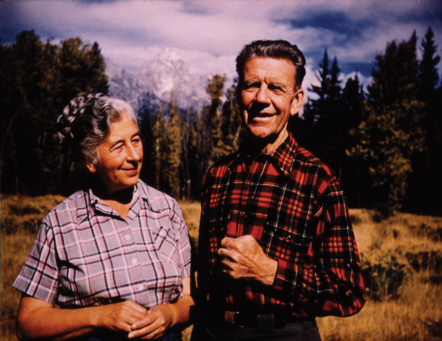
Margaret Murie
Dubbed the “Grandmother of the Conservation Movement,” Margaret “Mardy” Murie’s activism led to the passage of the Wilderness Act. A trailblazer and writer, Murie grew up in Fairbanks, Alaska, and later went on to become the first female graduate of the University of Alaska. Together with her husband, she made several trips into the Artic—the result of which was her book, “Two in the Far North”, a compelling personal account of her lifelong love of Alaska and a testimonial for the preservation of its wilderness.
Although life would eventually lead her away from the state, she never lost her love of its wild places. She organized the coalition that persuaded President Dwight D. Eisenhower to set aside 8 million acres of wilderness as the Arctic National Wildlife Range, which was later expanded and dubbed the Arctic National Wildlife Refuge.
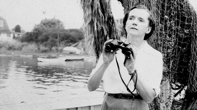
Rachel Carson
Carson began her career as an aquatic biologist writing radio scripts for the U.S. Bureau of Fisheries and eventually rose to become editor-in-chief of all publications for the U.S. Fish and Wildlife Service. In 1962, she published her seminal work “Silent Spring”, which brought widespread attention to the effects of dichloro-diphenyl-trichloroethane, an insecticide more commonly known as DDT, on bird populations. The public outcry that followed led to stricter regulations on chemical use in the environment, and Carson has since been credited with helping to launch the environmental movement.
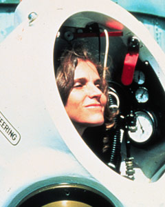
Sylvia Earle
Dr. Sylvia Earle is an oceanographer, aquanaut, author, and the first female to serve as chief scientist of National Oceanic and Atmospheric Administration, the federal agency responsible for fisheries management and coastal restoration, among other things. After developing a love for scuba diving in college, Earle went on to specialize in botany, believing that an understanding of marine plant life would be integral to ecosystem preservation.
As founder of Mission Blue, a global coalition to improve ocean protection measures and restore the world’s marine ecosystems, Earle utilizes the power of modern media to inform the public and decision-makers about the effects of overfishing, pollution, and climate change while advocating for habitat protection and restoration.
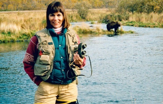
Anne LaBastille
Anne LaBastille was a woman who could have out-Thoreau-ed Thoreau himself. She built her influence through a successful writing career while living in a small cabin in a remote part of the Adirondack wilderness.
Her four-volume autobiographical series “Woodswoman”, published in 1976, has inspired decades of women to get outdoors and enjoy self-sufficient pursuits like hunting and fishing. And her 1980 book “Women and the Wilderness” addressed the historically male-dominated culture of conservation and put a spotlight on female naturalists.
A licensed wilderness guide, this Cornell graduate was also a consummate defender of the Adirondacks and served as commissioner of the Adirondack Park Agency from 1975 to 1993.
Mollie H. Beattie
Appointed as the first female director of the U.S. Fish and Wildlife Service in 1993 by President Clinton, Beattie fiercely opposed the dismantling and defunding of the Endangered Species Act and Clean Water Act in Congress. She was a forester by training and put great emphasis on managing habitat and the economy by stressing the responsibility of private landowners to effectively steward forest lands.
Unfortunately, her tenure with the Service was cut short by a fatal brain tumor, but not before she oversaw the establishment of 15 national wildlife refuges, the signing of more than 100 habitat conservation plans with private landowners, and the reintroduction of the gray wolf into the northern Rocky Mountains.
Lisa P. Jackson
Jackson started her career at the Environmental Protection Agency as a staff-level scientist before working her way up to the position of Administrator over the course of her career. The fourth woman and first Black American to hold the position, Jackson has spearheaded environmental programs to protect clean water, reduce harmful emissions, and protect at-risk communities.
Jackson eventually left the EPA to join Apple Inc. and now serves as the tech company’s vice president of Environmental Policy and Social Initiatives. She oversees efforts to minimize environmental impacts of business and address climate change through renewable energy and green materials.
Rue Mapp
After growing up in an outdoor-loving family, an adult Mapp was surprised to find that she was the only African American woman in her hiking groups and bike trips. Determined to get more members of her community involved in the outdoors, Mapp founded Outdoor Afro, a nonprofit organization dedicated to connecting Black Americans with outdoor spaces. Mapp’s goal is to shift the visual representation of what getting out into nature in America looks like and provide outdoor leadership training for people of color.
Her work has successfully connected underrepresented communities to nature and the benefits of spending more time outdoors. She currently serves on the boards of the Outdoor Industry Association the Wilderness Society, helping to shape conservation initiatives. She has also been named a National Geographic fellow.
9 Responses to “Eight Women Who Have Shaped Conservation”
Jim Greer
There may be more women out there that have done a lot for conservation but here is one worth mentioning – Rosalie Edge in Pennsylvania preserving Hawk Mountain and educating the public on the benefits provided by migrating raptors. https://www.hawkmountain.org/about-hawk-mountain-sanctuary
A very good first set of female conservation heroes — thanks! Let me suggest a few possible additions: Celia Hunter & Ginny Wood, former WACs who became bush pilots and leading forces in Alaska conservation, Rosalie Edge, who fought successfully in the 1930’s to return the Audubon Society to its roots in bird conservation; Julia Carrabias, the first woman to head Mexico’s Ministry for the Environment; Lady Bird Johnson, who beautified the nation’s capital and all of America and championed the cause of wildflower conservation; Ciiynthia Shogan, who for twenty years led the so far successful struggle to keep the oil industry from drilling in the coastal plain of the Arctic NWR; and Renee Askins, who championed the citizen’s movement to return wolves to Yellowstone NP.
Aurelia Skipwith – currently leads the US Fish and Wildlife Service, hunts, and has spearheaded largest rule making action to open hunting opportunities on National Wildlife Refuges.
Thx for sharing this. As has been shared, there are many others doing important conservation work. I’m hoping that some of my former college female students will continue this wonderful tradition. 🙂
Don’t forget Minerva Hamilton Hoyt, who was instrumental in protecting desert landscapes with the creation of the Joshua Tree and Death Valley national parks.
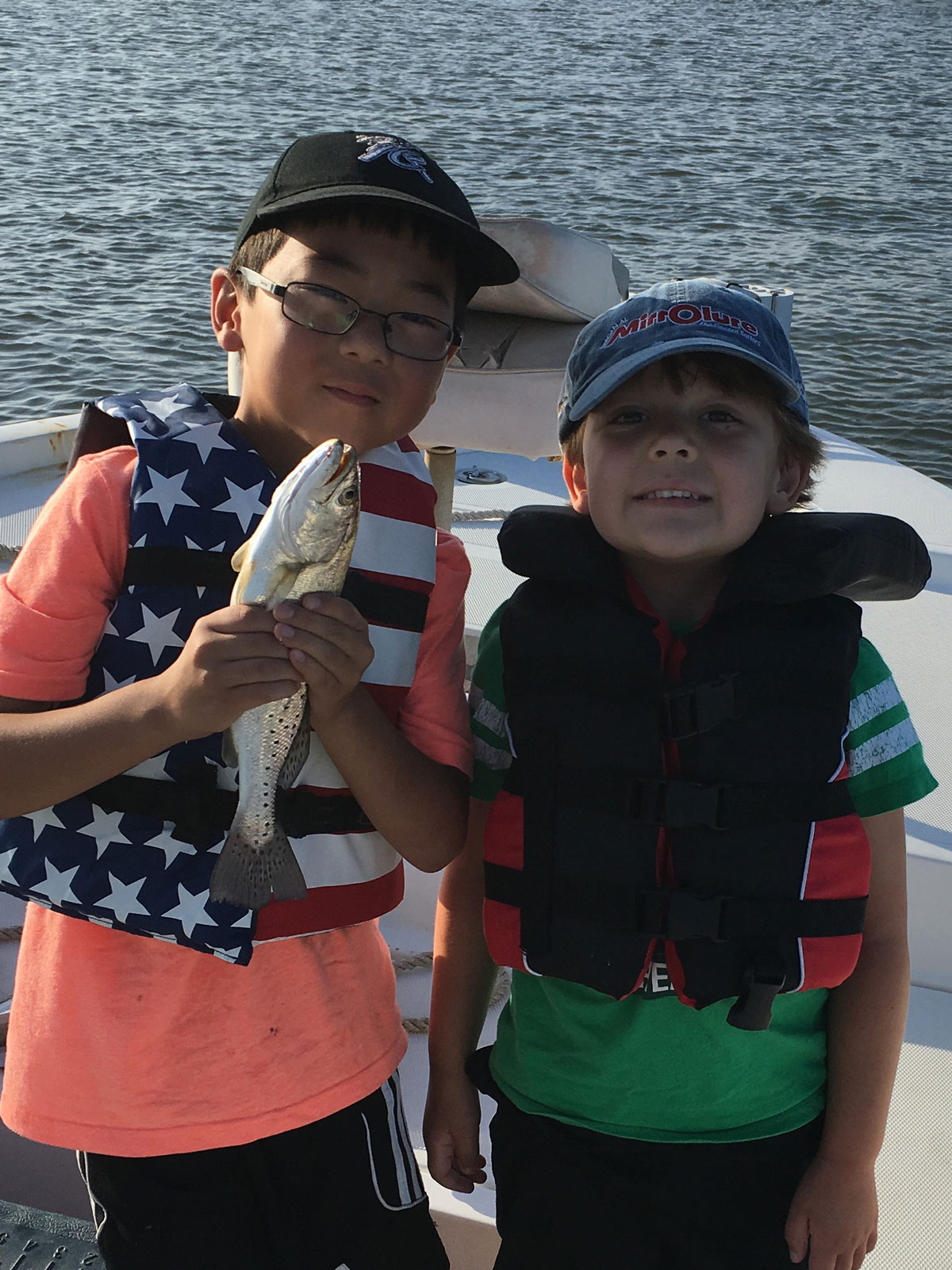
Five Things Your Fishing License Does for Conservation While You Catch Fish
These are your license dollars at work for fish habitat, water quality, and the next generation of anglers
When you buy or renew your fishing license, you’re probably only thinking about the possibility of the new season or a great day on the water. But are you aware of just how hard your license dollars are working on behalf of fish habitat and fishing access?
Here are five examples of how the a portion of the dollars spent on your fishing licenses, boat registrations, fishing gear, and boat fuel purchases go back to conservation and public access. You might be surprised—as much as $1.1 billion annually creates a sizeable down payment on the future of fishing in America.
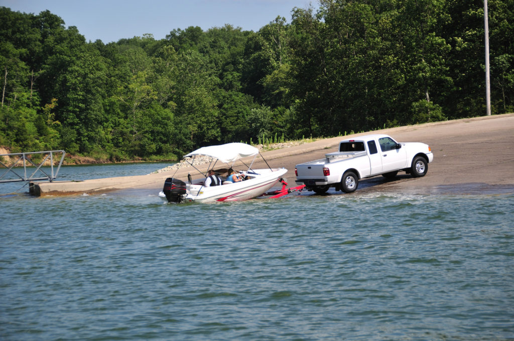
Improving Fishing and Boating Access
First, funds from license sales go toward fishing and boating access projects. One example is the Ramps & Pier Program in Mississippi, which helps pay for repairs to existing access points and the construction of four to six new boat ramps each year. The state of Oregon also has an excellent model of involving state and federal agencies in adding and upgrading new boating facilities.
Enhancing Water Quality
Boat registration funds help implement clean water projects that benefit fish habitat and improve the experience of anglers and boaters. The Clean Vessel Act program in Hawaii, for example, helped use these funds to construct a new sewage pump-out station and three new floating restrooms at the Haleiwa Small Boat Harbor—all in an effort to protect the sparkling turquoise waters of Hawaii for future generations.
Maintaining Fish Habitat
The excise taxes on your fishing gear go toward fisheries maintenance projects that help manage our state sport fisheries. For example, in New York State, biologists collect data through creel surveys and work to restore fish habitat for native brookies, American shad, river herring, and striped bass largely thanks to the taxes paid by the manufacturers of your fishing rods, reels, lures, baits, and flies. In Massachusetts, these funds are used to map fish habitat with GPS technology, sonar, and underwater vehicles through the state’s Fisheries Habitat Program. The more these experts learn, the better prepared they are to spot habitat issues and plan for improvements.
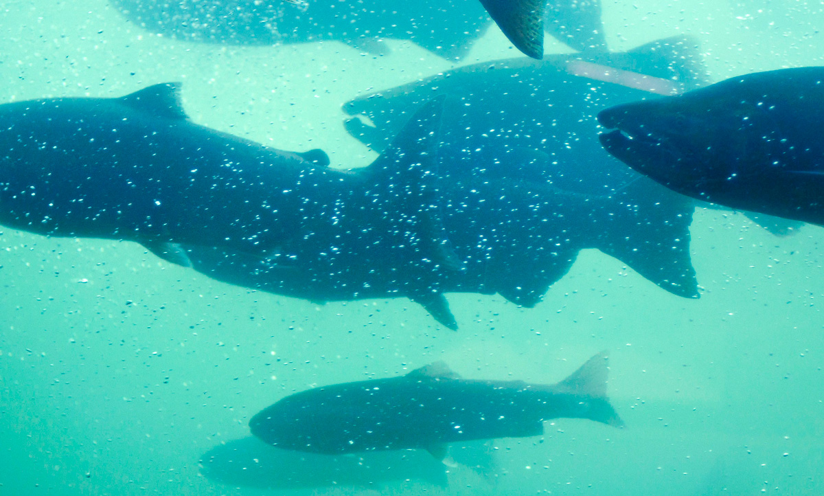
Salmon migrating upstream in the Bonneville Dam fish ladder. Photo by Tony Grover.
Teaching and Recruiting New Anglers
Fishing license funds also go to work for educational and recruitment programs that introduce new anglers to the sport. As more people take up fishing, there is a greater need for education on topics like species identification, conservation, regulations, and proper catch-and-release techniques. The state of Texas offers free workshops for first-timers or anyone who wants a refresher on the basics, and the saltwater angler education programs hosted by the Massachusetts Division of Marine Fisheries have been so successful that they hope to extend courses to all coastal areas of the state.
Planning for Long-Term Conservation
With an eye toward investing in our marine and freshwater resources, as well as the next generation of anglers, fishing license fees support long-term conservation plans for our rivers and streams. This robust funding, which has nothing to do with the federal balance sheet, is critical to ensuring an adequate quantity and quality of water to maintain the natural balance of aquatic ecosystems. Texas has used this money to fund its River Studies Program that addresses long-term water development, water planning, and water quality issues.
Photo courtesy of Sportsmen for the Boundary Waters.
Whether state agencies are studying rainbow trout populations or repairing boat ramps, your license fees are put to excellent use. Want to get started on your next fishing trip and give back to conservation? Buy or renew your license here.
TakeMeFishing.org contributor Debbie Hanson is an outdoor writer and avid angler who has written articles on fishing and boating for publications such as USA Today Hunt & Fish and Game & Fish Magazine. She is a member of the Florida Outdoor Writers Association. Read her blogs at takemefishing.org/blog and visit her personal blog at shefishes2.com.
Photos courtesy of Canstock Photo. This blog was originally posted August 14, 2017 and has been updated.
Ten Years Later: Louisiana’s Fragile Coast is Steadily Rebounding from Nation’s Worst Environmental Disaster
An in-depth look at four major restoration projects that have directly benefited anglers and hunters by improving coastal habitats using Deepwater Horizon penalties
INTRODUCTION
The explosion of the Deepwater Horizon oil rig and the subsequent oil spill in the spring and summer of 2010 was the worst environmental disaster in American history.
In the decade since this tragedy, oil spill penalties have been invested in projects that directly address the damage, improving the outlook for the Gulf of Mexico’s coastal communities and fish and wildlife habitat. There is optimism that the Gulf can recover from the unprecedented ecological threats, but reversing the long-term decline of the region’s coastal ecosystems and water quality will continue for decades to come.
Whiskey Island. Photo by Louisiana Coastal Protection and Restoration Authority.
Oil Spill Hits Habitat Already in Crisis
From April 20, 2010 until nearly five months after, oil gushed from the Macondo Well, located a mile below the Gulf of Mexico’s surface and 50 miles from Louisiana’s coast. An estimated 210 million gallons of crude flowed into the Gulf, casting a long shadow of uncertainty on the future of some of the world’s most fertile fishing grounds.
In Louisiana, coastal communities were still struggling to recover from the devastation that Hurricanes Katrina, Rita, Gustav, and Ike had wrought over the previous five years. Then, the Deepwater Horizon exploded, killing 11 men.
The state’s coastal habitats had been losing wetlands at a rate unmatched elsewhere in the nation, due to a combination of dams and levees cutting off sediment from the Mississippi River and the construction of thousands of miles of oil and gas canals and deep navigation channels. Suddenly, its coast faced a new threat that would certainly precipitate further habitat destruction.
Barrier islands, usually teeming with bird life and recreational fishermen in the spring and summer months, were among the areas hardest hit by the spill. Thick mats of weathered oil coated surf zones and cleanup crews scrambled to remove the tarred sands.
Bait and tackle shops and charter boat operations had done all they could to keep business going after the hurricanes, but they were shuttered once again. Anglers across the Gulf were anxious to hook up their boats and head to the coast, but oil coated their favorite shorelines and boat launches were crowded with cleanup crews.
There was no way to undo the damage caused by the negligence of those responsible for the disaster. Instead, the challenge for state, federal, and local leaders was to use the enormous penalties paid by BP, Transocean, Haliburton, and others to help fish, wildlife, and people recover from this unprecedented ecological and economic catastrophe and address the long-term ecological challenges that had been worsened by the spill.
The Numbers: From Fines to Fish Habitat
In 2015, BP—as the primary responsible party—agreed to pay $18.7 billion to the five Gulf of Mexico states for the ongoing environmental restoration efforts after the spill. Even earlier, BP had agreed to provide $1 billion in what was called “early restoration” funds to help the Gulf States begin addressing the damage to beaches, barrier islands, wetlands, and other habitats, while repairing lost access for recreational and commercial fishing. In all, BP has paid $54 billion for its part in causing the Deepwater Horizon disaster.
Other settlements provided $2.4 billion to the National Fish and Wildlife Foundation’s Gulf Environmental Benefit Fund to help states restore and protect vital fish and wildlife habitat. In Louisiana, the GEBF is providing $1.2 billion for beach and barrier island restoration and the construction of sediment diversions along the Mississippi River.
In all, Louisiana alone is set to receive nearly $9 billion in fines and penalties over the next two decades—all of it committed to building reefs, enhancing coastal fisheries, and restoring vital wetland, beach, barrier island, and ridge habitats. To date, approximately $900 million has been spent on a variety of projects in the state, including the restoration of the state’s largest pelican rookery, extensive shoreline protection projects, and the largest beach and barrier island revival in state history.
The infusion of oil spill fines and penalties is a large part of the more than $3 billion that Louisiana coastal protection and restoration officials plan to spend from 2021 to 2023 on habitat restoration efforts that will improve the state’s fishing and hunting opportunities and protect coastal communities.
PROJECTS
This report focuses on four major projects built or planned using Deepwater Horizon penalties that have directly benefited anglers and hunters by improving coastal habitats.
All totaled, they represent an investment of more than $600 million in making Louisiana’s “Sportsman’s Paradise” a world-class hunting and fishing destination for decades to come.
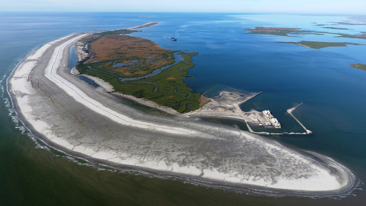
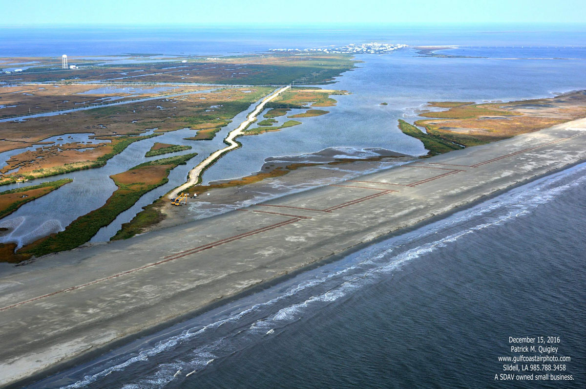
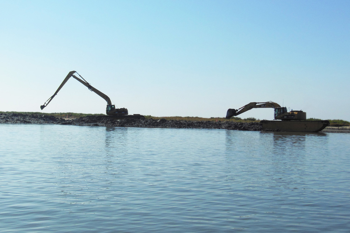
Aerial view of Caminada Headland construction. Photo by Patrick M. Quigley.
Caminada Headlands A.K.A. Elmer’s Island
The restoration of the Caminada Headlands is the largest coastal restoration project in Louisiana and the largest single investment in the recovery of the Gulf Coast after the 2010 Deepwater Horizon oil spill.
Known by locals as Elmer’s Island and Fourchon Beach, the Caminada Headlands is a 13-mile stretch of beaches, dunes, and marsh that extends from the mouth of Bayou Lafourche—called Belle Pass—all the way to Caminada Pass on the western tip of Grand Isle. This habitat was restored in two phases over five years using a combination of $145.9 million in oil spill fines from the National Fish and Wildlife Foundation’s Gulf Environmental Benefit Fund plus $40 million from the Coastal Impact Assistance Program and $30 million in state budget surpluses.
Without question, Caminada is Louisiana’s most popular summertime fishing destination. Its proximity to Grand Isle—Louisiana’s only inhabited barrier island—and Port Fourchon—one of the Gulf’s most popular angling jumping-off spots—means hundreds of thousands of anglers, crabbers, and beach combers visit Elmer’s and the Fourchon each year. The area is also home to Elmer’s Island Wildlife Refuge, a public recreation area overseen by the Louisiana Department of Wildlife and Fisheries, which is popular among anglers and bird watchers.
For the last century, hurricanes, strong winter storms, subsidence, and tidal currents have eaten away at the headland, causing the beach to retreat about 35 feet per year. These conditions threaten the more fragile marshes to its north, not to mention the energy infrastructure of Port Fourchon and camps and homes on Grand Isle and the only access road, Highway 1.
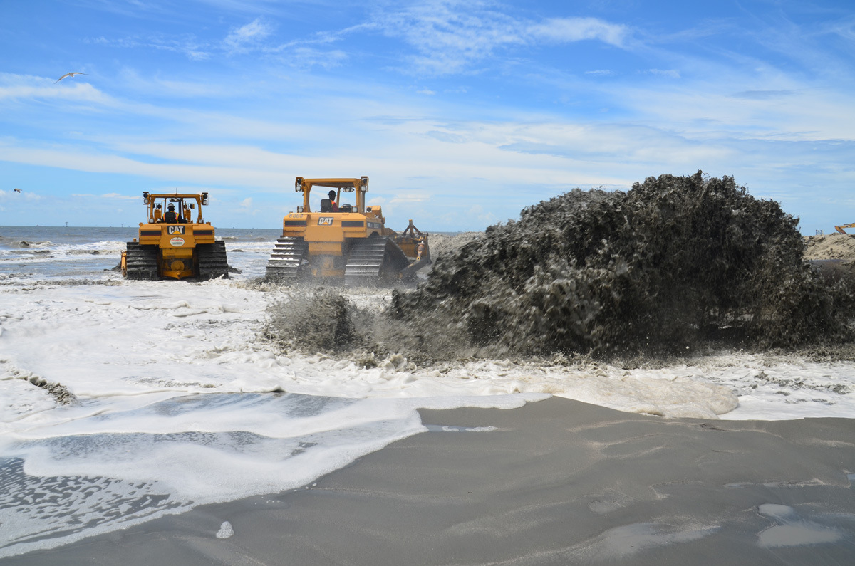
Construction at the Caminada Headlands. Photo by Louisiana Coastal Protection and Restoration Authority.
In 2010, oil from the Deepwater Horizon spill coated this beach. Many of the iconic pictures circulated in the media coverage of the spill, showing sheets of sticky, rust-colored tar mats and brown pelicans coated with oil, were taken at Elmer’s Island and the Fourchon Beach. Wading wasn’t allowed for more than two years, as heavy equipment and cleaning crews scoured the sand for tar mats.
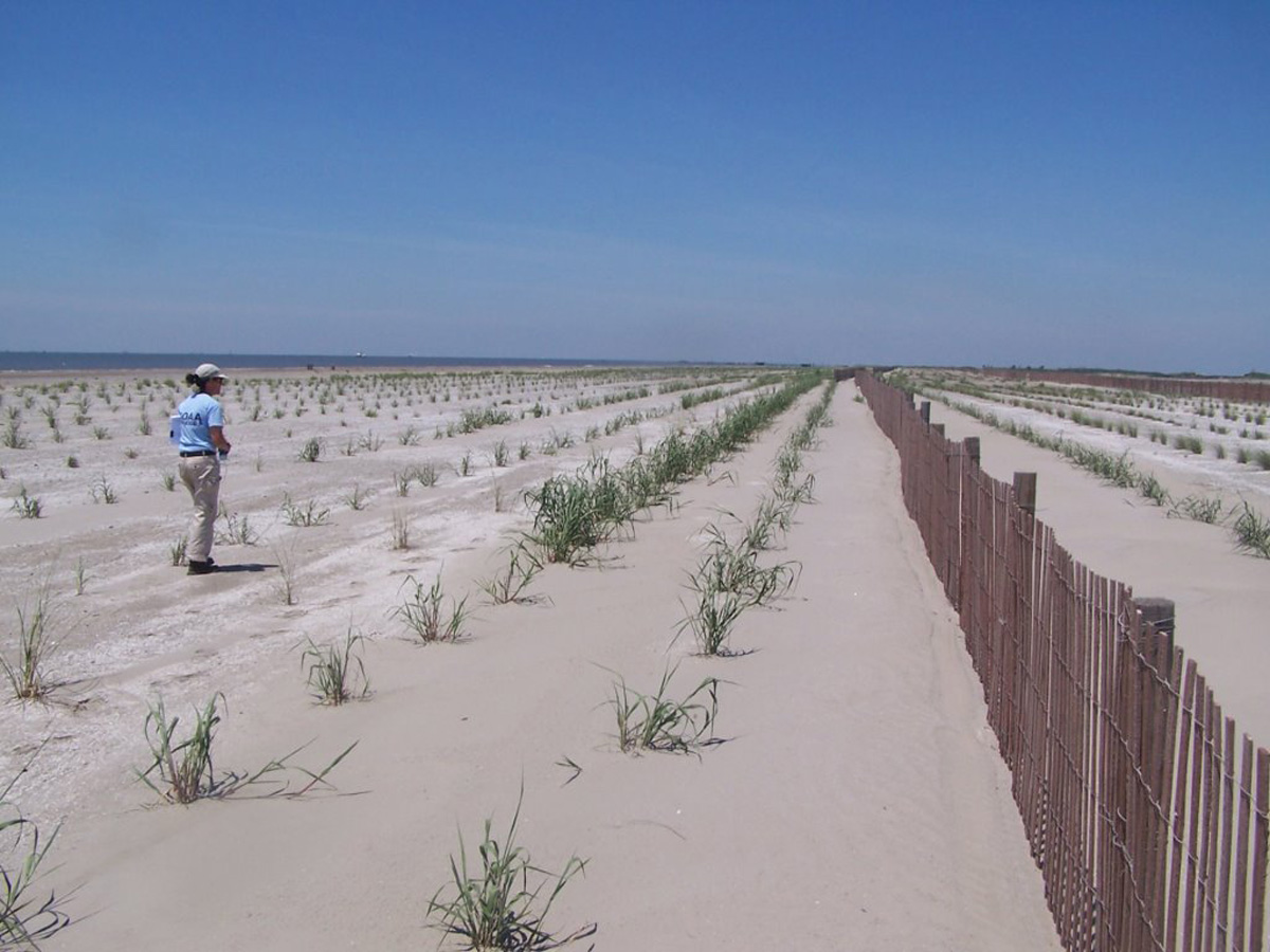
Louisiana’s Coastal Protection and Restoration Authority were back with more heavy equipment and personnel in August 2013, this time to restore the beaches and dunes, rather than drag and sift them for oil. The project used about 8.4 million cubic yards of sand mined from an ancient submerged delta of the Mississippi River to extend the beach 500 feet into the Gulf of Mexico, rebuild dunes up to seven feet tall, and plant those dunes with native vegetation. An additional 200 acres of tidal marsh were rebuilt, as well.
Barges moved the sand from Ship Shoal to a staging area in Belle Pass where it was pumped onto the beach and then shaped with bulldozers. Sand fencing was placed along the beach to help capture wind-blown sand to rebuild dunes as well. By the summer of 2017, Elmer’s was opened completely to wade fishing, restoring a summertime tradition that dates back several generations.
Queen Bess Island
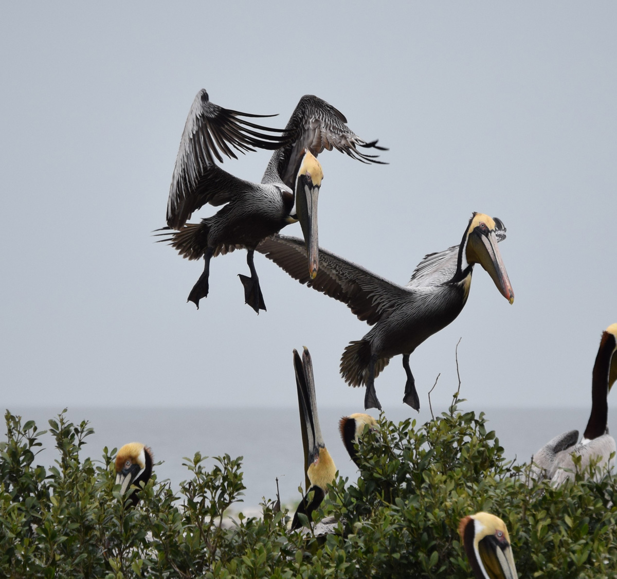
Nearly $19 million in fines from the Natural Resources Damage Assessment have been invested in Queen Bess Island, located just two miles east of Grand Isle in Barataria Bay, to repair decades of erosion and subsidence, as well as oil spill damage. While far smaller in scope compared to the Caminada project, this restoration work has had outsize impacts for anglers and Louisiana’s most iconic bird.
After DDT and other pesticides decimated pelicans in the 1950s and early 1960s, Louisiana was left without a native population of the bird emblazoned on its state flag. In 1971, biologists from Louisiana and Florida worked together to bring 750 young Brown Pelicans to the Barataria Basin, releasing them on Queen Bess, where 11 pairs originally built their nests.
By 2009, there were an estimated 80,000 or more Brown Pelicans in Louisiana and the bird was removed from the Endangered Species list. But only a year later, several thousand pelicans and critical habitat on Queen Bess Island were harmed by the Deepwater Horizon spill.
The island is now home to the largest population of brown pelicans in the Barataria Basin, and nesting habitat has grown from just five acres in the summer of 2019 to 36 acres upon completion of the project in late February 2020.
Brown pelicans at Queen Bess Island. Photo by Louisiana Department of Wildlife and Fisheries.
Queen Bess’s proximity to Grand Isle also means that it is visited by tens of thousands of anglers every year. The Barataria Basin was once dotted with small islands like Queen Bess, the remnants of old headlands and bayou banks once connected to the Mississippi River that erosion and subsidence has wiped from the landscape. This has meant less land to dampen waves and protect fish and fishermen, making the island even more important to anglers.
Construction for the Queen Bess project was compressed into a six-month period from late summer 2019 to late February 2020 to avoid interfering with pelican nesting season. It included ringing the island with limestone chunks up to three feet above sea level to give it additional capacity to withstand wave action, subsidence, and sea-level rise.
Rock breakwaters were also built on the southwest shoreline to provide calm water areas for pelicans and other birds. Then, more than 150,000 cubic yards of sediment dredged from the Mississippi River was transported about 25 miles to the island on barges. After the sediment was shaped by bulldozers, tidal sloughs were constructed to allow some water flow into the island and native vegetation was planted to enhance habitat and fight erosion.
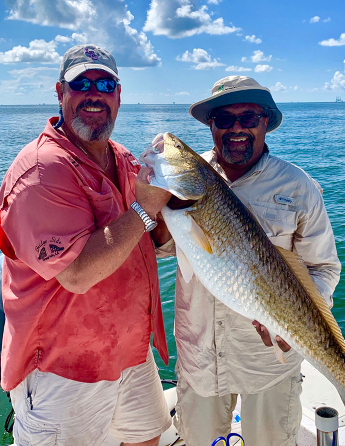
The restoration project is expected to extend the life of the island for more than three decades, allowing brown pelicans to thrive where anglers can chase speckled trout, redfish, and sheepshead for years to come.
Whiskey Island
Louisiana’s Coastal Protection and Restoration Authority has invested nearly $500 million in rebuilding more than 60 miles of beaches and barrier islands since 2007. It has also overseen construction of hundreds of acres of back-barrier marshes designed to enhance fisheries habitat and help retain the sand that has been pumped ashore by dredges to rebuild beaches and dunes.
Arguably, the most ambitious of these efforts, completed in 2018, is the restoration of the Caillou Lake Headlands in Terrebonne Parish, commonly known as Whiskey Island. It is one of three barrier islands that once comprised Isle Derniers, a massive 25-mile-long island that has been eaten away and fragmented over the last century by hurricanes and subsidence.
For more than a year, sand was pumped 10 miles to the island by a dredge from Ship Shoal, the massive sand deposit on the Gulf floor that also contributed to the restoration of Elmer’s Island. Gradually built up by the Mississippi River about 7,000 years ago, Ship Shoal will be tapped again in 2020 and 2021 for projects at West Belle Pass, Timbalier Island, and Trinity Island, which is immediately east of Whiskey Island.
All four projects are addressing the weaknesses in the barrier island shorelines of the Terrebonne Basin, fortifying protections for coastal communities and sustaining critical fish and wildlife habitat—all using funding from oil spill penalties.
The $117-million project at Whiskey Island has restored 1,000 acres of beaches and dunes and established another 160 acres of marsh platform. This builds upon the success of a 2009 project that created 300 acres of marsh on the island’s east end.
Anglers are particularly fortunate that Whiskey Island’s beaches and marshes, coated and stained by oil in 2010, have been renewed. The effort has helped to sustain and even enhance Terrebonne’s rich recreational and commercial fisheries and give coastal birds—like the brown pelican populations hit hard by the spill—a place to nest and feed for at least two more decades.
The project also demonstrates the broader scale of Louisiana’s coastal restoration efforts now that oil spill dollars have become available. Past barrier-island restoration efforts were pieced together over a decade or more. But with oil spill penalties committed by Louisiana and federal resource agencies like NOAA and the U.S. Fish and Wildlife Service, larger and more comprehensive projects can be built all at once. This ultimately saves money and makes for a more resilient and productive island.
Without the consistent, and now increased, investment in the restoration of Terrebonne Parish’s barrier islands over the last 30 years, it’s likely those islands would be little more than sandbars and submerged humps today, instead of continuing to be fish and bird meccas and the first-line of defense against hurricanes.
Mississippi River Reintroduction at Maurepas Swamp
Looking ahead, the restoration of Maurepas Swamp is a unique opportunity for the CPRA to expand coastal habitat restoration and sustainability projects beyond rebuilding coastal marshes and barrier islands.
Maurepas Swamp is a massive area of old-growth cypress-tupelo swamp nestled between Baton Rouge and New Orleans that separates Lake Maurepas from the Mississippi River. The swamp was once connected to areas that were flooded annually by the Mississippi, but it was isolated by levees more than a century ago. The natural hydrology of the swamp has also been interrupted by roadbeds and spoil banks from oil and gas canals.
Without the annual floods from the Mississippi River allowing sheet water to flow over the swamp, the native trees have lost a vital source of nutrients and the fish and wildlife have suffered. What could be a great area for largemouth bass, catfish, crawfish, and crappies—what the locals call sac a lait—is only a marginal fishery that has declined steadily over the last half century.
Broad areas of low-oxygen water filled with invasive vegetation, like water hyacinth and Salvinia, have replaced healthy swamps full of native submerged vegetation and the oxygen-rich water needed to support healthy fisheries. The Salvinia has also hampered what was once a world-class duck hunting area.
Maurepas Swamp. Photo by Louisiana Coastal Protection and Restoration Authority.
To bring back some of the nutrients and increase water health, in 2022 the CPRA is planning to begin construction of a structure on the Mississippi River that will allow for a relatively small but vastly important flow of water at 2,000 cubic feet per second through the swamp. Approximately 45,000 acres of imperiled swamp will slowly come back to life, limiting the saltwater intrusion brought by hurricanes and improving fisheries. Hopefully, a boost to waterfowl hunting and migratory and native wildlife habitat will follow.
The bulk of the funding is coming from the RESTORE Council, a federal-state collaboration created by the 2012 law of the same name, which committed 80 percent of oil spill penalties back to the Gulf States to address habitat and economic damages. In February 2020, the RESTORE Council granted Louisiana $130 million for the Maurepas project, and state officials are working to secure another $70 million in oil spill penalties, as well.
An added benefit for sportsmen and women is that much of the positive impacts will be on public land managed by Louisiana’s Department of Wildlife and Fisheries. The Maurepas Swamp Wildlife Management Area is a massive 122,000-acre public hunting and fishing area, much of which is located within the diversion’s area of influence. A 2013 settlement between MOEX, one of the owners of the Deepwater Horizon’s Macondo Well, and the U.S. Justice Department provided Louisiana with $6.75 million to add 11,145 acres to the WMA to preserve the coastal cypress-tupelo forest.
Improving the health of the swamp will also increase its ability to help protect adjacent communities from hurricane winds and storm surges. The swamp stores storm surge waters during hurricanes. The diversion can operate post-storm to push out higher salinity water and protect the trees and fish from long-term damage. The trees also help to dampen wind, further protecting communities.
In all, the conservation of Maurepas Swamp using the restorative power of the Mississippi River may prove to be one of the wisest investments of oil spill penalties thus far, especially given the long-term benefits to hunters, anglers, and local communities. Allowing the swamp to continue to degrade would jeopardize the cultural value of fishing and hunting in the area and leave numerous towns in Southeast Louisiana more vulnerable to future hurricanes.
Feature photo by Louisiana Department of Wildlife and Fisheries.
Bill’s passage proves that conservation transcends partisanship
(Washington D.C)—The U.S. Senate today in a 73-25 vote passed the Great American Outdoors Act giving hunters and anglers a major win.
This bipartisan bill fully and permanently funds the Land and Water Conservation Fund and invests in the crumbling infrastructure on federal public land.
“Today’s vote is historic in many ways,” said Whit Fosburgh, president and CEO of the Theodore Roosevelt Conservation Partnership. “It fulfills a promise we made 55 years ago to create a national legacy of investing in our natural resources. It also fixes our roads, trails, boat ramps, and recreational spaces so future generations can enjoy them. And it helps put Americans back to work through conservation at a time when unemployment rates are at near record levels.”
In addition to securing $900 million annually for the LWCF, the bill also invests $1.9 billion annually for the next five years to address the maintenance backlog on National Park Service, U.S. Forest Service, U.S. Fish & Wildlife Service, and Bureau of Land Management lands.
“Passing the Great American Outdoors Act proves that conservation issues transcend politics and partisanship,” added Fosburgh. “We want to thank Senators Gardner and Manchin for sponsoring the legislation and all the co-sponsors who pushed this bill through the Senate. We urge the House to follow suit and send this bill to the President’s desk showing that conservation works for America.”
How Far Fish Habitat Has Come in the Ten Years Since the Gulf Oil Spill
The Deepwater Horizon oil spill was ten years ago, and Louisiana’s coastal habitat is being rebuilt to flourish even better than before. In fact, lands that experts predicted would have vanished by now are supporting fish, wildlife, and outdoor recreation spending.
A decade ago, bulldozers, excavators, and hard-hat-donning work crews were removing millions of pounds of sand and vegetation coated in thick, tarry oil from Louisiana’s beaches and barrier islands after the Deepwater Horizon oil disaster.
The heavy equipment and hard hats have returned to our coast, but now it’s in an effort to restore damaged fish and wildlife habitat using fines paid by BP and others responsible for the spill. This year alone, the Louisiana Coastal Protection and Restoration Authority—in conjunction with federal partners at the U.S. Fish and Wildlife Service and the National Marine Fisheries Service—will begin, continue, or conclude restoration projects representing an investment of more than $250 million in Deepwater Horizon penalties.
Photo by NRCS.
Thirteen barrier islands and headland beaches line the Louisiana coast from Venice to the Barataria, Timbalier, and Terrebonne Basins. All of them have either been restored in the 10 years since the oil stopped spewing or will be restored in the next 10 years. In addition, some smaller islands beyond these areas—which are also critical habitat for fish, brown pelicans, and other coastal birds—have been restored.
Louisiana’s barrier islands and beaches are all remnant headlands of the ever-shifting Mississippi River Delta and the first line of defense against hurricanes and violent winter storms that batter the northern Gulf. Without barrier islands to break up the waves and dampen storm surges, the vulnerable wetlands and nursery grounds north of the islands would crumble and coastal communities would become even more exposed to the full fury of the Gulf of Mexico.
Of course, this is also extremely important habitat for the Gulf’s most popular sportfish, like speckled trout, redfish, and Spanish mackerel. If the surf is light, these beaches and islands are lined with boats and surf anglers tossing topwaters, live shrimp, and a variety of plastic plugs and swimbaits. On most summer days, the line of boats along popular Elmer’s Island and Timbalier Island stretches from horizon to horizon.
The dynamic nature of Louisiana’s coastline and the lack of sediment input from the Mississippi River has shortened the lifespan of many of these critical islands, especially since the river was extensively levied in the late 19th and early 20th century. Without investments of oil spill penalties and funds from state-federal partnership programs, some islands would be little more than subsurface sandbars today.
“In the early 80s, the islands in Terrebonne Parish were losing land at a tremendous rate and the prediction then was that all of those islands would be gone by 2015,” says Bren Haase, executive director of Louisiana’s Coastal Protection and Restoration Authority. “However, there have been a host of restoration efforts made throughout the area that have kept those islands largely intact and the land area has stayed roughly constant over the last 30 years.”
Photo by CWPPRA.
Three of the beach and island projects currently underway are designed to keep the Terrebonne Basin intact for the next 20 years or more and provide protection for infrastructure and the fishing camps, marinas, and bait shops in small but important towns like Port Fourchon, Leeville, Cocodrie, and Dulac.
Approximately 9.2 million cubic yards of sand will be dredged from a massive ancient Mississippi River delta in about 30 feet of water off Terrebonne Parish. The sand will be barged to the beaches and then shaped with earth-moving equipment before being planted with native grasses to help hold it in place.
In all, approximately $167 million in fines from the National Fish and Wildlife Foundation’s Gulf Environmental Benefit Fund is being spent to revive and extend the life of the West Belle Pass headland, Timbalier Island, and Trinity Island. The GEBF was the first fund established with oil spill penalties and dedicated $2.4 billion Gulf-wide to projects that restore fish and wildlife habitat damaged by Deepwater Horizon.
Haase, who has worked on coastal habitat restoration and hurricane protection efforts in Louisiana for more than 20 years, says the oil spill fines have allowed the CPRA and federal partners to expedite project construction, while dramatically increasing the size and scope of island and beach restoration projects.
Restoration efforts that once consisted of projects costing $15-million to $30-million and taken on piecemeal have grown into massive $100-million projects that can rebuild hundreds of miles of beach, dune, and tidal marsh all at once.
“Over the last decade we’ve taken a more system-wide approach to barrier island restoration,” says Haase. “Rather than build one project here and there, in our analysis, we saw that there were weaknesses in certain areas of islands and headlands that we could address that would prevent breaches and help provide more protection to the habitats inside the barrier islands.”
The challenge was always to use the unprecedented fines and penalties paid by those responsible for the economic and environmental destruction and loss of life to make sure the mistakes of the past weren’t repeated—to make the Gulf a better place post-spill. Louisiana’s investment and the innovation developed in restoring its critical barrier islands, beaches, and marshes shows that our state has wholeheartedly embraced that responsibility.
Theodore Roosevelt’s experiences hunting and fishing certainly fueled his passion for conservation, but it seems that a passion for coffee may have powered his mornings. In fact, Roosevelt’s son once said that his father’s coffee cup was “more in the nature of a bathtub.” TRCP has partnered with Afuera Coffee Co. to bring together his two loves: a strong morning brew and a dedication to conservation. With your purchase, you’ll not only enjoy waking up to the rich aroma of this bolder roast—you’ll be supporting the important work of preserving hunting and fishing opportunities for all.


There may be more women out there that have done a lot for conservation but here is one worth mentioning – Rosalie Edge in Pennsylvania preserving Hawk Mountain and educating the public on the benefits provided by migrating raptors. https://www.hawkmountain.org/about-hawk-mountain-sanctuary
You forgot Rosalie Edge, the real founder of Olympic National Park.
Excellent post of important women and I had only heard of two! Well written and concise. Very much appreciate the information.
A very good first set of female conservation heroes — thanks! Let me suggest a few possible additions: Celia Hunter & Ginny Wood, former WACs who became bush pilots and leading forces in Alaska conservation, Rosalie Edge, who fought successfully in the 1930’s to return the Audubon Society to its roots in bird conservation; Julia Carrabias, the first woman to head Mexico’s Ministry for the Environment; Lady Bird Johnson, who beautified the nation’s capital and all of America and championed the cause of wildflower conservation; Ciiynthia Shogan, who for twenty years led the so far successful struggle to keep the oil industry from drilling in the coastal plain of the Arctic NWR; and Renee Askins, who championed the citizen’s movement to return wolves to Yellowstone NP.
Thank you for sharing! It is wonderful to see the spotlight on female conservationists!
Aurelia Skipwith – currently leads the US Fish and Wildlife Service, hunts, and has spearheaded largest rule making action to open hunting opportunities on National Wildlife Refuges.
Thx for sharing this. As has been shared, there are many others doing important conservation work. I’m hoping that some of my former college female students will continue this wonderful tradition. 🙂
Don’t forget Florida’s Marjorie Carr who fought to stop the Cross Florida Barge Canal.
Don’t forget Minerva Hamilton Hoyt, who was instrumental in protecting desert landscapes with the creation of the Joshua Tree and Death Valley national parks.