fbpx

June 17, 2020

Ten Years Later: Louisiana’s Fragile Coast is Steadily Rebounding from Nation’s Worst Environmental Disaster

An in-depth look at four major restoration projects that have directly benefited anglers and hunters by improving coastal habitats using Deepwater Horizon penalties

INTRODUCTION

The explosion of the Deepwater Horizon oil rig and the subsequent oil spill in the spring and summer of 2010 was the worst environmental disaster in American history.

In the decade since this tragedy, oil spill penalties have been invested in projects that directly address the damage, improving the outlook for the Gulf of Mexico’s coastal communities and fish and wildlife habitat. There is optimism that the Gulf can recover from the unprecedented ecological threats, but reversing the long-term decline of the region’s coastal ecosystems and water quality will continue for decades to come.

Whiskey Island. Photo by Louisiana Coastal Protection and Restoration Authority.
Oil Spill Hits Habitat Already in Crisis

From April 20, 2010 until nearly five months after, oil gushed from the Macondo Well, located a mile below the Gulf of Mexico’s surface and 50 miles from Louisiana’s coast. An estimated 210 million gallons of crude flowed into the Gulf, casting a long shadow of uncertainty on the future of some of the world’s most fertile fishing grounds.

In Louisiana, coastal communities were still struggling to recover from the devastation that Hurricanes Katrina, Rita, Gustav, and Ike had wrought over the previous five years. Then, the Deepwater Horizon exploded, killing 11 men.

The state’s coastal habitats had been losing wetlands at a rate unmatched elsewhere in the nation, due to a combination of dams and levees cutting off sediment from the Mississippi River and the construction of thousands of miles of oil and gas canals and deep navigation channels. Suddenly, its coast faced a new threat that would certainly precipitate further habitat destruction.

Barrier islands, usually teeming with bird life and recreational fishermen in the spring and summer months, were among the areas hardest hit by the spill. Thick mats of weathered oil coated surf zones and cleanup crews scrambled to remove the tarred sands.

Bait and tackle shops and charter boat operations had done all they could to keep business going after the hurricanes, but they were shuttered once again. Anglers across the Gulf were anxious to hook up their boats and head to the coast, but oil coated their favorite shorelines and boat launches were crowded with cleanup crews.

There was no way to undo the damage caused by the negligence of those responsible for the disaster. Instead, the challenge for state, federal, and local leaders was to use the enormous penalties paid by BP, Transocean, Haliburton, and others to help fish, wildlife, and people recover from this unprecedented ecological and economic catastrophe and address the long-term ecological challenges that had been worsened by the spill.

The Numbers: From Fines to Fish Habitat

In 2015, BP—as the primary responsible party—agreed to pay $18.7 billion to the five Gulf of Mexico states for the ongoing environmental restoration efforts after the spill. Even earlier, BP had agreed to provide $1 billion in what was called “early restoration” funds to help the Gulf States begin addressing the damage to beaches, barrier islands, wetlands, and other habitats, while repairing lost access for recreational and commercial fishing. In all, BP has paid $54 billion for its part in causing the Deepwater Horizon disaster.

Other settlements provided $2.4 billion to the National Fish and Wildlife Foundation’s Gulf Environmental Benefit Fund to help states restore and protect vital fish and wildlife habitat. In Louisiana, the GEBF is providing $1.2 billion for beach and barrier island restoration and the construction of sediment diversions along the Mississippi River.

In all, Louisiana alone is set to receive nearly $9 billion in fines and penalties over the next two decades—all of it committed to building reefs, enhancing coastal fisheries, and restoring vital wetland, beach, barrier island, and ridge habitats. To date, approximately $900 million has been spent on a variety of projects in the state, including the restoration of the state’s largest pelican rookery, extensive shoreline protection projects, and the largest beach and barrier island revival in state history.

The infusion of oil spill fines and penalties is a large part of the more than $3 billion that Louisiana coastal protection and restoration officials plan to spend from 2021 to 2023 on habitat restoration efforts that will improve the state’s fishing and hunting opportunities and protect coastal communities.

PROJECTS

This report focuses on four major projects built or planned using Deepwater Horizon penalties that have directly benefited anglers and hunters by improving coastal habitats.

All totaled, they represent an investment of more than $600 million in making Louisiana’s “Sportsman’s Paradise” a world-class hunting and fishing destination for decades to come.

Aerial view of Caminada Headland construction. Photo by Patrick M. Quigley.
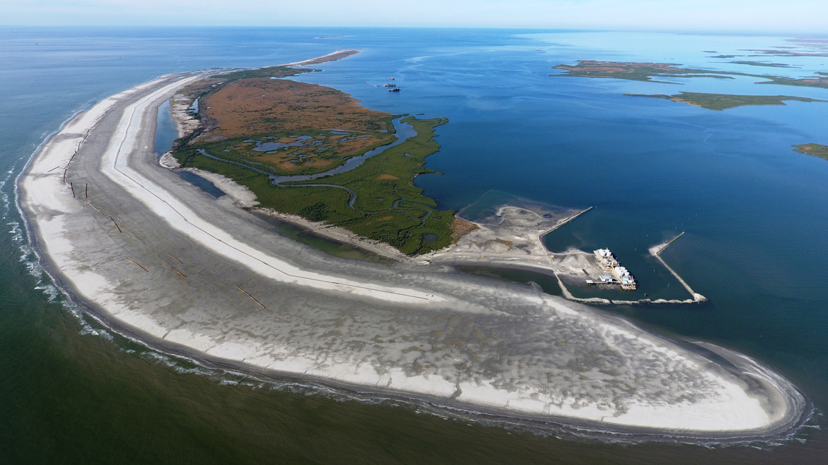
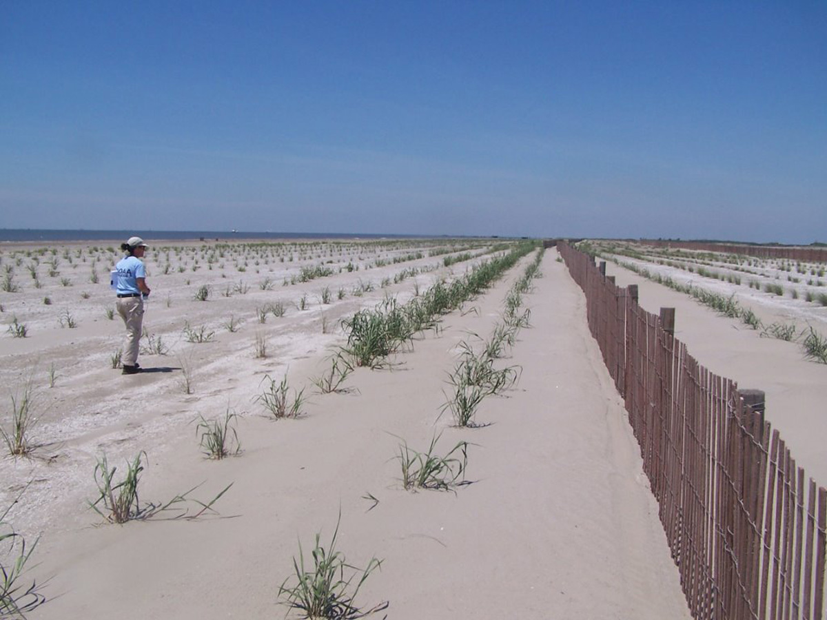
Caminada Headlands A.K.A. Elmer’s Island

The restoration of the Caminada Headlands is the largest coastal restoration project in Louisiana and the largest single investment in the recovery of the Gulf Coast after the 2010 Deepwater Horizon oil spill.

Known by locals as Elmer’s Island and Fourchon Beach, the Caminada Headlands is a 13-mile stretch of beaches, dunes, and marsh that extends from the mouth of Bayou Lafourche—called Belle Pass—all the way to Caminada Pass on the western tip of Grand Isle. This habitat was restored in two phases over five years using a combination of $145.9 million in oil spill fines from the National Fish and Wildlife Foundation’s Gulf Environmental Benefit Fund plus $40 million from the Coastal Impact Assistance Program and $30 million in state budget surpluses.

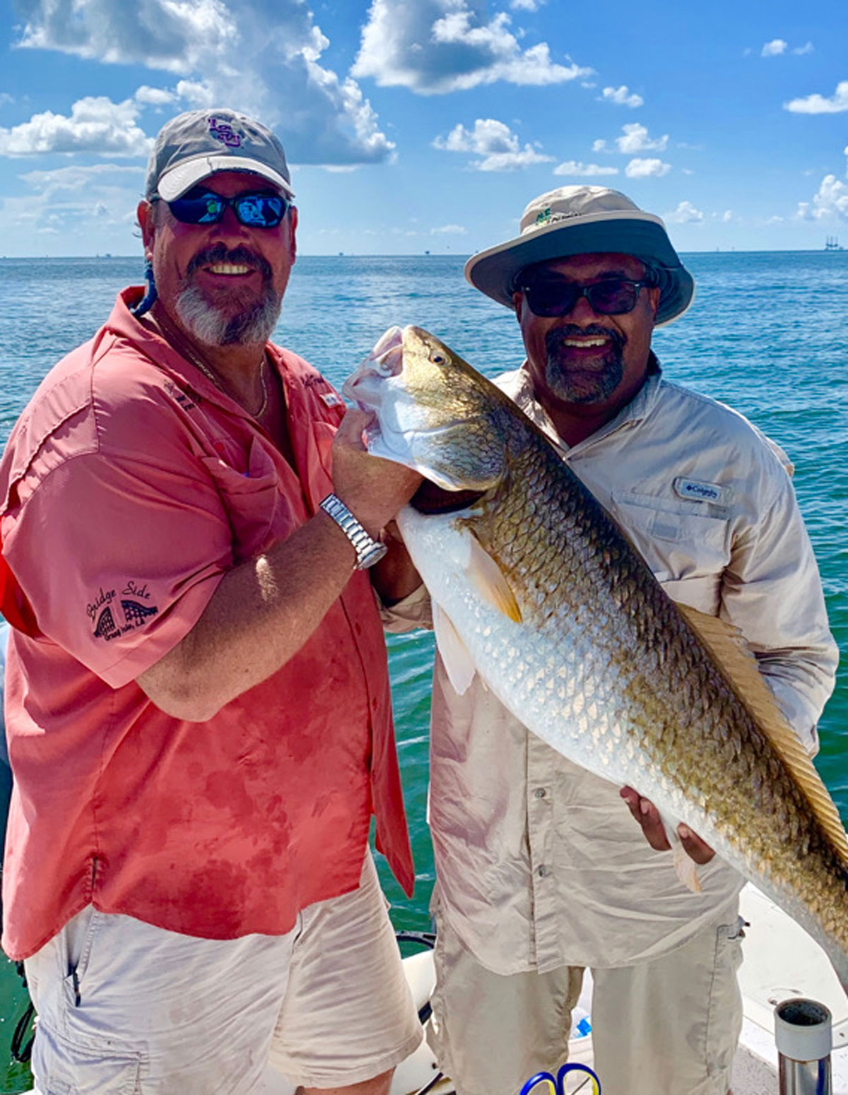
Without question, Caminada is Louisiana’s most popular summertime fishing destination. Its proximity to Grand Isle—Louisiana’s only inhabited barrier island—and Port Fourchon—one of the Gulf’s most popular angling jumping-off spots—means hundreds of thousands of anglers, crabbers, and beach combers visit Elmer’s and the Fourchon each year. The area is also home to Elmer’s Island Wildlife Refuge, a public recreation area overseen by the Louisiana Department of Wildlife and Fisheries, which is popular among anglers and bird watchers.

For the last century, hurricanes, strong winter storms, subsidence, and tidal currents have eaten away at the headland, causing the beach to retreat about 35 feet per year. These conditions threaten the more fragile marshes to its north, not to mention the energy infrastructure of Port Fourchon and camps and homes on Grand Isle and the only access road, Highway 1.

Construction at the Caminada Headlands. Photo by Louisiana Coastal Protection and Restoration Authority.

In 2010, oil from the Deepwater Horizon spill coated this beach. Many of the iconic pictures circulated in the media coverage of the spill, showing sheets of sticky, rust-colored tar mats and brown pelicans coated with oil, were taken at Elmer’s Island and the Fourchon Beach. Wading wasn’t allowed for more than two years, as heavy equipment and cleaning crews scoured the sand for tar mats.

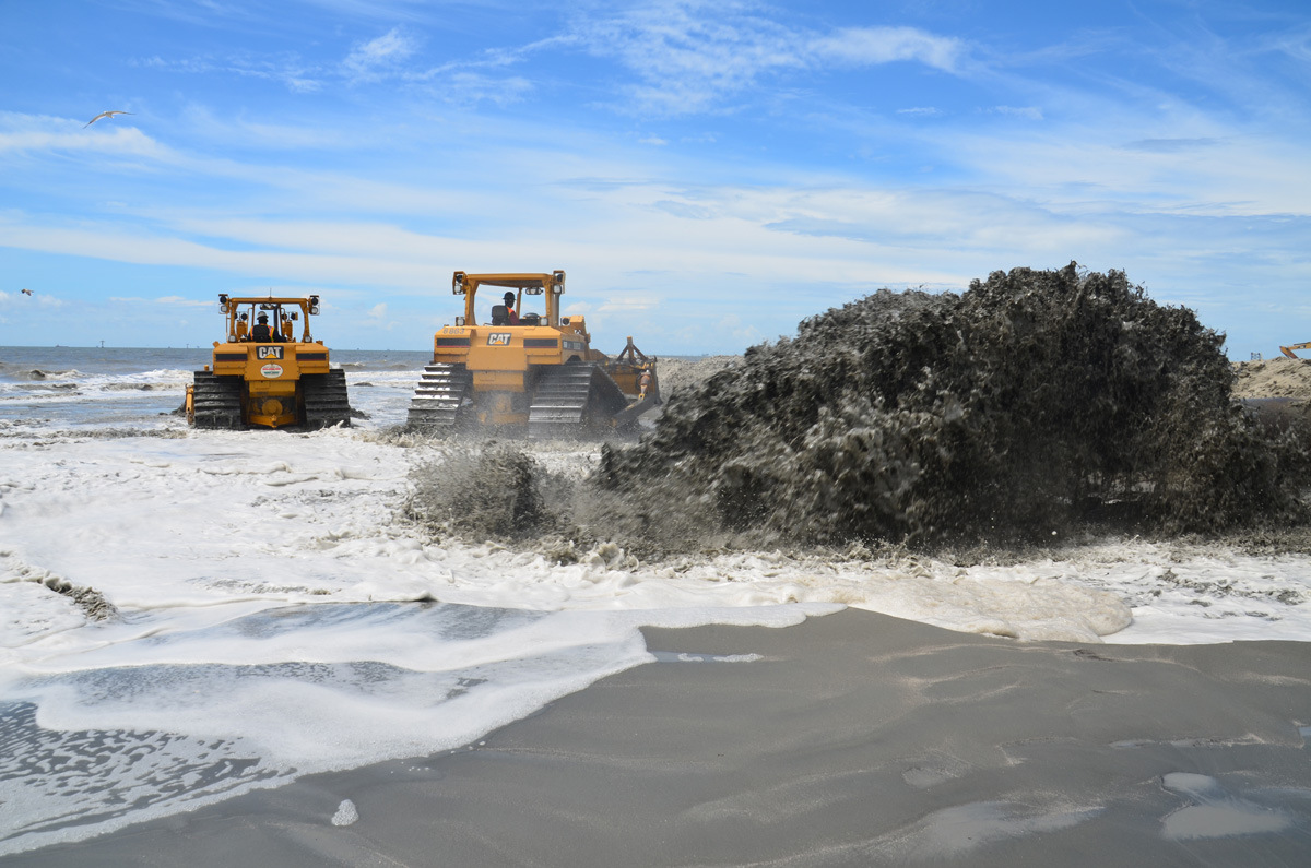
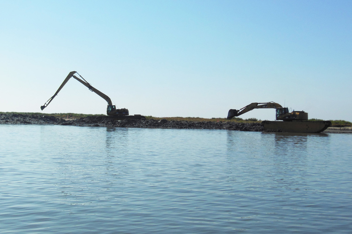
Louisiana’s Coastal Protection and Restoration Authority were back with more heavy equipment and personnel in August 2013, this time to restore the beaches and dunes, rather than drag and sift them for oil. The project used about 8.4 million cubic yards of sand mined from an ancient submerged delta of the Mississippi River to extend the beach 500 feet into the Gulf of Mexico, rebuild dunes up to seven feet tall, and plant those dunes with native vegetation. An additional 200 acres of tidal marsh were rebuilt, as well.

Barges moved the sand from Ship Shoal to a staging area in Belle Pass where it was pumped onto the beach and then shaped with bulldozers. Sand fencing was placed along the beach to help capture wind-blown sand to rebuild dunes as well. By the summer of 2017, Elmer’s was opened completely to wade fishing, restoring a summertime tradition that dates back several generations.

Queen Bess Island

Nearly $19 million in fines from the Natural Resources Damage Assessment have been invested in Queen Bess Island, located just two miles east of Grand Isle in Barataria Bay, to repair decades of erosion and subsidence, as well as oil spill damage. While far smaller in scope compared to the Caminada project, this restoration work has had outsize impacts for anglers and Louisiana’s most iconic bird.

After DDT and other pesticides decimated pelicans in the 1950s and early 1960s, Louisiana was left without a native population of the bird emblazoned on its state flag. In 1971, biologists from Louisiana and Florida worked together to bring 750 young Brown Pelicans to the Barataria Basin, releasing them on Queen Bess, where 11 pairs originally built their nests.

By 2009, there were an estimated 80,000 or more Brown Pelicans in Louisiana and the bird was removed from the Endangered Species list. But only a year later, several thousand pelicans and critical habitat on Queen Bess Island were harmed by the Deepwater Horizon spill.
The island is now home to the largest population of brown pelicans in the Barataria Basin, and nesting habitat has grown from just five acres in the summer of 2019 to 36 acres upon completion of the project in late February 2020.

Brown pelicans at Queen Bess Island. Photo by Louisiana Department of Wildlife and Fisheries.

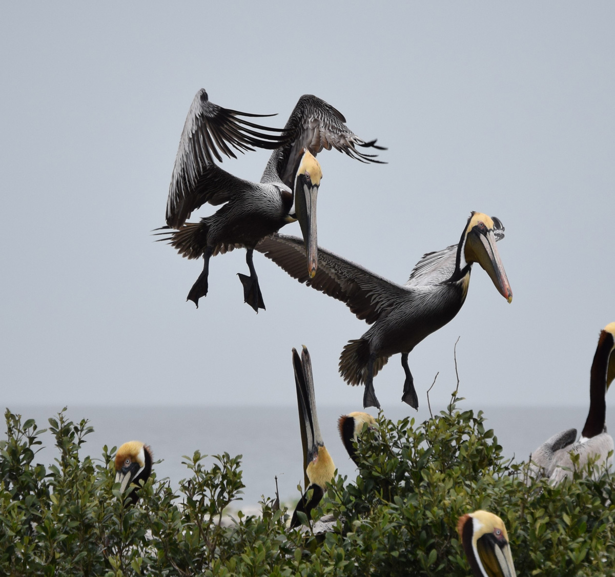
Queen Bess’s proximity to Grand Isle also means that it is visited by tens of thousands of anglers every year. The Barataria Basin was once dotted with small islands like Queen Bess, the remnants of old headlands and bayou banks once connected to the Mississippi River that erosion and subsidence has wiped from the landscape. This has meant less land to dampen waves and protect fish and fishermen, making the island even more important to anglers.

Construction for the Queen Bess project was compressed into a six-month period from late summer 2019 to late February 2020 to avoid interfering with pelican nesting season. It included ringing the island with limestone chunks up to three feet above sea level to give it additional capacity to withstand wave action, subsidence, and sea-level rise.

Rock breakwaters were also built on the southwest shoreline to provide calm water areas for pelicans and other birds. Then, more than 150,000 cubic yards of sediment dredged from the Mississippi River was transported about 25 miles to the island on barges. After the sediment was shaped by bulldozers, tidal sloughs were constructed to allow some water flow into the island and native vegetation was planted to enhance habitat and fight erosion.

The restoration project is expected to extend the life of the island for more than three decades, allowing brown pelicans to thrive where anglers can chase speckled trout, redfish, and sheepshead for years to come.
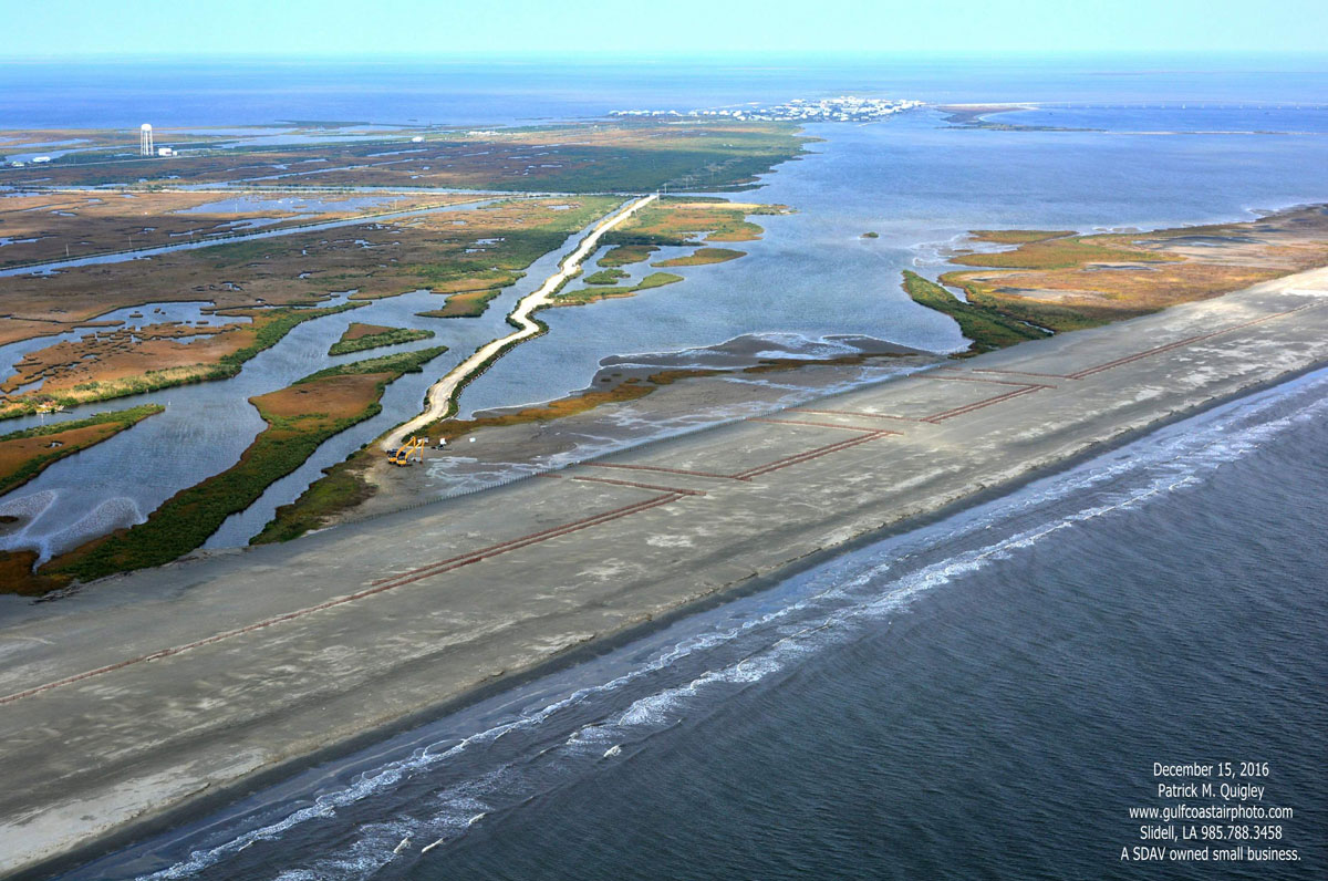
Whiskey Island

Louisiana’s Coastal Protection and Restoration Authority has invested nearly $500 million in rebuilding more than 60 miles of beaches and barrier islands since 2007. It has also overseen construction of hundreds of acres of back-barrier marshes designed to enhance fisheries habitat and help retain the sand that has been pumped ashore by dredges to rebuild beaches and dunes.

Arguably, the most ambitious of these efforts, completed in 2018, is the restoration of the Caillou Lake Headlands in Terrebonne Parish, commonly known as Whiskey Island. It is one of three barrier islands that once comprised Isle Derniers, a massive 25-mile-long island that has been eaten away and fragmented over the last century by hurricanes and subsidence.

For more than a year, sand was pumped 10 miles to the island by a dredge from Ship Shoal, the massive sand deposit on the Gulf floor that also contributed to the restoration of Elmer’s Island. Gradually built up by the Mississippi River about 7,000 years ago, Ship Shoal will be tapped again in 2020 and 2021 for projects at West Belle Pass, Timbalier Island, and Trinity Island, which is immediately east of Whiskey Island.

All four projects are addressing the weaknesses in the barrier island shorelines of the Terrebonne Basin, fortifying protections for coastal communities and sustaining critical fish and wildlife habitat—all using funding from oil spill penalties.

The $117-million project at Whiskey Island has restored 1,000 acres of beaches and dunes and established another 160 acres of marsh platform. This builds upon the success of a 2009 project that created 300 acres of marsh on the island’s east end.

Anglers are particularly fortunate that Whiskey Island’s beaches and marshes, coated and stained by oil in 2010, have been renewed. The effort has helped to sustain and even enhance Terrebonne’s rich recreational and commercial fisheries and give coastal birds—like the brown pelican populations hit hard by the spill—a place to nest and feed for at least two more decades.

The project also demonstrates the broader scale of Louisiana’s coastal restoration efforts now that oil spill dollars have become available. Past barrier-island restoration efforts were pieced together over a decade or more. But with oil spill penalties committed by Louisiana and federal resource agencies like NOAA and the U.S. Fish and Wildlife Service, larger and more comprehensive projects can be built all at once. This ultimately saves money and makes for a more resilient and productive island.

Without the consistent, and now increased, investment in the restoration of Terrebonne Parish’s barrier islands over the last 30 years, it’s likely those islands would be little more than sandbars and submerged humps today, instead of continuing to be fish and bird meccas and the first-line of defense against hurricanes.

Mississippi River Reintroduction at Maurepas Swamp

Looking ahead, the restoration of Maurepas Swamp is a unique opportunity for the CPRA to expand coastal habitat restoration and sustainability projects beyond rebuilding coastal marshes and barrier islands.

Maurepas Swamp is a massive area of old-growth cypress-tupelo swamp nestled between Baton Rouge and New Orleans that separates Lake Maurepas from the Mississippi River. The swamp was once connected to areas that were flooded annually by the Mississippi, but it was isolated by levees more than a century ago. The natural hydrology of the swamp has also been interrupted by roadbeds and spoil banks from oil and gas canals.

Without the annual floods from the Mississippi River allowing sheet water to flow over the swamp, the native trees have lost a vital source of nutrients and the fish and wildlife have suffered. What could be a great area for largemouth bass, catfish, crawfish, and crappies—what the locals call sac a lait—is only a marginal fishery that has declined steadily over the last half century.

Broad areas of low-oxygen water filled with invasive vegetation, like water hyacinth and Salvinia, have replaced healthy swamps full of native submerged vegetation and the oxygen-rich water needed to support healthy fisheries. The Salvinia has also hampered what was once a world-class duck hunting area.

Maurepas Swamp. Photo by Louisiana Coastal Protection and Restoration Authority.

To bring back some of the nutrients and increase water health, in 2022 the CPRA is planning to begin construction of a structure on the Mississippi River that will allow for a relatively small but vastly important flow of water at 2,000 cubic feet per second through the swamp. Approximately 45,000 acres of imperiled swamp will slowly come back to life, limiting the saltwater intrusion brought by hurricanes and improving fisheries. Hopefully, a boost to waterfowl hunting and migratory and native wildlife habitat will follow.

The bulk of the funding is coming from the RESTORE Council, a federal-state collaboration created by the 2012 law of the same name, which committed 80 percent of oil spill penalties back to the Gulf States to address habitat and economic damages. In February 2020, the RESTORE Council granted Louisiana $130 million for the Maurepas project, and state officials are working to secure another $70 million in oil spill penalties, as well.

An added benefit for sportsmen and women is that much of the positive impacts will be on public land managed by Louisiana’s Department of Wildlife and Fisheries. The Maurepas Swamp Wildlife Management Area is a massive 122,000-acre public hunting and fishing area, much of which is located within the diversion’s area of influence. A 2013 settlement between MOEX, one of the owners of the Deepwater Horizon’s Macondo Well, and the U.S. Justice Department provided Louisiana with $6.75 million to add 11,145 acres to the WMA to preserve the coastal cypress-tupelo forest.

Improving the health of the swamp will also increase its ability to help protect adjacent communities from hurricane winds and storm surges. The swamp stores storm surge waters during hurricanes. The diversion can operate post-storm to push out higher salinity water and protect the trees and fish from long-term damage. The trees also help to dampen wind, further protecting communities.

In all, the conservation of Maurepas Swamp using the restorative power of the Mississippi River may prove to be one of the wisest investments of oil spill penalties thus far, especially given the long-term benefits to hunters, anglers, and local communities. Allowing the swamp to continue to degrade would jeopardize the cultural value of fishing and hunting in the area and leave numerous towns in Southeast Louisiana more vulnerable to future hurricanes.


Feature photo by Louisiana Department of Wildlife and Fisheries.

One Response to “Ten Years Later: Louisiana’s Fragile Coast is Steadily Rebounding from Nation’s Worst Environmental Disaster”

Do you have any thoughts on this post?

XHTML: You can use these tags: <a href="" title=""> <abbr title=""> <acronym title=""> <b> <blockquote cite=""> <cite> <code> <del datetime=""> <em> <i> <q cite=""> <s> <strike> <strong>

Comments must be under 1000 characters.

Senate Passes Great American Outdoors Act

Bill’s passage proves that conservation transcends partisanship

(Washington D.C)—The U.S. Senate today in a 73-25 vote passed the Great American Outdoors Act giving hunters and anglers a major win.

This bipartisan bill fully and permanently funds the Land and Water Conservation Fund and invests in the crumbling infrastructure on federal public land.

“Today’s vote is historic in many ways,” said Whit Fosburgh, president and CEO of the Theodore Roosevelt Conservation Partnership. “It fulfills a promise we made 55 years ago to create a national legacy of investing in our natural resources. It also fixes our roads, trails, boat ramps, and recreational spaces so future generations can enjoy them. And it helps put Americans back to work through conservation at a time when unemployment rates are at near record levels.”

In addition to securing $900 million annually for the LWCF, the bill also invests $1.9 billion annually for the next five years to address the maintenance backlog on National Park Service, U.S. Forest Service, U.S. Fish & Wildlife Service, and Bureau of Land Management lands.

“Passing the Great American Outdoors Act proves that conservation issues transcend politics and partisanship,” added Fosburgh. “We want to thank Senators Gardner and Manchin for sponsoring the legislation and all the co-sponsors who pushed this bill through the Senate. We urge the House to follow suit and send this bill to the President’s desk showing that conservation works for America.”

June 9, 2020

How Far Fish Habitat Has Come in the Ten Years Since the Gulf Oil Spill

The Deepwater Horizon oil spill was ten years ago, and Louisiana’s coastal habitat is being rebuilt to flourish even better than before. In fact, lands that experts predicted would have vanished by now are supporting fish, wildlife, and outdoor recreation spending.

A decade ago, bulldozers, excavators, and hard-hat-donning work crews were removing millions of pounds of sand and vegetation coated in thick, tarry oil from Louisiana’s beaches and barrier islands after the Deepwater Horizon oil disaster.

The heavy equipment and hard hats have returned to our coast, but now it’s in an effort to restore damaged fish and wildlife habitat using fines paid by BP and others responsible for the spill. This year alone, the Louisiana Coastal Protection and Restoration Authority—in conjunction with federal partners at the U.S. Fish and Wildlife Service and the National Marine Fisheries Service—will begin, continue, or conclude restoration projects representing an investment of more than $250 million in Deepwater Horizon penalties.

Photo by NRCS.

Thirteen barrier islands and headland beaches line the Louisiana coast from Venice to the Barataria, Timbalier, and Terrebonne Basins. All of them have either been restored in the 10 years since the oil stopped spewing or will be restored in the next 10 years. In addition, some smaller islands beyond these areas—which are also critical habitat for fish, brown pelicans, and other coastal birds—have been restored.

Louisiana’s barrier islands and beaches are all remnant headlands of the ever-shifting Mississippi River Delta and the first line of defense against hurricanes and violent winter storms that batter the northern Gulf. Without barrier islands to break up the waves and dampen storm surges, the vulnerable wetlands and nursery grounds north of the islands would crumble and coastal communities would become even more exposed to the full fury of the Gulf of Mexico.

Of course, this is also extremely important habitat for the Gulf’s most popular sportfish, like speckled trout, redfish, and Spanish mackerel. If the surf is light, these beaches and islands are lined with boats and surf anglers tossing topwaters, live shrimp, and a variety of plastic plugs and swimbaits. On most summer days, the line of boats along popular Elmer’s Island and Timbalier Island stretches from horizon to horizon.

The dynamic nature of Louisiana’s coastline and the lack of sediment input from the Mississippi River has shortened the lifespan of many of these critical islands, especially since the river was extensively levied in the late 19th and early 20th century. Without investments of oil spill penalties and funds from state-federal partnership programs, some islands would be little more than subsurface sandbars today.

“In the early 80s, the islands in Terrebonne Parish were losing land at a tremendous rate and the prediction then was that all of those islands would be gone by 2015,” says Bren Haase, executive director of Louisiana’s Coastal Protection and Restoration Authority. “However, there have been a host of restoration efforts made throughout the area that have kept those islands largely intact and the land area has stayed roughly constant over the last 30 years.”

Photo by CWPPRA.

Three of the beach and island projects currently underway are designed to keep the Terrebonne Basin intact for the next 20 years or more and provide protection for infrastructure and the fishing camps, marinas, and bait shops in small but important towns like Port Fourchon, Leeville, Cocodrie, and Dulac.

Approximately 9.2 million cubic yards of sand will be dredged from a massive ancient Mississippi River delta in about 30 feet of water off Terrebonne Parish. The sand will be barged to the beaches and then shaped with earth-moving equipment before being planted with native grasses to help hold it in place.

In all, approximately $167 million in fines from the National Fish and Wildlife Foundation’s Gulf Environmental Benefit Fund is being spent to revive and extend the life of the West Belle Pass headland, Timbalier Island, and Trinity Island. The GEBF was the first fund established with oil spill penalties and dedicated $2.4 billion Gulf-wide to projects that restore fish and wildlife habitat damaged by Deepwater Horizon.

Haase, who has worked on coastal habitat restoration and hurricane protection efforts in Louisiana for more than 20 years, says the oil spill fines have allowed the CPRA and federal partners to expedite project construction, while dramatically increasing the size and scope of island and beach restoration projects.

Restoration efforts that once consisted of projects costing $15-million to $30-million and taken on piecemeal have grown into massive $100-million projects that can rebuild hundreds of miles of beach, dune, and tidal marsh all at once.

“Over the last decade we’ve taken a more system-wide approach to barrier island restoration,” says Haase. “Rather than build one project here and there, in our analysis, we saw that there were weaknesses in certain areas of islands and headlands that we could address that would prevent breaches and help provide more protection to the habitats inside the barrier islands.”

The challenge was always to use the unprecedented fines and penalties paid by those responsible for the economic and environmental destruction and loss of life to make sure the mistakes of the past weren’t repeated—to make the Gulf a better place post-spill. Louisiana’s investment and the innovation developed in restoring its critical barrier islands, beaches, and marshes shows that our state has wholeheartedly embraced that responsibility.


This story first appeared as a guest blog for Fishing Tackle Retailer in honor of World Oceans Day. Top photo by Tim Donovan.

June 5, 2020

Public Wants to Maintain Safeguards in Nation’s Largest National Forest

Comments received by the Forest Service show a powerful public consensus in direct opposition to the proposal to roll back conservation measures in the Tongass

It just makes sense to most Americans that we should have a say in the management of the public lands that all of us own. And, in fact, that’s how things are supposed to work. Meetings in local communities, opportunities for individuals to comment, and pragmatic collaboration involving various stakeholders are critical to the planning processes that guide agencies like the U.S. Forest Service.

That’s why hunters and anglers should be seriously concerned by the administration’s proposed elimination of the Roadless Rule in Alaska.

Why Does the Tongass Matter?

At nearly 17 million acres—approximately the size of West Virginia—the Tongass National Forest in Alaska is the largest national forest in the U.S. and the world’s largest remaining temperate rainforest. Vast swaths of undeveloped forests— some older than 500 years—are at the heart of a decades-old debate about how best to manage this unique forest that is home to approximately 70,000 Alaskans living in 32 mostly rural communities.

More than half of the Tongass – 9.2 million acres – is managed under the direction of the 2001 Roadless Rule. This management plan works to safeguard vital habitat for important fish and wildlife species, including Sitka black-tailed deer, black and brown bear, moose, and even Roosevelt elk. Outstanding opportunities for hunting draw visitors from around the world and fuel Southeast Alaska’s vibrant tourism industry.

The Tongass also features some of the nation’s most productive salmon watersheds, earning the distinction of “America’s salmon forest.” Salmon are a way of life and critical food source for rural Southeast Alaskans, who eat an average of 75 pounds of salmon per person each year. Healthy salmon habitat fuels the region’s economy and supplies a global food chain. More Southeast Alaskans are employed in commercial fishing than any other private sector.

Credit: Howie Garber Photography
How Does the Roadless Rule Work for Alaska?

By safeguarding undeveloped landscapes and watersheds in the Tongass, the Roadless Rule supports industries that depend on intact forests and high-quality habitat, such as hunting, fishing, and other forms of outdoor recreation, tourism, and commercial fishing. The rule also has built in flexibility and allows for community development projects when they serve the public interest. Since the Roadless Rule was implemented, all 57 requests for new projects in roadless areas of the Tongass—spanning mining, renewable energy development, and community access—have been granted by the Forest Service.

Why Is the Forest Service Proposing to Lift the Roadless Rule in Alaska?

In January 2018, the State of Alaska petitioned the U.S. Department of Agriculture to allow for the development of a state-specific roadless rule. Many hunting and fishing groups and businesses were willing to consider a compromise option, facilitated by a Citizen’s Advisory Committee, that balanced the need to conserve critical fish and wildlife habitat while allowing some new commercial logging in other areas of the forest.

The opportunity for a compromise solution was all but eliminated last summer when the White House intervened after an off-the-record meeting between President Trump and Governor Dunleavy. Following that meeting, the Department of Agriculture and the Forest Service were directed to propose the most extreme option: a full exemption of the Roadless Rule in Alaska.

The agency’s proposal, as written, would open 9.2 million acres of public land—more than half of the forest—to industrial development, including 165,000 acres of irreplaceable old-growth forests.

Because of these extreme actions, those who support conservation and wildlife habitat are left with only one option: oppose the Forest Service’s recommendation to lift the Roadless Rule in Alaska.

Credit: Howie Garber Photography
What Does the Public Have to Say About This Issue?

According to data recently released by the Forest Service, 96 percent of “unique letters” commenting on the draft Tongass proposal support keeping the Roadless Rule in place. Fewer than 1 percent of the 250,000+ comments support the full exemption favored by the administration. Likewise, the Forest Service’s analysis of testimony from 18 subsistence hearings in Southeast Alaska determined that a “vast majority” of local residents support keeping the Roadless Rule and protecting vast swaths of old-growth temperate rainforest from clear-cut logging.

Clearly, the plan to rollback conservation safeguards for millions of acres of some of the world’s most productive salmon and Sitka black-tailed deer habitat does not reflect the priorities and values of Alaskans and disregards feedback from nearly a quarter-million public land owners across the country who took time to participate in this process.

Unless the Forest Service rethinks its proposal for the Tongass, the result will be an unsustainable management framework likely to face legal and long-term political challenges. The uncertainty being created through this effort hurts all stakeholders: rural residents who practice a subsistence lifestyle, small businesses that earn a living from the land, land managers trying to balance the needs of all user groups, and hunters and anglers who dream of visiting Southeast Alaska.

What Happens Next?

The Forest Service is expected to issue a final decision on the proposed Roadless Rule exemption this summer. Interested in the Tongass National Forest and other Alaska issues affecting hunters and anglers?

Sign up with the TRCP here to receive updates on how you can get involved and make your voice heard.

Top photo: Joseph via Flickr

How Mending Fences Makes a Difference for Migrating Big Game

Upgrading wire fences with help from landowners and volunteers aids animal movement across the West

A video we posted on Instagram recently showed that just a single strand of barbed wire on a dilapidated fence was enough to stymie a six-point bull elk as it attempted to pass through. The bull hit the wire with his right front hoof, pulled his leg back, and got slightly startled at being tangled, but it managed to step away from the fence.

I’m pretty sure that old fence didn’t harm the bull or ultimately impede him getting to wherever he was going, but this is not always the case. Many of us have witnessed deer, elk, and pronghorn antelope nervously walking up and down a fence line or, worse yet, tangled up in a fence either dead or left to die. This also is a habitat connectivity issue—one that can create additional challenges for big game in areas where their migration routes are already fragmented by roads and other obstacles.

Wild critters frustrate many landowners by damaging fences, creating the extra work of mending them so that livestock does not escape. But there are alternatives for making fences more friendly to wildlife.

Barbed and Beyond

When asked about innovations of the 19th century, few people would likely name barbed wire, but its invention changed the American West almost overnight—and it has had consequences for wildlife ever since.

After the Civil War, Western rangelands were homesteaded and settled, but landowners needed a way to keep livestock within their property boundaries. This technology essentially ended the “open range” grazing era and changed the West forever.

Barbed wire is perhaps the most pervasive option in big game country, but of course it’s not the only style of fence with impacts for migrating animals. Woven wire fences are almost impossible for wildlife to pass through. When these are combined with a barbed top wire, it is a lethal and impenetrable combination considered the most detrimental to wildlife.

Photo by Texas Parks and Wildlife.
What Happens to Wildlife?

There are several rather obvious impacts of fencing on wildlife worth mentioning. First, our big game animals—like mule deer, pronghorns, and elk—did not evolve with fences across once open spaces, so traditional migration corridors of these animals have been interrupted and altered.

But animals can just jump over fences, right? Well, yes, or go under them. And most critters can clear a fence without issue. But many animals become entangled and die from either starvation, dehydration, hypothermia, or predation. Juveniles are especially vulnerable and make up a large percentage of big game animals killed by fences. Animals with horns or antlers sometimes get their headgear tangled up in fencing, and their fate may be the same as if they’d attempted to jump a fence.

It’s not just existing fencing that can cause trouble—dilapidated fences that are no longer being monitored, used, or maintained can be a real danger to critters, too.

According to the Colorado Parks and Wildlife Department’s “Fencing with Wildlife in Mind” brochure, fences incompatible with wildlife are those that:

  • Are too high to jump.
  • Are too low to crawl under.
  • Have wires spaced too close together.
  • Have wires that are too loose.
  • Are difficult for fleeing animals to see.
  • Create a complete movement barrier.
Photo courtesy of Wyoming Game and Fish Dept.
Where Fencing Works for Wildlife

On the other hand, strategically placed fencing can sometimes be a good thing for big game animals, because it funnels them to safety. One of the three most critical factors involved with placing an effective wildlife crossing over or under a roadway is to ensure that fencing guides the animals to the structure.

The Arizona Game and Fish Department found this out firsthand by retrofitting the fencing at an older and ineffective crossing structure on Interstate 17. Prior to the retrofit fencing project, an average of 20 elk per year collided with vehicles. After adequate fencing was installed, there was a whopping 97-percent reduction in vehicle collisions with elk.

Often, game-proof fencing, which is typically 8 feet or taller and made of woven wire, is needed to reduce damage to certain crops or other property. Such exclusion fences reduce unnecessary conflicts with humans and the need for damage control of problem animals or populations.
Mending Fences

Most state and federal agencies have guidelines for wildlife-compatible fencing, and there is certainly no shortage of recommendations available. Wildlife-friendly options should have:

  • A smooth wire at the top no higher than 42 inches from the ground—on steep slopes, pinpointing where the animal would leap from helps to determine the effective fence height.
  • A smooth wire at the bottom at least 18 inches above the ground.
  • Built with no stays on the fence and posts at least 16 feet apart.

Many landowners have stepped up to help solve fencing problems for wildlife. Ruben Vasquez, a district conservationist with the Natural Resources Conservation Service in Wyoming, wrote about ranchers who realized that existing five- or six-wire barbed and woven wire fences prevented pronghorns, elk, and deer from moving freely across their lands. It was also expensive to continually repair fences damaged by wildlife attempting to cross.

With help from the Farm Bill’s Environmental Quality Incentives Program, many landowners have been able to replace their existing fences with more wildlife-friendly versions, and this is a win-win. In 2017, Vasquez reported that 29,000 feet, or roughly five and a half miles, of problem fences were replaced with wildlife-friendly fence on just one Wyoming ranch.

Landowners can also leave certain gates open or sections of fence where wildlife readily cross during their seasonal migrations. The key, of course, is knowing precisely when and where animals move and encounter the fences. But this is a good tactic to help facilitate seasonal movements across private lands during predictable time periods.

Getting to the Other Side

Of course, there can never be too much of a good thing, and thousands of miles of dangerous fencing remains across our landscapes. Federal land management agencies need to prioritize retrofitting incompatible fences that threaten wildlife across our public lands. Landowners are doing great work to help make fences wildlife-friendly, but more resources and technical support would help expand these efforts.

Adequate, long-term funding for Farm Bill conservation programs like EQIP and other resources will be needed to help retrofit unsafe fences across the West. But volunteers can help too. Old fences need to be pulled off the land either simply to remove the hazard or before new, safer fences can be installed.

In many areas, fence removal and replacement projects can be easily tackled by conservation volunteers in an afternoon or two. Others may take more time, resources, and skilled labor to complete, but projects like this help sportsmen and women get more involved in conservation and thinking about how game species use habitat on a landscape scale. Where migration corridors are fragmented and interrupted by development and other threats, installing the right fence can be a small price to pay to help knit together these important travel routes.


Top photo by Idaho Game and Fish Department.

HOW YOU CAN HELP

CHEERS TO CONSERVATION

Theodore Roosevelt’s experiences hunting and fishing certainly fueled his passion for conservation, but it seems that a passion for coffee may have powered his mornings. In fact, Roosevelt’s son once said that his father’s coffee cup was “more in the nature of a bathtub.” TRCP has partnered with Afuera Coffee Co. to bring together his two loves: a strong morning brew and a dedication to conservation. With your purchase, you’ll not only enjoy waking up to the rich aroma of this bolder roast—you’ll be supporting the important work of preserving hunting and fishing opportunities for all.

Learn More
Subscribe

You have Successfully Subscribed!

You have Successfully Subscribed!

You have Successfully Subscribed!

You have Successfully Subscribed!

You have Successfully Subscribed!