fbpx

April 3, 2020

Six Ways to Practice Responsible Recreation on Public Lands and Waters

The TRCP joins its conservation partners and industry leading brands in calling for hunters and anglers to protect their access and act responsibly as they enjoy the outdoors. Please remember to practice #ResponsibleRecreation.

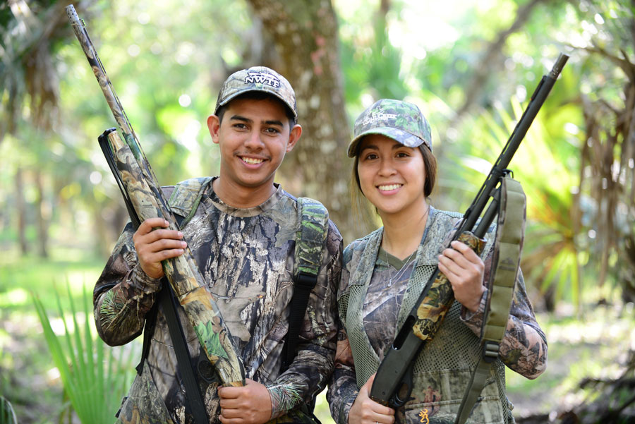
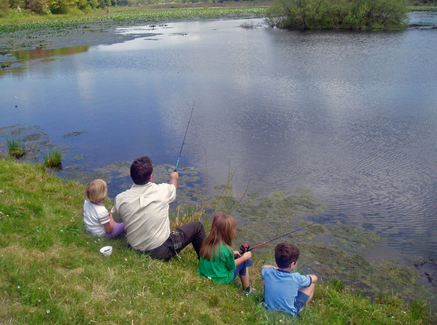
As the weather gets warmer—and as cabin fever heats up, as wellchasing spring turkeys or bears and wetting a line probably seem like great way to escape some of the stress we’re currently experiencing. In many states, campgrounds and national parks are beginning to re-open to visitors. And while many Americans are discovering that being outdoors can offer something of a temporary return to normalcy, it’s important that we pursue our passions in the upcoming weeks and months in a responsible way given our current reality.

#ResponsibleRecreation means adhering to a few simple commitments:
  • Plan ahead by purchasing any necessary licenses or park passes online.
  • Stay close to home. Traveling to far-away destinations creates a greater risk of spreading COVID-19.
  • Follow everyday best practices for preventing infection. Wash your hands, maintain social distancing, and stay home if you are experiencing symptoms.
  • Be aware of any relevant state and federal guidelines. Even if your destination is open to outdoor recreation, the rules for use may be different now than they otherwise would be.
  • Pack out your trash and be respectful of our shared resources. For years now, our national parks have struggled to keep up with increased visitation and currently have a backlog of maintenance and repair needs in excess of $11.9 billion. Now, many parks and other public facilities are understaffed. (Take action on this issue here.)
  • Share your adventures on social media in a way that encourages others to make similarly responsible choices. Be sure to use the hashtag #ResponsibleRecreation.

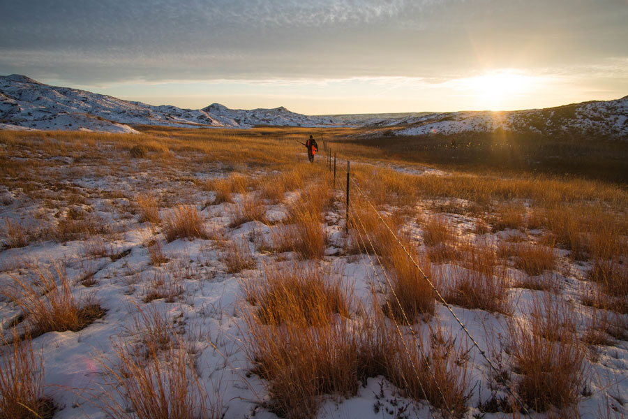
In short, please do get outside. But stay safe, follow the law, and keep it local. Here’s why. 

The Rules May Have Changed 

Following the law has always been part of being a hunter or angler. But what has changed under current circumstances are some of the rules regarding access and opportunity, particularly on public lands. 

Certain public lands have closed to visitors (especially national parks and other areas that draw large crowds). But even on those that remain open, you may find closed public facilities like visitors centers, campgrounds, restrooms, or boat ramps. Be sure before you go that your destination is open for recreation and be certain to respect any temporary closures. Many agencies, like the Forest Service and the National Park Service, have established pages on their websites where COVID-19-related news and updates are highlighted. 

Likewise, hunters and anglers must also double-check that seasons, regulations, and/or openers haven’t been changed by state fish and game agencies. Nebraska, for instance, is no longer selling non-resident spring turkey permits, and Washington has closed several hunting seasons as well as its recreational fisheries.  

So remember: before you pack up your vehicle and hit the road, call ahead or check online to be sure you’re not running afoul of any temporary changes to regulations or access opportunities. 

Photo: Tim Donovan
Small Communities Are Strapped 

With extra time on your hands, you may be tempted to explore new terrain or use the opportunity to check a destination off your bucket list, especially when many are unable to work and have restless children at home. And it also seems right during this economic downturn to support the guides, outfitters, and small businesses that cater to visiting hunters and anglersBut there’s good reason to keep it simple and head to the local woods and waters instead. 

Travel to faraway destinations creates more of a risk for disease spreading. Keep in mind that many rural areas and “gateway” communities do not have the same healthcare infrastructure and stores of medical supplies that you’d find in more populated areas, and that these places typically have a higher percentage of older residents who may be vulnerable to the coronavirus. 

Likewise, groceries and other home goods in rural communities are limited and needed by those that live there. While many businesses usually depend on spending by out-of-town visitors, during these unusual circumstances they’d rather have stock on the shelf available for their neighbors.  

 And when you do get outit is more important than ever to think about the risks before making decisions in the outdoors.

This Is Not the Time to Take Physical Risks 

In addition to the ways that the healthcare precautions we’ve all been following might apply to outdoor recreation ( i.e., avoid crowded trailheads, give others extra space on the boat rampetc.), there are extra considerations for those of us who like to get out and explore on the water and wild landscapes. 

Search and rescue efforts, emergency evacuations, and similar incidents put at risk our first responders and draw resources away from our already over-burdened medical facilities. Emergency services across the country have asked outdoor recreators to choose lower-risk backcountry activities during these extraordinary times. 

So by all means, get out and enjoy what we all love about time in the outdoors: fresh air, exercise, and a break from the stress of everyday life. But don’t forget about the role we all have to play in the effort to keep one another safe.

Keep it simple, know the rules, stay safe, and make this the season to savor the best hunting and fishing your town or county has to offer—who knows, you might just discover an overlooked opportunity in your own backyard.


Top photo: Virginia State Parks via Flickr

3 Responses to “Six Ways to Practice Responsible Recreation on Public Lands and Waters”

  1. Hunters and fisherpersons are the least of the problems relating to corona virus, because they are outdoors and separated from other persons. They should be encouraged to go out rather than in crowded stores and other venues. To forbid hunting and fishing is dumb.

  2. Mike Wilson

    I disagree for many of the reasons explained in your plan. But I understand the comment. Trump took a knee, walked off the field and abdicated to the Governors. So there are wild inconsistencies and mixed messages. In Nebraska a popular outlet mall will be allowed to open this weekend, but I can’t camp with my son in the local State Park. That is a very mixed message. The comment does not reflect lack of understanding, but rather a lack of “buy-in”! That’s the result of no national plan and serious and consistent message.

    • W Sumner

      Well, that’s how federalism works. Each state should be best equipped to handle their own affairs. Beaurocrats in DC should not be deciding how many out of state turkey permits should be sold in NB. You think Trump is the one who should decide that? Come on…

Do you have any thoughts on this post?

XHTML: You can use these tags: <a href="" title=""> <abbr title=""> <acronym title=""> <b> <blockquote cite=""> <cite> <code> <del datetime=""> <em> <i> <q cite=""> <s> <strike> <strong>

Comments must be under 1000 characters.

March 20, 2020

MAPLand Act: The Basics

Landmark new legislation in Congress promises to bring public land access into the 21st century

Digital mapping and GPS technologies have revolutionized the ways in which sportsmen and women navigate public lands. By pinpointing a user’s real-time location on the landscape, handheld GPS units and smartphone applications allow hunters and anglers to know exactly where they stand relative to property boundaries and other key landmarks.

Unfortunately, when it comes to public lands, incomplete and inconsistent mapping data prevents hunters and anglers as well as land management agencies—including the Forest Service, Bureau of Land Management, National Park Service, and Army Corps of Engineers—from utilizing the full benefit of these technologies. 

But a bipartisan bill recently introduced into both chambers of Congress promises to bring our public land mapping records into the 21st century. Here’s how the Modernizing Access to our Public Land (MAPLand) Act would do that.

Photo: Rick Hutton
Restoring lost recreation opportunities

Most recreational opportunities on public lands are identified in agency management plans and appear on agency-produced paper maps that show, for instance, roads and trails open to different types of motorized and non-motorized vehicles. Sometimes alongside a national forest road you’ll see a sign marking a zone where hunting or recreation shooting is, such as near a campground or forest service ranger station. Other times you’ll pull up to a mountain lake parking lot and a sign is posted that specifies horsepower restrictions for boats. 

While some of this information might, in certain places, be available in a GPS-compatible format, in most places it is not. As a result, it is difficult for the general public to find specific information about available recreation opportunities on their public lands without spending considerable time exploring public lands to ground-truth areas or poring over volumes of agency documents. Sometimes, a person might avoid hunting in an area altogether simply because they can’t tell by looking at a sign where the shooting boundary starts and ends. Many members of the public might also avoid driving on an open road because the existing sign long ago went missing and they don’t want to inadvertently break the rules. 

A lack of modern information about recreational access opportunities on public lands is resulting in lost days afield, and in the 21st century, sportsmen and women should be able to reference their handheld GPS or other mapping units so that they can instantly know the rules for recreation and where the boundaries of restricted areas are located within a matter of feet. Such measures would not only help busy Americans discover new recreation opportunities and give them confidence to enjoy the outdoors, but it would also reduce conflicts and the likelihood that outdoor enthusiasts will break the rules. 

This need for better information is what the MAPLand Act is designed to address by providing funding and guidance to our land management agencies to digitize mapping information about outdoor recreation. This includes, among other things, seasonal allowances and restrictions for vehicle use on public roads and trails; boundaries of areas where hunting or recreational shooting is regulated or closed; and portions of rivers and lakes on federal land that are closed to entry, closed to watercraft, or have horsepower limitations for watercraft.

Photo: Rick Hutton
Shining a Light on Access Opportunities and Challenges

Millions of acres of federal public lands across the country have restricted access, particularly in areas with mixed public and private landownership. In the West alone, more than 9.52 million acres of federal public lands have no permanent legal means of access and permission to access to public lands across private property can be difficult to obtain.    

In many places where public land trail and road access exists across private land, it was established by a legal agreement known as an easement, in which an agency such as the BLM or Forest Service formally acquired the permanent right for the public to travel a designated route (such as a road or trail) across private land. 

Many of the agencies’ records of access easements across private lands are still held on paper files at local offices and cannot be easily accessed or reviewed. The Forest Service alone has an estimated 37,000 recorded easements, but only 5,000 have been digitized and uploaded into an electronic database.

Currently, the federal land management agencies lack the resources and capacity to digitize and standardize these records. Because of this, it is difficult for hunters and anglers to understand the full extent of access opportunities. And when they are not used, public rights-of-way can be forgotten by the public and the agency alike. 

MAPLand would require our public land agencies to digitize records of easements or rights-of-way across private lands, making it possible for the public to understand where public access has been formally secured in legal records. Doing so would both help expand public access opportunities and reduce conflict with landowners, because everyone would have factual information about access allowances and restrictions.    

In addition, by giving land managers a comprehensive picture of all available access points, they can fulfill their mission to identify public lands with limited or nonexistent public access, and take proactive steps in cooperation with private landowners to open those lands to the public. Conservation groups and land trusts that have been working on access issues will be able to use this data to identify priority areas and work more efficiently to expanding opportunities on our public lands. 

Take Action

Elected officials need to know how much MAPLand would mean to hunters and anglers. Write your lawmakers today and ask them to support public land access! 


Top photo: Rick Hutton

March 13, 2020

Our Call to Modernize Public Lands Data

Here’s why MAPLand could be a game-changer for unlocking inaccessible public lands

When onX and TRCP teamed up in 2018 to study the issue of landlocked federally managed public lands in the West, we highlighted several priorities that needed to be addressed by agencies and lawmakers in order to work on opening access to the 9.52 million acres of public lands in the West where it currently does not exist.

Here’s what we had to say about the need for digitized, standardized easement data, which helps explain why the MAPLand Act is such a critical piece of legislation.

DOWNLOAD THE REPORT

“As much as these findings identify a clear need for expanded access to public lands and waters, they also highlight the need for federal land management agencies to develop standardized datasets for easements, rights-of-way, and established corridors across private land to which the public has binding and legal public access. Many of these access rights were secured decades ago, and they remain housed locally at land management agency offices in paper and electronic files.
While this report’s analysis is based on the most comprehensive road inventory currently available, the lack of readily obtainable data on easements and rights-of-way makes it all but impossible for anyone – including the agencies themselves – to have a complete understanding of where legal public access exists, or does not exist, across private lands.
Compiling these data and converting them into consistent datasets would enable private and public entities to create maps that provide sportsmen and women with greater certainty about where public access is guaranteed by law. This information would also help the federal agencies and land trusts prioritize acquisition projects that would open landlocked public lands.”
Off-Limits, But Within Reach: Unlocking the West’s Inaccessible Public Lands, p. 8

March 10, 2020

MAPLand Act Simplifies Access to Hunting and Fishing Opportunities

Legislation invests in digitized, integrated mapping resources for outdoor recreation

The Theodore Roosevelt Conservation Partnership is hailing landmark legislation that will enhance outdoor recreation on public lands by investing in modern technology that allows sportsmen and women to know exactly which lands and waters they can access.

U.S. Senators Martha McSally (R-Ariz) and Angus King (I-Maine) and U.S. Representatives Derek Kilmer (D-Wash) and Russ Fulcher (R-Idaho) today introduced the Modernizing Access to Our Public Land (MAPLand) Act to digitize recreational access information and make those resources available to the public.

Currently, many of the easement records that identify legal means of access onto national forests or BLM-managed lands are stored at the local level in paper files, which makes it difficult for hunters, anglers, and even the agencies to identify public access opportunities. Of 37,000 existing easements held by the U.S. Forest Service, only 5,000 have been converted into digital files.

The MAPLand Act would direct federal land management agencies to consolidate, digitize, and make publicly available recreational access information as GIS files. These records would include information about legal easements and rights-of-way across private land; year-round or seasonal closures on roads and trails, as well as restrictions on vehicle-type; boundaries of areas where special rules or prohibitions apply to hunting and shooting; and areas of public waters that are closed to watercraft or have horsepower restrictions.

“GPS technology has become an essential part of the public-land user’s toolkit,” said Whit Fosburgh, president and CEO of the Theodore Roosevelt Conservation Partnership. “This bill will allow sportsmen and women to take full advantage of the world-class opportunities on our public lands, make it easier to follow the rules while recreating outside, and reduce access conflicts. Quite simply, this is a common-sense investment in the future of hunting, fishing, and outdoor recreation. We want to thank Senators McSally and King and Representatives Fulcher and Kilmer for taking the lead on this important legislation.”

In addition to improving the public’s ability to access public lands, the bill would help land management agencies — in cooperation with private landowners — prioritize projects to acquire new public land access or improve existing access. According to a 2018 report by the TRCP and onX, a digital-mapping company, more than 9.52 million acres of federally managed public lands in the West lack permanent legal public access because they are surrounded entirely by private lands. Digitizing easement records would be the first step towards addressing this challenge systematically.


What Others Are Saying:

“Public land recreation has been revolutionized by handheld GPS technology in smartphones and other devices, allowing users of all types and experience levels to know where they stand in the outdoors. After spending over a decade gathering recreation information for our customers and making it easily discoverable, we continue to find valuable recreation information that exists only on paper. The data need to be complete, easy to find, and easy to use for the public to fully understand the recreation opportunities available to them. The MAPLand Act is a much-needed investment in the outdoor recreation industry and in the future of empowering the public to get outside and experience our public lands.”
— Eric Siegfried, Founder, onX

“The Mule Deer Foundation commends Senators McSally and King and Representatives Fulcher and Kirby on the introduction of the Modernizing Access to Our Public Land Act. This important legislation will do a great deal to assist sportsmen and women in identifying places where they can hunt and fish on the public lands that they as taxpayers own. All told, this is a common-sense and long-overdue idea that will benefit sportsmen and women, as well as the communities all across our country with economies driven by outdoor-recreation spending.”
— Miles Moretti, President/CEO, The Mule Deer Foundation

“Quality hunting and fishing opportunities have two requirements: healthy habitat and access. This bill makes sure that information about public land access and areas open for hunting and fishing is kept current and readily available for sportsmen and women. We want to ensure that all Americans can enjoy the world-class sporting opportunities found on public lands and this legislation will help to ensure just that.”
— Steve Kandell, Director, Trout Unlimited’s Sportsmen’s Conservation Project

“Access is one of the most important aspects for a thriving outdoor recreation economy. Yet, it isn’t just access to land and water, it’s also access to information about the very lands we recreate on, where they are, when and how they are accessible and oftentimes this data is antiquated or even inaccurate. In order for us to continue to grow this important sector that makes up 2.2% of the national GDP and employs 5.2 million Americans, we need to know where we can get outside on public and private lands and when and how to best protect them. Modernizing Access to our Public Land Act will help us do just that and improve the information we have to safely enjoy all that outdoor recreation has to offer. ORR is proud to support this legislation.”
— Jessica Wahl, Executive Director, Outdoor Recreation Roundtable


Image courtesy of National Parks.

January 8, 2020

Podcast: Increasing Public Land Access in the West

Joel Webster, Director of the Theodore Roosevelt Conservation Partnership’s Center for Western Lands joins Dave and Nephi on Your Mountain Podcast to talk about public land access. Specifically, they discuss TRCP’s work with OnX to identify and map the 6.35 million acres of public lands in the West that have no permanent, public access. Topics include: the history of TRCP; the importance of access to the future of hunting; corner crossing; successful existing access partnerships with landowners; ideas for increasing access; Joel’s mountain; and so much more. 


HOW YOU CAN HELP

CHEERS TO CONSERVATION

Theodore Roosevelt’s experiences hunting and fishing certainly fueled his passion for conservation, but it seems that a passion for coffee may have powered his mornings. In fact, Roosevelt’s son once said that his father’s coffee cup was “more in the nature of a bathtub.” TRCP has partnered with Afuera Coffee Co. to bring together his two loves: a strong morning brew and a dedication to conservation. With your purchase, you’ll not only enjoy waking up to the rich aroma of this bolder roast—you’ll be supporting the important work of preserving hunting and fishing opportunities for all.

Learn More
Subscribe

You have Successfully Subscribed!

You have Successfully Subscribed!

You have Successfully Subscribed!

You have Successfully Subscribed!

You have Successfully Subscribed!