fbpx

February 23, 2017

Wetlands Were Drained Under USDA’s Watch

Proving that faster isn’t always better, nearly three-quarters of safeguarded wetlands lost their protection when the agency started using old data to move quickly through a backlog of requests

It wasn’t so long ago that we were feeling pretty good about conservation in rural America. Last month, sportsmen and women celebrated the extraordinary amount of federal money invested in improving habitat and water quality on private lands. But the latest news is not so welcome: An internal watchdog report from the U.S. Department of Agriculture details the agency’s thoroughly misguided policies around wetland protection in the Prairie Pothole Region, also known as America’s Duck Factory.

USDA’s Spotty Record with Pothole Wetland Protection

This is the third in a recent string of concerning reports from the watchdog agency, the Office of the Inspector General.

In the first report, OIG outlined that, due to a lack of coordination across the department, USDA wasn’t actually checking on the tracts of land that were subject to conservation compliance, possibly causing the federal government to pay farm subsidies to landowners who drained wetlands or plowed highly erodible land, contrary to federal law and the will of the American taxpayer. Next, OIG reported that where USDA was completing compliance checks, the checks were pretty well mismanaged—meaning inconsistent, incomplete, outdated, and possibly unethical.

Now, OIG reports that the USDA made significant procedural changes that actually allowed producers to drain more wetlands, , further contradicting the intent of conservation compliance. These changes effectively reversed 20 years of agency history and policy. Moreover, they were not officially communicated to field staff and never disclosed to the public.

America's duck factory prairie potholes region
America’s duck factory. Top and above images courtesy of USFWS Mountain-Prairie/Flickr.
Good Intentions Gone Awry

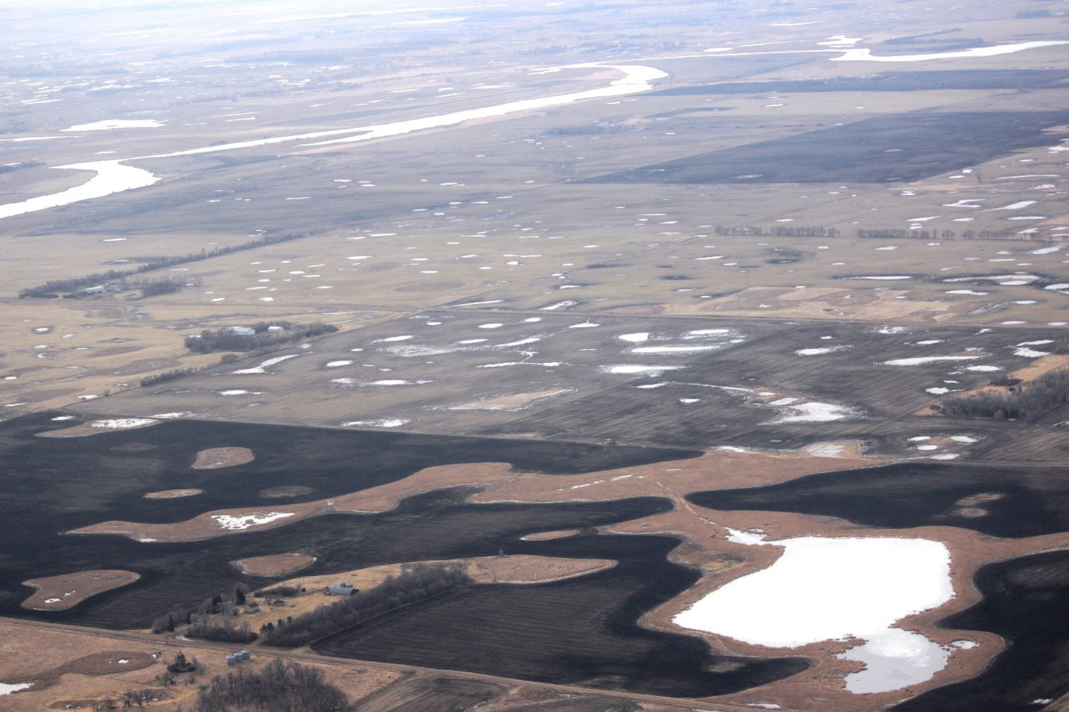
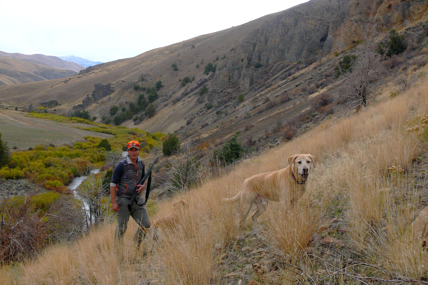
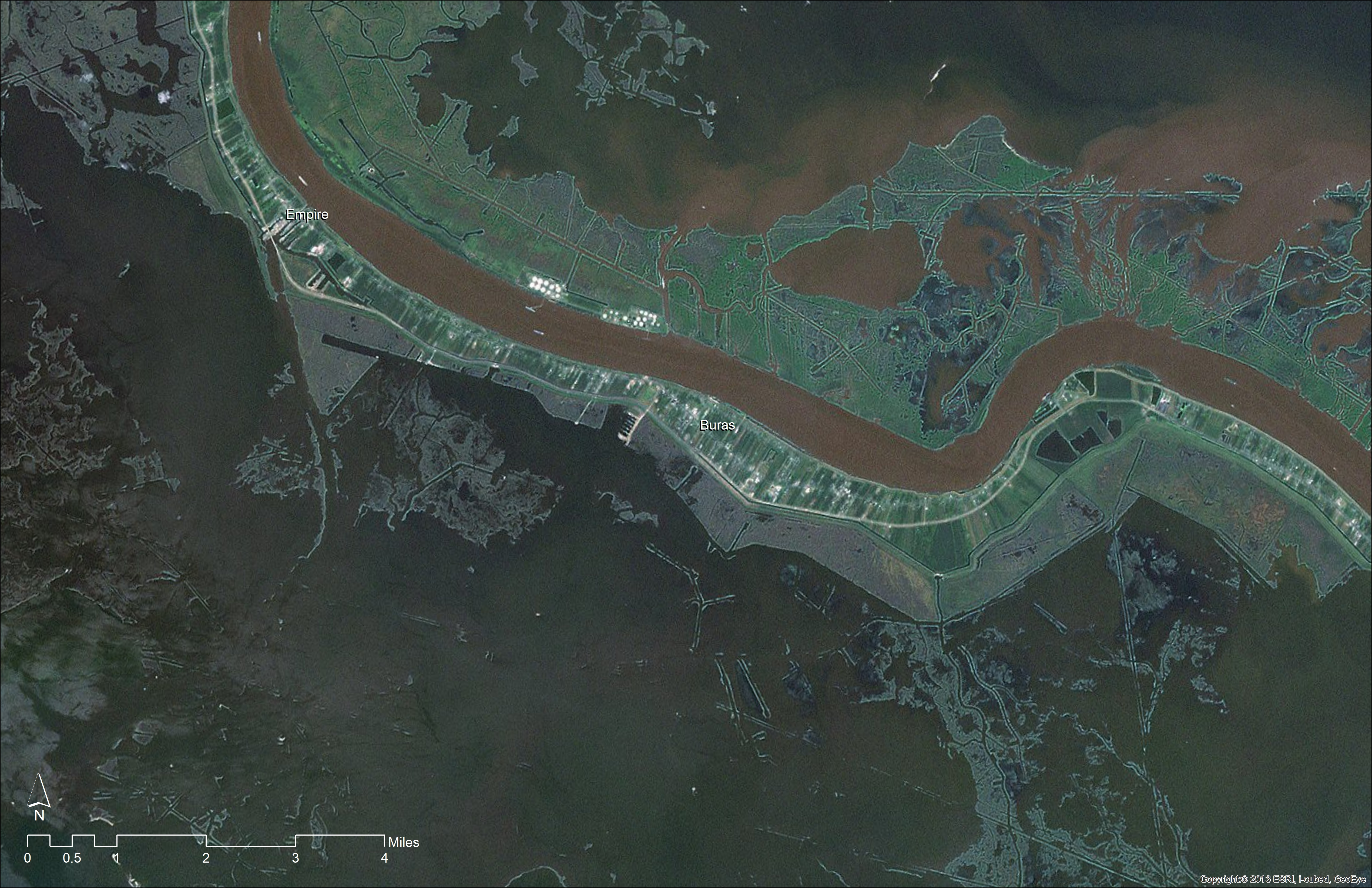
Starting in about 2009 in the Prairie Pothole states (Iowa, Minnesota, and North and South Dakota), the USDA faced a massive backlog of requests for “certified wetland determinations” from landowners and farmers who needed to know whether the wetlands on their property were indeed subject to USDA’s conservation compliance requirements. This determination tells farmers whether draining those wetlands would make them ineligible for federal farm benefits.

In 2013, USDA amped up its work to respond to landowner demand for certifications and reduce the backlog, and began accepting wetland determinations made by the agency prior to 1996. In some cases, USDA staff used pre-1996 determinations to replace more up-to-date wetland data for the same tracts.

While the agency’s actions were well intended, this policy change as described by OIG is highly problematic. USDA’s longstanding policy had been that most wetland determinations made prior to 1996 were inaccurate, unacceptable, and not considered “certified;” up to 60 percent were wrong. As OIG notes, the agency “replaced its backlog of pending determinations with inaccurate determinations.”

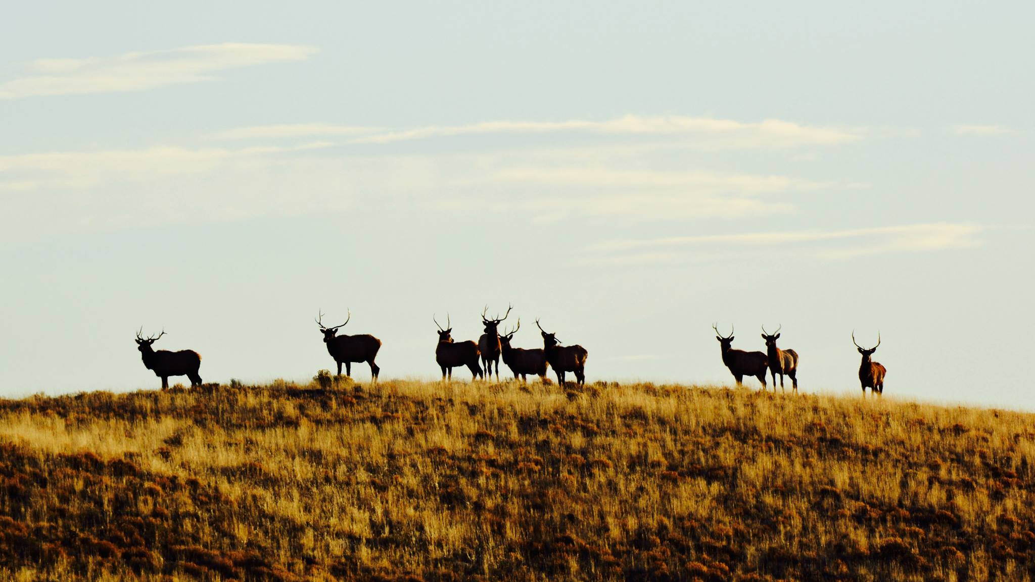
As a result, the policy change reduced the acreage of wetlands eligible for protection by nearly 75 percent in the Prairie Pothole Region, the breeding grounds for more than 50 percent of North America’s waterfowl.

Here’s just one example of the result: In 2010, USDA determined there were 34 acres of wetlands on one farmer’s property, but pre-1996 maps showed only 2.5 wetland acres. The change in policy to certify old determinations allowed the farmer to drain 31.5 acres of wetlands, or 93 percent of what was shown on the more recent, more accurate map.

To say this is frustrating would be an understatement. Combine it with the fact that USDA made this change outside of the normal regulatory process—it was not publicized and there was no opportunity for the public to comment on the new directive to use old materials—and it becomes incredibly worrisome. Then consider the previous two OIG reports, and you get a pretty depressing picture of USDA’s oversight of privately-owned wetlands in the U.S. (Fun fact: Private land is home to three-quarters of this country’s remaining wetlands.)

Moving Forward

We’re gearing up for the next Farm Bill—the massive legislative package that directs farm conservation programs, including conservation compliance—and contemplating what agriculture policy might look like under President Trump and a GOP-controlled Congress. When many conservationists consider what might be coming down the pike, it might be tempting to view every new challenge as a five-alarm fire and to get nostalgic for the past. But these watchdog reports from the Obama Administration present a stark reminder that good intentions only get you so far, and that there is always room for improvement in conservation policy, whatever your politics.

You can bet the farm that the TRCP and our partners will continue birddogging USDA’s wetlands policy, regardless of who’s sitting in the Oval Office (or more appropriately, in the secretary’s office at USDA). And as always, we’ll continue our work more broadly to make sure that Congress passes laws to improve fish and wildlife habitat, and that the Trump administration faithfully carries out those laws, so you always have a place to hunt and fish.

Learn more about conservation in the Farm Bill. 

4 Responses to “Wetlands Were Drained Under USDA’s Watch”

  1. H. Reading

    USDA works for ag interests (including timber interests). It’s right in the name, United States Department of Agriculture. That says it all. From bending over forward for its masters to allowing welfare livestock operations to self-report, with no followup, predator losses, the public loses.

  2. Matthew Van Camp

    It boils down to a lack of policing on the USDA’s part, and a failure to have in place proper watchdogs. Though I have a hard time believing that groups such as ‘Ducks Unlimited’ haven’t been sounding the Alarm. So, was the Obama administration in on this loss of wetlands? I don’t think that this new batch of politicians is gonna generate alotta self-propelled activism, but the conservatives have usually been on the side of sportsmen, so…
    All I can say is that loud activism is going to be key. Watchdogs and Whistleblowers have got to ‘step up’ to the plate, and we’ve got to get busy and make our gov’t ‘toe-the-line’ for sure!

Do you have any thoughts on this post?

XHTML: You can use these tags: <a href="" title=""> <abbr title=""> <acronym title=""> <b> <blockquote cite=""> <cite> <code> <del datetime=""> <em> <i> <q cite=""> <s> <strike> <strong>

Comments must be under 1000 characters.

February 20, 2017

The Land We Love: A Photo Essay

If Congress is successful in rolling back our say in public land management, these are some of the places that could suffer

Threats to public lands take many forms. The latest attack involves a resolution that would strip away your ability to speak up for how you want your local BLM public lands managed. Furthermore, it would revert the BLM’s planning procedures to those put in place in 1983 and could prevent them from ever being updated with the same solutions for improving agency transparency and public input.

The House has already voted to block the updated planning rule and soon it could come to a Senate vote. This is an affront to sportsmen and women, many of whom depend on these lands for hunting and fishing. The time to act is now.

If this all seems a little abstract, scroll through these images to see what we’re fighting for. These are the BLM lands we love.

Space

Heads Up
Charlie Bulla (the photographer behind these stunning images) snapped this spike bull elk on public land overseen by the BLM’s Lewistown Field Office. Someday, a public-lands hunter might shoot him with something other than a camera—thanks to the multiple-use mission of the BLM. Giving the public more opportunities to weigh in on land-use planning could ensure that habitat, critters, and sportsmen get a piece of that multi-use pie.

Space

Monster Bulls
Randy Newberg (center) is a passionate and articulate advocate for public lands, and it’s clear why. This photo (and his bull) were taken on BLM land near Casper, Wyoming.

Space

Freedom Flies
Whit Fosburgh, TRCP’s president and CEO, found his calling as a sportsman growing up in the Adirondacks, but he doesn’t forgo many opportunities to head out West. Here, he trades his fly rod for a camera to capture this scene on the Yellowstone River, accessible via BLM land in Montana.

Space

Bachelor Party
Our Idaho field rep Rob Thornberry will be on the lookout for these Rocky Mountain bull elk again this fall, when he’s hunting on public lands managed by the BLM Idaho Falls District and Upper Snake Field Office. If there had been a mule deer among them that day, Rob’s hunting partner and photographer, Mike Clement, wouldn’t have wasted any time taking pictures.

Space

Firsts with Family
Ed Arnett (left), TRCP’s senior scientist, helped his cousin Larry bag his first pronghorn on BLM public land in southern Wyoming. Without public lands, we’d venture to guess that there would be far fewer first hunts like this.

Space

Habitat Improvement
The BLM’s Safford Field Office oversees one of nine regions in Arizona and manages 1.4 million acres of land across six counties. By locking the BLM into decades-old planning procedures, Congress would prevent these land managers from adapting more advanced, scientific management across that landscape. Image courtesy of John Hamill, TRCP’s Arizona field representative.

Space

Sunrise Scoping
TRCP’s Western field associate, Kevin Farron, snapped this photo of our Western lands director, Joel Webster, as he was glassing for mule deer at first light on BLM lands within the Dillon Field Office district in Montana.

Space

Happy Harvest
Newberg with yet another public-lands success story, this time in the BLM Rawlins District in Wyoming.

Space

Cows Can Come, Too
During a mule deer hunt, Farron snapped this classic Western scene—a cattle gate on public land in the Dillon Field Office BLM district. Hunting, fishing, cattle grazing, and other extractive activities are permitted on BLM lands. Public comment periods are necessary to keep the agency accountable to an appropriate balance—and one Senate vote could leave hunting and fishing priorities in the dust.

Space

Rising to the Ridgeline
Vistas like these can make even an unpunched tag worth the trip. Horse Camp Trail in the BLM Lewistown Field Office area puts on a pretty nice show. Image courtesy of Charlie Bulla.

Space

Making Memories
Joel Webster and his father at the end of a successful hunt on BLM lands in Utah’s Henry Mountains.

Here’s what you can do.

We’re not going down without a fight, and we’ve created a couple of tools so you can let your lawmakers know that you aren’t either.

Head over to our action alert page to send a letter to your Senator in support of BLM’s planning updates. We also created this Twitter tool to make it easy for you to reach key targets in the Senate directly.

As always, when you sign our Sportsmen’s Access petition, we’ll send letters to your local, state, and national lawmakers saying that you support keeping these lands public.

Enjoyed what you saw? Check out another BLM landscape worthy of conservation from photographer Charlie Bulla.

February 7, 2017

House Votes to Eviscerate Rule Giving Sportsmen More Say on Public Land Use

Representatives would revert BLM land-use planning back to an ineffective and outdated rule and prevent positive changes from being included in future revisions

Using an obscure legislative process, a majority of the U.S. House of Representatives voted to block the BLM’s new land-use planning rule, known as Planning 2.0, and roll back the additional opportunities the rule affords the public to voice concerns about land management decisions on 245 million acres. The Senate is expected to vote on a similar resolution next week.

Nineteen sportsmen’s groups, conservation organizations, outdoor recreation trade associations, and businesses that rely on public lands sent a letter to congressional leadership this week opposing the move to roll back Planning 2.0 through the Congressional Review Act, a little-known law that enables Congress to roll back regulations within 60 legislative days of their enactment. Once repealed through this process, a substantially similar rule cannot be rewritten.

The letter urges lawmakers to allow the incoming Secretary of the Interior a chance to address concerns with the new rule, rather than scrap it altogether.

Image courtesy of TRCP staff.

“A Congressional Review Act repeal of the BLM planning rule would eliminate Planning 2.0, revert BLM planning to a problematic decades-old planning process, and likely eliminate the BLM’s authority to revise its planning regulations ever again in the future,” says Joel Webster, director of Western lands with the Theodore Roosevelt Conservation Partnership. “We urge Congress to take a different course and address remaining concerns by working collaboratively with the new Secretary of the Interior.”

Many groups are frustrated by the potential lost momentum for improvements that would benefit wildlife habitat along migration corridors and in seasonal ranges. New technology has revealed critical data on these important areas, which are not considered under the old planning rule largely developed in 1983.

As Congress dials back our say in #publiclands, sportsmen won't stay quiet Click To Tweet

“Under the spirit of Planning 2.0, improvements are already being made to the way we conserve once-overlooked habitat that elk, mule deer, and other big game animals rely on, even if it’s just for a portion of their journey,” says Steve Williams, president of the Wildlife Management Institute and former director of the U.S. Fish and Wildlife Service. “Increased coordination under the rule will only mean that the best possible science is used to our advantage, not ignored.”

Outdoor recreation businesses deserve better, but sportsmen and women will not stay quiet on this issue, says Ben Bulis, president of the American Fly Fishing Trade Association. “If recent public outcry against bad public land policy proves anything, it’s that we’ll be heard either way—we’d just rather be part of the democratic process.”

Click here to take action now. Don’t let Congress roll back this rule and take away your voice in how our public lands are managed.

February 1, 2017

Congress Overreaches to Roll Back Americans’ Say in Public Land Management

Lawmakers pursue obscure legislative process for blocking a rule created to give the public more say in management plans for 245 million acres of BLM public lands

Sportsmen, landowners, and former Bureau of Land Management employees strongly criticized a move by senators and representatives to overturn the BLM’s revised land-use planning rule, known as Planning 2.0. Using the obscure and rarely used Congressional Review Act, federal decision makers took a first step toward repealing the new rule and rolling back opportunities for the public to have more say in land management decisions.

Top and above images courtesy of Bob Wick/BLM

In a statement, Senate co-sponsors of a Congressional Review Act resolution cite bad information as motivation to revoke the rule, namely that the final rule fails to prioritize feedback from all stakeholders, including local governments. However, if lawmakers are successful, the BLM would continue using outdated guidelines for land-use planning established in 1983, which keep the public in the dark until very late in the planning process.

“It has been publicly recognized by county commissioners and conservation districts that the BLM took meaningful steps between the draft and final planning rules to accommodate requests from local governments and the public in reworking land-use planning,” says Whit Fosburgh, president and CEO of the Theodore Roosevelt Conservation Partnership. “Now, Congress is taking steps to reduce agency transparency and limit the public’s ability to have a say in how their public lands are managed. While a few concerns might remain, Congress is going about this the wrong way.”

The Congressional Review Act is a little-known law that enables Congress to roll back regulations within 60 legislative days of their enactment. The BLM planning rule, while under development since 2014, was finalized in December 2016, so it falls within the window of eligibility for repeal by the CRA. The process has only been successful once.

“The Western Landowners Alliance supports the BLM’s efforts in updating planning to meet today’s needs in the West,” says Lesli Allison, executive director of the Western Landowners Alliance. “There are opportunities for improvement, but not to the detriment of eliminating all the good progress that has been made to date. We believe working  through the Secretary of Interior is the best way to achieve our goals and constructively address any remaining concerns with the rule.”

Most disturbingly, once a rule is overturned through the CRA, no new rule that is “substantially the same” can be developed.

“A Congressional Review Act repeal would eliminate Planning 2.0 and likely eliminate the BLM’s authority to revise their planning regulations ever again in the future,” says Jesse Juen, president of the Public Lands Foundation and a longtime BLM employee. “Instead of stripping the incoming Secretary of the Interior of his authority before he takes office, lawmakers should work with the new administration to make refinements to a planning process that many stakeholders championed.”

Hunters and anglers in Western states can click here to write their lawmakers and urge them to let Planning 2.0 stand.

January 25, 2017

Local Public Input is Critical to Rebuilding Louisiana’s Coastline

The public process for vetting these important projects will affect conservation, hurricane protection, and land loss over the next five years

Louisiana’s coast is a dynamic landscape of swamps, marsh lands, barrier islands, bayous, rivers, lakes and bays surrounding coastal towns and cities—and all of this is linked by a unique culture of food, music, fishing, hunting, and other outdoor activities that rely on our abundant natural resources.

Unfortunately, for the last 80 years, this ever-changing system has been shrinking faster than any other landscape on earth, threatening world-class fishing and hunting opportunities, domestic energy development, commercial seafood harvest, the country’s largest port system, and the homes of hundreds of thousands of residents.

The impacts to the nearly 2 million people living south of Interstate 10 (and arguably the entire state and nation) can be devastating, but there are solutions in the works and a public process for Louisianans to be heard. This week and last, concerned sportsmen and women had the chance to ask questions and challenge the folks in charge of planning for the next five years of coastal protection and restoration projects designed to reverse devastating land loss, while boosting fish and wildlife habitat.

Here’s what they learned.

A Plan for Louisiana’s Future

For the last decade, the Louisiana Coastal Protection and Restoration Authority has been tasked with trying to slow coastal land loss, protect coastal communities, and safeguard our infrastructure, including the kind that supports fisheries and wildlife. The blueprint for this effort has been a detailed list of projects and initiatives aimed at ensuring Louisianans don’t face the catastrophic losses we experienced during Hurricanes Katrina and Rita in 2005.

The Coastal Master Plan, by law, must be reviewed by the public every five years and then approved by the state’s legislature. As wonky as it sounds, this is a critical opportunity for everyday sportsmen and women to get involved with shaping the future of conservation in our state.

Where Funding Will Flow

The 2017 plan, like the 2012 plan before it, calls for funding to be split roughly in half between building community resiliency—using levees and floodwalls and elevating homes and businesses—and habitat restoration—through marsh and barrier island creation, diversions, and limiting saltwater intrusion.

Thanks mostly to the nearly $8 billion the state has received, or will receive, in fines from BP and others responsible for the 2010 Deepwater Horizon oil disaster, some coastal wetlands, barrier islands and vital ridges and other geographic features can be created, restored, and protected in the long term. The agency proposes to accomplish this by diverting sediment from the Mississippi River below New Orleans, diverting freshwater from the Mississippi and Atchafalaya Rivers to wetlands threatened by saltwater intrusion, and various dredging projects.

Diversions are the cornerstone of efforts to restore and sustain the marshes adjacent to the Mississippi River. A single diversion on the west side of the river south of New Orleans called the Mid-Barataria Diversion, will move as much as 75,000 cubic feet per second of sediment-laden river water into shallow bays and lakes to help re-establish marshes that have been lost over the last century to erosion and subsidence. East of the river, the Mid-Breton Diversion will move water at about 35,000 cubic feet per second.

Impact to Fish and Wildlife

The 2017 plan is the first Master Plan for our area with detailed models that predict the future of coastal habitat for species like speckled trout, brown and white shrimp, largemouth bass, and crawfish—fisheries that are vital to commercial and recreational fishermen. It also projects what changes we can expect for habitat important to gadwall and teal, the ducks most targeted by coastal waterfowl hunters.

The area south of Buras was brackish and salt marsh as late as the 1970s, but has become almost entirely open water in the last 40 years. Louisiana has lost more than 1900 square miles of coastal lands in the last century. This satellite image was taken in 2012. Image courtesy of NOAA.
And If We Do Nothing?

Unfortunately, the latest models also paint a grimmer picture of what can realistically be saved and protected and what will, ultimately, be claimed by the Gulf of Mexico. The worst-case scenario from 2012 was a one- to two-foot rise in sea level—these are now the best-case scenarios in the 2017 plan.

If we do nothing, projections show that as much as 4,000 square miles of land will sink or be inundated by rising seas (yes, both of these things are happening at once) over the coming century—that’s more than twice the land loss predicted in 2012.

More than 25,000 homes and businesses across Louisiana’s coast will have to be elevated and made more storm-resilient over the next half century so as not to succumb to coastal flooding from tropical storms, hurricanes, and other extreme weather events. Some communities may have to be relocated altogether. Presenting this worst-case scenario isn’t the easiest task for state coastal planners, but it’s absolutely essential that coastal residents understand the difficult future that lies ahead in an ever-changing landscape.

How You Can Help

We’ve outlined the basics here, but if you want to learn more, read the full draft plan at the Louisiana CPRA website. Public comments are still being accepted through March 26—it is your civic right and, ultimately, your duty as a sportsman to weigh in. Email masterplan@la.gov to make your voice heard!

HOW YOU CAN HELP

CHEERS TO CONSERVATION

Theodore Roosevelt’s experiences hunting and fishing certainly fueled his passion for conservation, but it seems that a passion for coffee may have powered his mornings. In fact, Roosevelt’s son once said that his father’s coffee cup was “more in the nature of a bathtub.” TRCP has partnered with Afuera Coffee Co. to bring together his two loves: a strong morning brew and a dedication to conservation. With your purchase, you’ll not only enjoy waking up to the rich aroma of this bolder roast—you’ll be supporting the important work of preserving hunting and fishing opportunities for all.

Learn More
Subscribe

You have Successfully Subscribed!

You have Successfully Subscribed!

You have Successfully Subscribed!

You have Successfully Subscribed!

You have Successfully Subscribed!