fbpx

January 30, 2018

This Is the Number One Question Midwestern Sportsmen Asked Us About the Farm Bill

Right now, Congress is drafting the 2018 Farm Bill and sportsmen want to be a part of the conversation

There is no greater opportunity for conservation in America than the prospect of a new Farm Bill, especially considering that it accounts for nearly $5 billion in nationwide spending on soil health, water quality improvements, and on-the-ground habitat for the wildlife we love to pursue. But in agriculture-dominant states, the stakes are particularly high for landowners, sportsmen, and surrounding communities.

This is why the TRCP recently joined forces with the Illinois Conservation Foundation to speak with hunters and anglers in three local forums about the Farm Bill conservation programs that help create better habitat and access on private lands in the Prairie State. For me, it also meant that—not long after joining the TRCP as the new director of agriculture and private lands in D.C.—I was going home.

Why Illinois?
Photo courtesy of Kevin Chang.

Illinois is 95 percent private land, and—as in many Corn Belt states—access for hunting and fishing is increasingly limited. It’s in places like my home state that the Farm Bill can be a game changer for the college kid who can’t afford a deer lease or parents who are looking for a place to take their kid hunting or fishing for the very first time. Through federal funding made available by the Farm Bill’s Voluntary Public Access and Habitat Incentive Program, the Illinois Recreational Access Program has opened up 17,600 acres of private land to the public for hunting and fishing. That’s a big win for sportsmen, but also the small businesses we rely on to keep us fueled, fed, and geared up for our adventures.

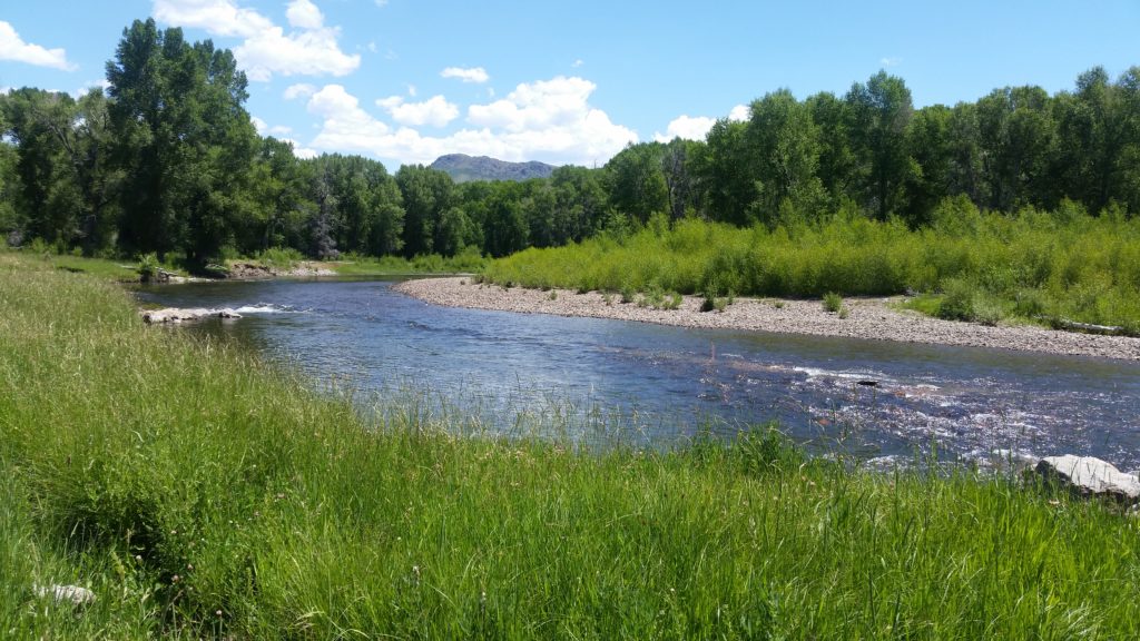
Illinois also boasts 87,110 miles of rivers and streams within the state and another 880 miles of river along its borders. This means that Illinois has a tremendous opportunity to utilize the conservation tools within the Farm Bill to improve water quality across the rest of the Mississippi River Basin. As farmers are incentivized to convert less productive croplands to habitat, the great side effect of creating better conditions for deer, ducks, and pheasants is capturing sediment, fertilizer, and pesticide run-off before it enters local waters.

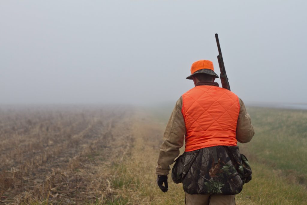
As I can personally attest, Illinois is a very special place to grow up hunting and fishing. Like most, I started with a 4-10 shotgun and squirrels. When I wasn’t exploring the woods looking for greys and reds, it was blue gill with a cane pole. With coaching from my father and brother, I graduated to taking white tail with a bow and largemouth bass with a bait caster- all without ever leaving Southern Illinois.

Hunting and fishing is a critical component of the economy in Illinois. In total, the outdoor recreation economy accounts for $24.8 billion in consumer spending and directly supports 200,000 jobs. Sportsmen in Illinois also have the unique advantage of having three Representatives and one Senator on the House and Senate Agriculture committees that will craft the next Farm Bill.

We’re Glad You Asked

After walking through the complex alphabet soup of Farm Bill programs and their benefits with nearly 100 sportsmen from Alton to Peoria, we expected (and encouraged) questions. But I was surprised by the most common thing we heard: How can we make our elected officials understand how important this is? Sportsmen and women were sold, and they wanted to carry the message to the people who needed to hear it.

At TRCP, we’re working to make it as easy as possible. For one thing, we share everything we know about the Farm Bill and how it can impact your hunting and fishing on our blog­—click HERE to get the latest right in your inbox. We also give you as many chances as possible to contact your lawmakers directly on the issues that matter. Start now by sharing your story about the value of access and enhancing sportsmen’s opportunities to hunt and fish in the next Farm Bill. 

If you’d like to learn more about the 2018 Farm Bill or talk about additional ways to get involved, contact me directly at amaggos@trcp.org.


4 Responses to “This Is the Number One Question Midwestern Sportsmen Asked Us About the Farm Bill”

  1. Rev David Reitz

    I own a rural property and it is partly woodland and partly crop ground. What is being done to stop penalizing me for having wildlife habitat? Since my property is more than 50 % wooded I get to pay sky high tax rate while the corn field my neighbor owns gets taxed at only about 10% of what I pay.

Do you have any thoughts on this post?

XHTML: You can use these tags: <a href="" title=""> <abbr title=""> <acronym title=""> <b> <blockquote cite=""> <cite> <code> <del datetime=""> <em> <i> <q cite=""> <s> <strike> <strong>

Comments must be under 1000 characters.

January 22, 2018

This Beer Metaphor Helps Explain Why We Need Habitat Mitigation

When it comes to balancing development with stewardship of fish and wildlife habitat, mitigation is a critical conservation tool that more sportsmen and decision makers should understand

The simplest definition of mitigation is “the action of reducing the severity, seriousness, or painfulness of something.” A colleague of mine once shared a great metaphor that helps to explain the concept: Let’s say you and I are sitting at a bar enjoying our favorite beverage and you’ve finished half of yours when I suddenly knock it over, spilling what’s left.

Would you feel the effects of my actions were mitigated if I bought you half a drink? How about if I grabbed a napkin, soaked up the remains of your drink, and squeezed it back into your glass? Even if you were to accept this and drink the remaining soaked up beverage, it would be a loss to you.

Truly mitigating the impact I had on your evening would, at the very least, mean buying you a new drink. I should probably consider buying the next round, too, if I want to get invited again!

Now, what if the precious resource lost was not your favorite IPA, but fish and wildlife habitat?

Development projects, like this oil and gas well pad, that have impacts on wildlife that could not be avoided or minimized should mitigate those impacts in other ways, like habitat restoration or permanent protection in adjacent habitat or other suitable areas.
First, Do No Harm

There is a foundational hierarchy to mitigation, and it starts with doing no harm: The very best way to mitigate impacts of development on habitat is to avoid those impacts in the first place. After all, some places are just too important to develop, or it might not be possible to replace that habitat elsewhere.

Think about the very best wintering area for a mule deer herd. Some may argue those deer “will just go somewhere else” if a project goes in that would have impacts. But will they? Even if they do alter their course, we have no way of knowing if they are just as likely to survive a harsh winter on different terrain. Wouldn’t it be better to avoid the area in the first place?

The next step in this hierarchy is to minimize impacts. A project developer should employ a wide range of actions to avoid as much disturbance as possible to animals in the area. For example, a proposed transmission line could be located along an existing road system to minimize fragmenting otherwise undisturbed habitat. Or, loud noises could be minimized in a variety of ways to lessen disturbance to animals.

If unavoidable or unforeseen impacts occur, the next step in the mitigation hierarchy is to compensate for the loss by creating habitat somewhere else. This might involve securing a conservation easement on private land or restoring adjacent habitat with treatments designed to improve conditions for the affected species overall. Compensatory mitigation for a new road system or oil and gas field in sagebrush habitat could involve, for example, payments by the developer to cut invasive juniper trees that have pushed out sage species’ preferred cover.

Mitigation funding from development projects could be used to restore sagebrush habitat quality by removing invasive conifer species not favored by many species like sage grouse. Photo credit: Jeremy R. Roberts, Conservation Media
Beyond the Footprint

A very important consideration when determining how much compensatory mitigation is needed is understanding how animals respond to the project. Sometimes it’s not enough to replace the habitat removed in the area of a well pad, road, or wind turbine—often referred to as the “footprint” of the project.  At times, the affected wildlife might also avoid using what looks like perfectly good habitat around the project footprint because they just don’t like being near the infrastructure, noise, or humans. In this case, to truly mitigate the actual impact, we have to figure out the footprint plus the area the animals avoid near it and replace that habitat elsewhere to achieve what is called “no net loss.”

Mitigation that only accounts for the footprint of the project is almost always a loss—think about that half a beer I spilled. Buying my buddy half a pint doesn’t really set the situation right, even though I’m technically replacing what he lost. There’s no other way to go from less habitat to no net loss of habitat unless mitigation accounts for the entire area affected by the presence of a project.

Easements on private property are a commonly used tool for mitigation, where project developers agree to an amount of compensation for their impacts and often a third party such as a land trust or non-profit organization, secures land for the transaction and long-term protection and management of quality habitat for fish and wildlife.
A New Era of Energy Development

So why does all this matter for sportsmen and women? Without mitigation as a tool for conservation, development equates to a loss of fish and wildlife habitat—plain and simple. That’s why the TRCP is working with our partners and a wide range of conservation and sportsmen’s groups to speak up for habitat mitigation, especially where there’s an appetite for more development on public lands.

Lost habitat equals fewer animals, less opportunity for hunters and anglers, and a hit to the local outdoor recreation economy. Sportsmen and women must stay informed and engaged, even on public land management issues as complex as mitigation, so we don’t wind up settling for half a beer.


This post was originally published in March 2018 and has been updated.


January 16, 2018

Where Public Lands Are in Limbo, Local Sportsmen Help Find a Path Forward

For decades, 500 Wilderness Study Areas in the West have awaited individual acts of Congress to resolve how they should be managed, and those closest to the land are finally helping to make the call—wilderness or something else?

When archery hunter Harvey Dalton drew a coveted bighorn sheep tag for the Dubois Badlands in Wyoming, he knew he was in for a hunt of a lifetime. After all, he’d been applying and collecting preference points for 40 years before drawing the tag.

Unlike most bighorn hunting units where it takes hours in the saddle or on foot to get into the backcountry of rugged northwest Wyoming, the Badlands has plenty of road access. But it certainly wasn’t flat hiking further into the steep draws where sheep are often tucked away. The sweat equity Dalton put in over four weeks made connecting with a big ram even more meaningful, but he was troubled by evidence of ATV and dirt bike use he saw in areas where there should have been none.

Unfortunately, while the Dubois Badlands remains a Wilderness Study Area—one of more than 500 parcels of public land across the West set aside decades ago as potential wilderness—there continues to be confusion from public land users, and even land managers, about what kinds of activities are allowed there.

Bighorn sheep rams prepare to spare on the sheer cliffs of the Dubois Badlands. Courtesy of Bill Sincavage @jakeysforkwyoming
What Is a Wilderness Study Area?

In 1976, legislation directed the Bureau of Land Management to inventory undeveloped public land for areas that could be managed as wilderness, for the opportunities to find solitude or pursue traditional outdoor recreation. This resulted in almost 13 million acres identified as Wilderness Study Areas, but they weren’t meant to stay in limbo forever. It takes an act of Congress to change the status of these areas, by either designating them as wilderness or releasing them to be managed for other uses, so the process of reaching a final resolution has been slow—as in decades long.

Wyoming has yet to resolve any of its 42 Wilderness Study Areas encompassing 570,000 acres, including the Dubois Badlands. Sportsmen and others are hoping to finally make some progress through the Wyoming Public Lands Initiative—a process where stakeholders, including the public, can weigh in on how the land ought to be managed and make recommendations to legislators.

From Local to Legislation

Here is how the WPLI works: Counties have the option to join the initiative and develop citizen advisory committees made up of hunters, ranchers, energy industry representatives, and other public land stakeholders. Committees listen to public comment and data from agencies, spend time on the ground, and work to reach recommendations for whether Wilderness Study Areas in their county should be designated wilderness, released to be managed for multiple-use, or given some other type of designation. Recommendations from across the state go to elected officials and, if all goes according to plan, eventually become law. It’s no simple task.

This collaborative, local approach has worked well in other Western states. Nevada has been a leader in addressing Wilderness Study Areas since the 2000s—compromises came out of the counties and eventually resulted in bipartisan bills from Congress that struck a balance between conservation and development needs. Some of these efforts were successful within just a few years; others took public land users on a decades-long rollercoaster ride.

It was always worth it, but it had to be done thoughtfully, one study area at a time. One-sided proposals that either designate all areas as wilderness or release all of them get introduced in almost every legislative session—and die as fast as an antelope shot through the heart.

In fact, right now in Wyoming, proposed legislation that would release many of Wyoming’s Wilderness Study Areas is causing confusion and could undermine the work that locals have accomplished through WPLI.

Dalton with his hard-earned ram in the Dubois Badlands. Courtesy of Harvey Dalton


More Than Lines on a Map

While we currently know them as Wilderness Study Areas, these are also the places where we’ve enjoyed epic fishing with friends, camping in remote canyons with more deer sign than human tracks, or the sheep hunt of a lifetime. These areas matter and we owe it to them to follow through on what we started in 1976. The WPLI effort is an opportunity to clarify the future management of these lands and provide certainty to all who rely on them.

This is why the TRCP is representing sportsmen on the Fremont County committee and collaborating with our local partners—like Bowhunters of Wyoming, where Dalton serves as vice president—in other counties to finally resolve the status of these public lands. We want to make sure that the best possible path forward for management of fish and wildlife is clear, not confusing, and that areas like the Dubois Badlands continue to provide quality backcountry hunting and fishing opportunities.

But we can’t do it alone. Sportsmen and women are some of the most active users of our public lands and, as such, perhaps some of the most knowledgeable about current conditions. We also have a lot at stake in management changes. If you want to share your input with the WPLI committees or attend a meeting, learn more here.

You can also encourage our decision makers to advocate for responsible management of public lands, especially through initiatives that bring locals to the table, by signing the Sportsmen’s Country petition. It’s our latest effort to safeguard public-land hunting and fishing opportunities by not only keeping public lands public, but also keeping them well-managed. Help us get to 10,000 signatures this year!


Top photo courtesy of Bill Sincavage @jakeysforkwyoming. 

January 15, 2018

Can Conservation Catch Up With Migration Mapping Technology?

Now that breakthroughs in wildlife research and GPS technology have taught us more about big-game migration corridors, we can’t ignore the value of these habitats—we have to conserve them

Wildlife management on public lands has benefited greatly from advancements in technology. In particular, our understanding of how and where big game species migrate has grown exponentially in recent years.

When I was a graduate student researching Rocky Mountain bighorn sheep in the late 1980s, satellite or GPS radio collars were simply not available. Back then, researchers had to capture their study animals, fit them with collars made with technology of that era, and follow animals around trying to determine their locations and habitat-use patterns.

Sometimes this meant three researchers all scrambling up to separate high points to triangulate where an animal was, using a telemetry receiver and antenna. Each one of us would determine the direction of the strongest signal emitting from the animal’s collar, aim a compass in that direction, and plot the bearing on a map. The place where our three lines intersected was theoretically where the critter was located. But times sure have changed.

Photo by Tom Koerner/USFWS via flickr
No Compass, No Fuss

Today, advances in GPS telemetry are remarkable. Scientists merely have to catch the animals they’re studying to fit them with GPS collars that are accurate to within a few feet. No more worrying about triangulating compass bearings and human error—we know exactly where these critters are spending their time. GPS collars can also be programmed to mark multiple locations for each animal over any desired 24-hour period and automatically send this data to the scientist’s computer, tablet, or smartphone. Software has been developed that can sift through the data and build our maps for us.

Scientists now have the capability to build a travel log for the spring or fall journey of each antelope, bighorn sheep, or mule deer. Locations can be easily plotted in a GIS—a computer system for data related to positions on Earth’s surface—to create accurate, detailed maps showing where the animals traveled, how much time they spent in certain areas, and which habitats they preferred during these annual migrations between winter and summer range.

In Wyoming, scientists used this technology to follow mule deer 150 miles from the Red Desert to Hoback Junction, south of Jackson Hole, and transformed their research into a broader effort called the Wyoming Migration Initiative. Their goal is to advance the understanding and appreciation of Wyoming’s migratory big game species through science and public outreach, and they are currently working to expand to other Western states. This could help broaden the available data and build awareness among sportsmen and women, wildlife managers, and lawmakers across the region.

But the problem remains that our conservation policy and planning tools haven’t been updated, even as we’ve learned so much more, and these critical habitats are still largely overlooked.

A mule deer buck has migrated to its winter range in southern Wyoming, where it will stay until following greening vegetation back to its summer range.

The discovery of the Red Desert-to-Hoback migration corridor led the state of Wyoming to revise their policy definitions and develop a strategy for conserving vital migration corridors. This should help the Wyoming Game and Fish Department as they work with the BLM on conserving this often overlooked habitat, so it could be a model to follow.

Hopefully these efforts will help advance conservation with good policy, because when migration corridors are not given this kind of attention, they may be damaged, developed, or lost from the landscape. Loss of these corridors could have drastic impacts on big-game herds, hunting opportunities, and the outdoor recreation economy.

Time for a System Upgrade

All of the fancy data and maps in the world would be pointless without adequate policy and management actions to conserve the migration corridors that we now understand are important for big game species’ survival. We need to use what we’ve learned to ensure that the iconic big game herds of the west can be sustained well into the future.

Now that mule deer can literally send scientists mobile notifications of their whereabouts and preferences, it’s time for a policy upgrade based on this new information. It’s not enough to maintain and restore the habitat where wildlife spend most of their time, especially if degraded habitat conditions along migration routes can prevent them from getting there.

It is not enough anymore, either, for sportsmen and women to simply fight for keeping public land public. It is critical that hunters and anglers get involved in public land management decisions that could help accomplish more, like conserving migration routes and stopover areas.

Improving the management of our public lands will undoubtedly be a long journey. Sign the petition at sportsmenscountry.org to take the first step.


Top photo by John Carr/USFWS via flickr

This story was originally published February 25, 2016 and has been updated.

January 11, 2018

BLM’s Proposed Plan for Missoula Public Lands Benefits Fish and Wildlife Habitat

Updates to the Missoula Field Office’s resource management plan will help balance multiple uses of 162,000 acres in Montana for the next 20 years or more

The Bureau of Land Management’s Missoula Field Office has revealed proposed updates to its resource management plan, which outlines how more than 162,000 acres of public lands should be managed for the next 20 to 30 years. The planning process helps balance multiple uses of public lands, including much of Johnsrud Park along the Blackfoot River Corridor and sizeable sections of the Garnet Mountain Range and the John Long Range.

“We are encouraged by the direction of this draft plan, which incorporates measures that would benefit fish and wildlife habitat as well as recreational opportunities for Montana sportsmen,” says Scott Laird, Montana field representative with the Theodore Roosevelt Conservation Partnership. “It’s a step in the right direction that reflects the values of local sportsmen and women, so it’s crucial that we remain at the table as this planning process advances.”

The area is popular with hunters for its whitetails, mule deer, elk, and forest grouse, and many of the tributaries to the Blackfoot River and Rock Creek are critical spawning habitat for bull trout and westslope cutthroats.

“The draft plan recognizes the importance of conserving areas that support recreational fisheries and provide valuable access for anglers,” says David Brooks, executive director for Montana Trout Unlimited. “These outdoor recreation opportunities are part of Montana’s identity and define a local way of life. That’s why it’s worth it to plan carefully for the future of these public lands.”

Angler on the Blackfoot River outside Missoula, Mont. Photo by BLM via flickr.

“As a member of the community who also happens to rely on healthy wildlife and dependable hunting seasons to run my business, I’m encouraged by the proposal to maintain certain areas of intact habitat,” says Casey Smith, owner of Straight6Archery. “It’s good for the wildlife we love to pursue and the way people have used this public land for generations.”

The BLM will collect public comments on the draft and host three meetings in Missoula, Phillipsburg, and Lubrecht Forest to open a dialogue with the public on the status of the plan. Based on this feedback, the agency will make revisions and issue an updated resource management plan this spring.

Sportsmen should attend one of the public meetings to learn about the proposed changes, ask questions of BLM staff, and provide feedback to the agency on how you use our public lands. Here are some suggested talking points to take into the meeting:

  • Much of the Missoula field office has been intensively managed in the past, and active habitat restoration could do great things for fish and wildlife populations. The agency should not only conserve, but also restore and enhance habitats for big game and wild trout.
  • In response to requests from local sportsmen groups, the BLM is considering the adoption of Backcountry Conservation Areas in four individual areas of public land within the Missoula field office. If adopted, this management tool would be used to prioritize the conservation and restoration of important wildlife habitats, while also managing areas to provide for quality hunting and fishing opportunities. The BLM should adopt Backcountry Conservation Areas in the Missoula area resource management plan.
  • Some public lands within the Missoula BLM field office are difficult to access because they are landlocked by adjacent private lands. The BLM should prioritize voluntary acquisitions and easements that would expand the public’s access to their public lands.

If you want to know more about how you can make a difference through this public lands planning process, please contact Scott Laird, TRCP’s Montana field representative, at Slaird@trcp.org.

Learn more about the resource management planning process here.

Top photo of the Blackfoot River courtesy of the BLM via flickr.

HOW YOU CAN HELP

CHEERS TO CONSERVATION

Theodore Roosevelt’s experiences hunting and fishing certainly fueled his passion for conservation, but it seems that a passion for coffee may have powered his mornings. In fact, Roosevelt’s son once said that his father’s coffee cup was “more in the nature of a bathtub.” TRCP has partnered with Afuera Coffee Co. to bring together his two loves: a strong morning brew and a dedication to conservation. With your purchase, you’ll not only enjoy waking up to the rich aroma of this bolder roast—you’ll be supporting the important work of preserving hunting and fishing opportunities for all.

Learn More
Subscribe

You have Successfully Subscribed!

You have Successfully Subscribed!

You have Successfully Subscribed!

You have Successfully Subscribed!

You have Successfully Subscribed!